News
Southern California Prepares for Major Rainstorms Starting Wednesday
LOS ANGELES, California — After experiencing a sluggish start to the rainy season, Southern California is bracing for a significant influx of moisture beginning Wednesday. Forecasts indicate the first storm will reach Los Angeles County around noon and will deliver rain through early Friday, according to Robbie Munroe, a meteorologist with the National Weather Service.
The weather system is expected to relieve a dry spell that has plagued the region, contributing to one of the driest starts in recorded history. “We’ve been playing catch-up, it feels like, the whole winter after an extremely dry period through January,” Munroe said. “February was still a little below normal, but at least it kind of got us closer to what we might see this time of year.”
As of this Tuesday, downtown Los Angeles has recorded just 5.58 inches of rain since the water year began on October 1, falling short of the seasonal average of 11.08 inches. The annual average for the area is 14.25 inches. The upcoming storms promise to add much-needed moisture to the parched landscape.
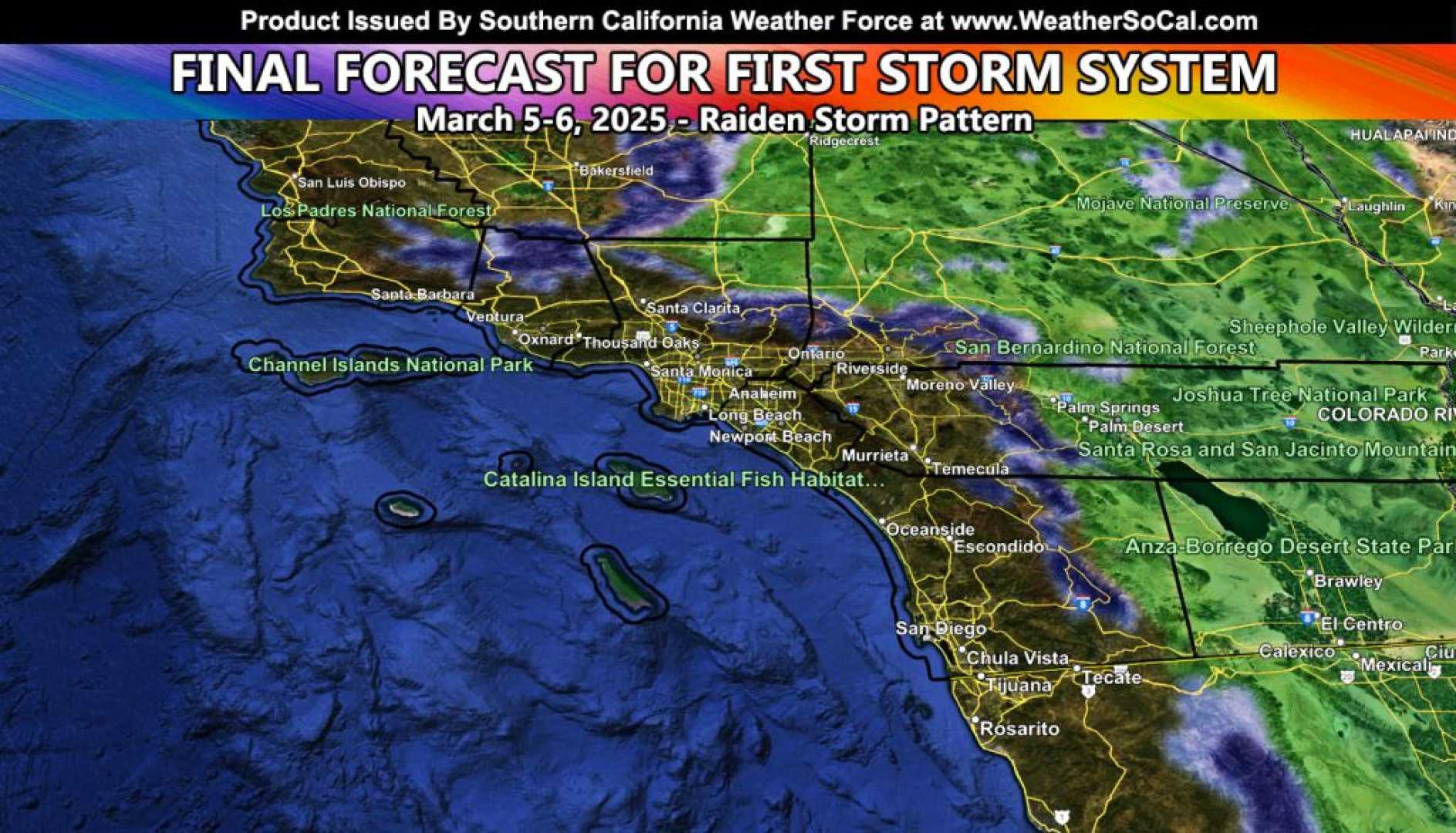
The current storm system is projected to bring between a tenth and an inch of rain for coastal regions, and up to two inches for foothills and mountains. Those at elevations above 4,500 feet may see two to five inches of snow, while temperatures could generate isolated thunderstorms Wednesday night through Thursday evening.
On Thursday, winds are expected to gust between 30 and 50 mph, which could exacerbate the impact of any thunderstorms that develop. Forecasters have warned that the surge of rain can lead to hazardous conditions, primarily in burn scar areas where debris flows could pose significant risks. “There’s a potential for isolated mud flows, and some streets could be blocked by mud and debris,” cautioned Angela George-Moody, chief deputy director of L.A. County’s Department of Public Works.
George-Moody stated that crews are prepared, having inspected flood control facilities to ensure they are ready for the expected runoff. She recommended that residents prepare their properties by clearing drainage paths and utilizing sandbags for protection.
This week’s storm is anticipated to be just the opening act, with more storms expected to hit Southern California next week. A separate weather system is forecasted to bring additional rain from Sunday night into Tuesday. Munroe noted that a wet March could delay the onset of high fire season, which often follows the dry winter months. “The longer we can have wet weather into the spring, it will usually help us delay when things get a chance to really dry out,” said Munroe.
As the region continues to battle the effects of previous wildfires, including those that struck in January, the arrival of rain can lead to a mix of blessings and challenges. Experts are keeping a close eye on rainfall rates, warning that rain falling at half an inch per hour heightens the risk of mudslides and debris flows.
Despite the approaching storms, southern California’s water supply situation remains precarious. As highlighted by recent reports, California’s snowpack is currently at 85% of average, with variations across the state’s various regions. With recent climate warming trends, lower elevations are expected to see less snow. The upcoming storms could significantly affect the snowpack, which is crucial for the state’s water supply.
The public is urged to stay informed as forecasters continue to monitor the evolving weather patterns, and residents are reminded to prepare for potentially hazardous conditions as the storms roll in.


