News
Storm Systems Set to Impact Arizona Late This Week
PHOENIX, Ariz. — A series of storm systems is poised to sweep through Arizona, beginning Wednesday night and continuing into Friday, according to the Arizona’s Family First Alert Weather team. As weather conditions shift, residents can expect varying temperatures and precipitation across the state.
Following a chilly and breezy start to the week with a high of 67 degrees in the Valley, temperatures are forecasted to rise. A sunny day today will see highs reaching 73 degrees, while tomorrow could see temperatures peak at 79 degrees.
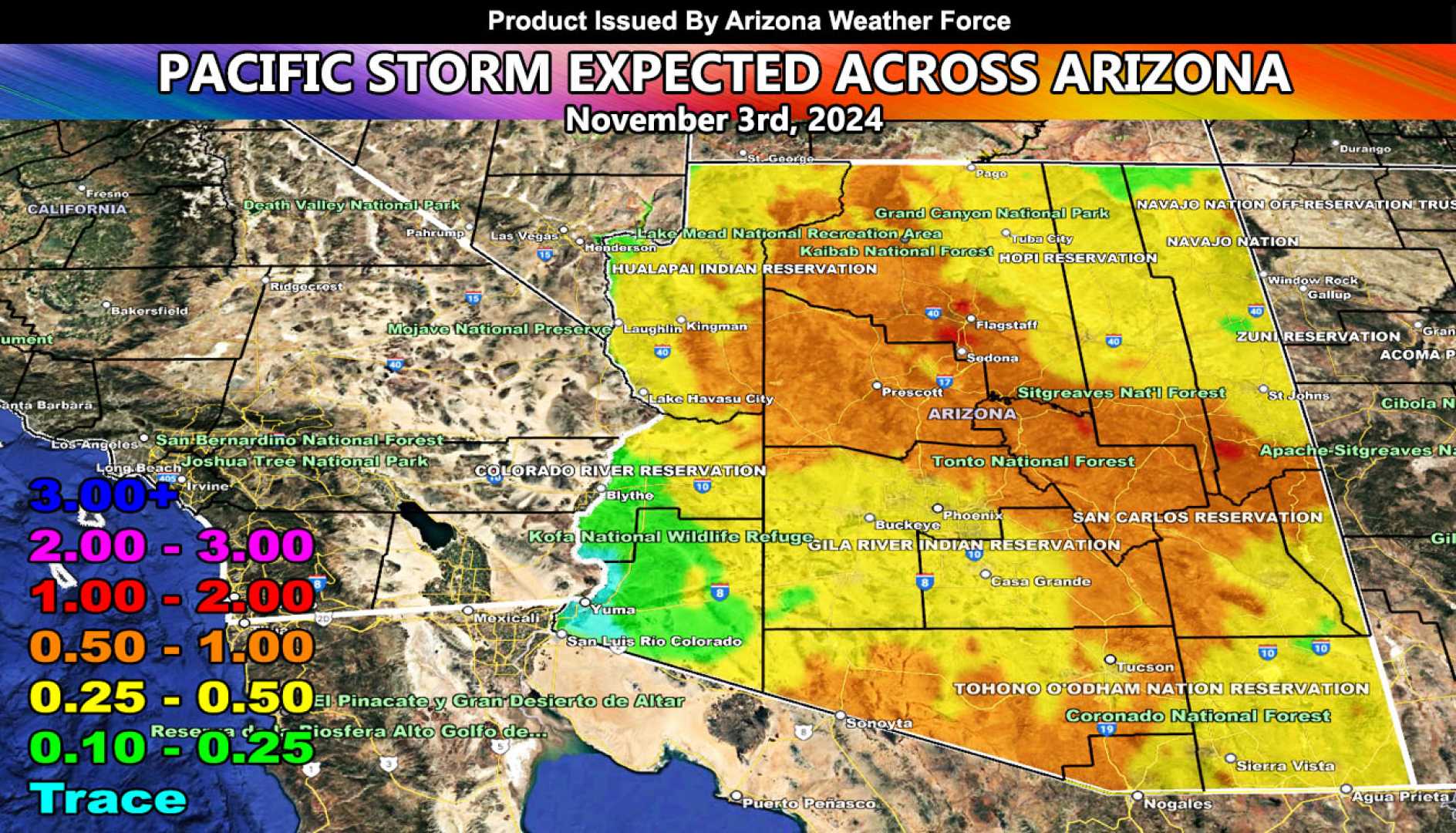
However, the calm weather is temporary. The first of multiple storm systems will arrive Wednesday night, bringing a 30-40% chance of rain in the Valley. Winds are also expected to increase, resulting in gusty conditions with a cooler high of 71 degrees on Thursday.
Rain and snow are anticipated in northern Arizona, with forecasters predicting some accumulation from this initial storm. A more powerful storm system will follow on Friday, likely resulting in significant snow in the high country at elevations as low as 4,000 feet.
The National Weather Service has issued forecasts indicating a 50% chance of rain in the Valley on Friday, with potential rainfall ranging from one-tenth to one-quarter inch. Temperatures will drop markedly, with highs struggling to reach 64 degrees. The combination of rain, snow, and wind may impact travel in the affected regions.
February 2025 was notably the warmest February on record for metro Phoenix, according to the National Weather Service. However, long-range forecasts suggest that March may trend back to average temperatures.
Weather patterns appear to remain active, with another storm system expected to bring additional chances for precipitation over the weekend. As residents prepare for potential weather-related disruptions, they are encouraged to stay informed through local weather updates.


