News
Storms Threaten St. Louis with Tornadoes and Hail on Friday
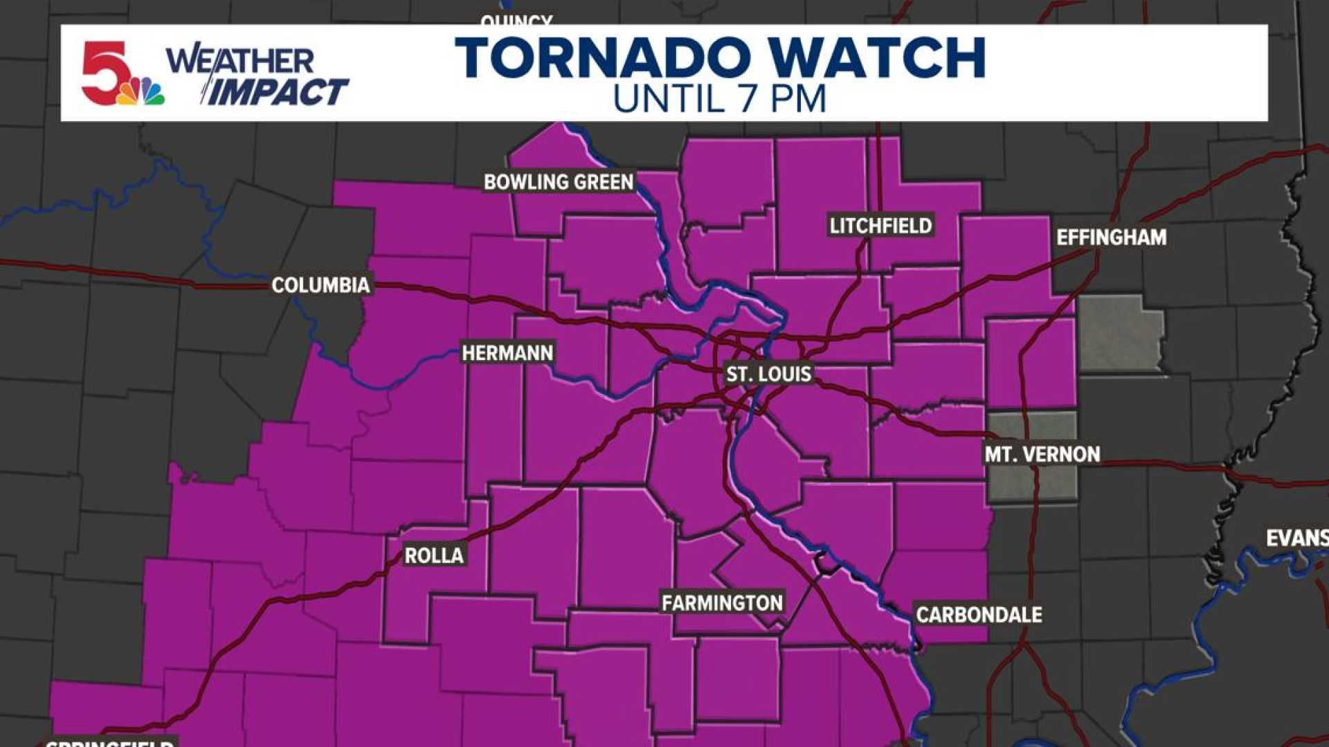
ST. LOUIS — Strong storms, including possible tornadoes and baseball-sized hail, are expected in the St. Louis area on Friday from 1 p.m. to 7 p.m., according to the 5 On Your Side Weather Impact Team.
Meteorologists confirmed a tornado touchdown in Clayton as St. Louis City, St. Louis County, and parts of the Metro East were placed under a tornado warning until 3:15 p.m. Additionally, a tornado was reported northeast of Des Arc around 3 p.m. and warnings were also issued for St. James and the surrounding areas of Crawford County until 2:30 p.m.
The Storm Prediction Center has rated St. Louis’ risk for severe weather at a four out of five, indicating a moderate risk level. “Our main reason for issuing a Weather Impact Alert Day for Friday is to give you as much of a heads up on the potential for impactful and potentially disruptive weather,” reported 5 On Your Side meteorologists.
The forecast highlights large hail as the main threat, though strong winds and a few tornadoes can’t be overlooked. Meteorologists noted the southeast of St. Louis may see the worst conditions.
“While the threat may be better to the southeast, that doesn’t mean other areas won’t experience severe weather,” the report stated. Residents are advised that not everyone will get rain, and storm predictions remain uncertain with just hours to go.
This outbreak follows severe storms on Thursday that affected Wisconsin and Minnesota. Tornadoes reported in those states caused damage and power outages as the storm system moves northeast into Canada. Warnings for severe thunderstorms remain in place across millions in the mid-Mississippi, Tennessee and Ohio Valleys where tornadoes and flash flooding are possible.
The situation remains fluid as meteorologists monitor developments. Updates will be provided as new information becomes available.


