News
Tornado Watch Issued as Severe Storms Approach East Tennessee
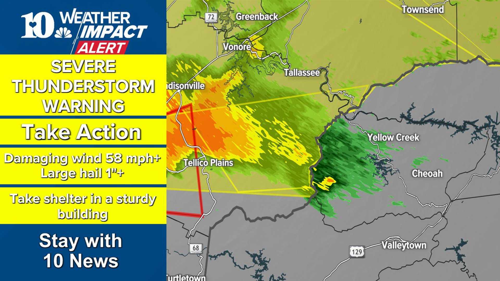
KNOXVILLE, Tenn. — A Tornado Watch is in effect for much of East Tennessee and parts of Kentucky until 8 p.m. EDT today. The National Weather Service warns that severe storms, including damaging winds and isolated tornadoes, are possible as a low-pressure system approaches from the northwest.
The Storm Prediction Center has placed East Tennessee and Southeast Kentucky at a level 3 out of 5 risk for severe weather, indicating that strong storms are likely. Meteorologists are closely monitoring the situation and advise residents to stay updated on weather alerts.
The primary threat from today’s storms will be damaging winds, with gusts potentially exceeding 60 mph. Such winds can topple trees and power lines, leading to power outages. Residents are urged to keep their mobile devices charged and have multiple sources for receiving weather notifications.
In addition to strong wind, hail and isolated tornadoes also pose a risk. Recent heavy rainfall has saturated the ground, heightening the likelihood of uprooted trees and localized flooding.
Scattered storms are expected to develop this afternoon, particularly along and west of Interstate 75. These initial cellular storms could produce large hail and isolated tornadoes. As the afternoon progresses, these cells may merge into a linear line of storms, forecasted to move across the area from about 7 p.m. to midnight.
Officials advise residents to seek shelter indoors during severe weather. Those in areas with increased tornado risk should identify safe locations within their homes, ideally places without windows and as far away from the exterior as possible. Essentials such as medication, power banks, and important documents should be kept readily accessible in emergency bags.
As conditions continue to evolve, those in East Tennessee should prepare for adverse weather and stay alert for ongoing updates.


