News
Tornado Watch Issued for Southeast Wisconsin as Severe Weather Approaches
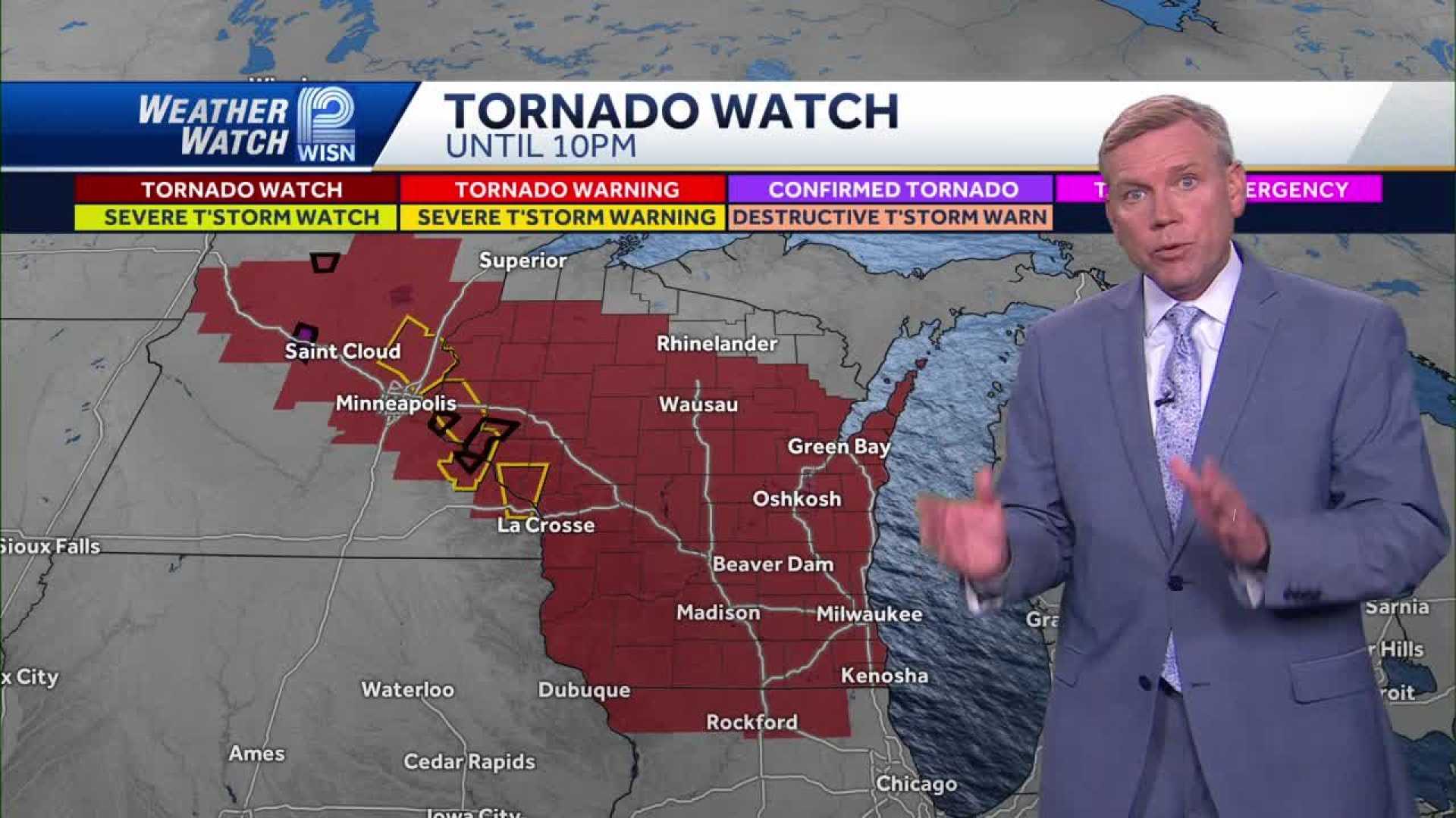
MILWAUKEE, Wis. — The National Weather Service has issued a tornado watch for all of southeast Wisconsin, including counties such as Kenosha, Racine, Milwaukee, and Sheboygan, until 10 p.m. on Thursday, May 15. This alert is part of a broader forecast for strong to severe storms across the region.
Forecasters indicate that the watch will remain in effect due to the possibility of severe weather, including large hail and wind gusts up to 70 mph. Residents are urged to stay vigilant and monitor local weather updates as conditions may deteriorate quickly.
The Storm Prediction Center has categorized the severe weather risk for southwestern Wisconsin as enhanced, rating it a level 3 out of 5. Meteorologists expect thunderstorms to begin developing in the early afternoon, specifically between 2 p.m. and 4 p.m., coinciding with peak heating when the atmosphere becomes unstable.
“This is a serious situation, and we want everyone to be prepared for severe weather, including potential tornadoes,” said Mark Baden from WeatherWatch 12. “Storms could intensify as they move eastward into southeast Wisconsin, especially between 4 p.m. and 8 p.m.”
The strongest storms are predicted to be north of Interstate 94, but authorities cannot discount intense storms south of the interstate as well. A lake breeze effect may create conditions favorable for brief tornadoes, particularly near Lake Michigan.
In preparation for possible severe weather, the public is encouraged to download weather apps that provide alerts and interactive radar. The CBS 58 Weather app is one option for residents to stay updated on storm developments.
As conditions evolve throughout the evening, officials remind the public to stay alert for any emergency notifications and heed safety instructions as necessary. Continued updates will be provided as the situation develops.


