News
Weather Changes Ahead: Spotty Showers Tuesday, Sunshine This Weekend
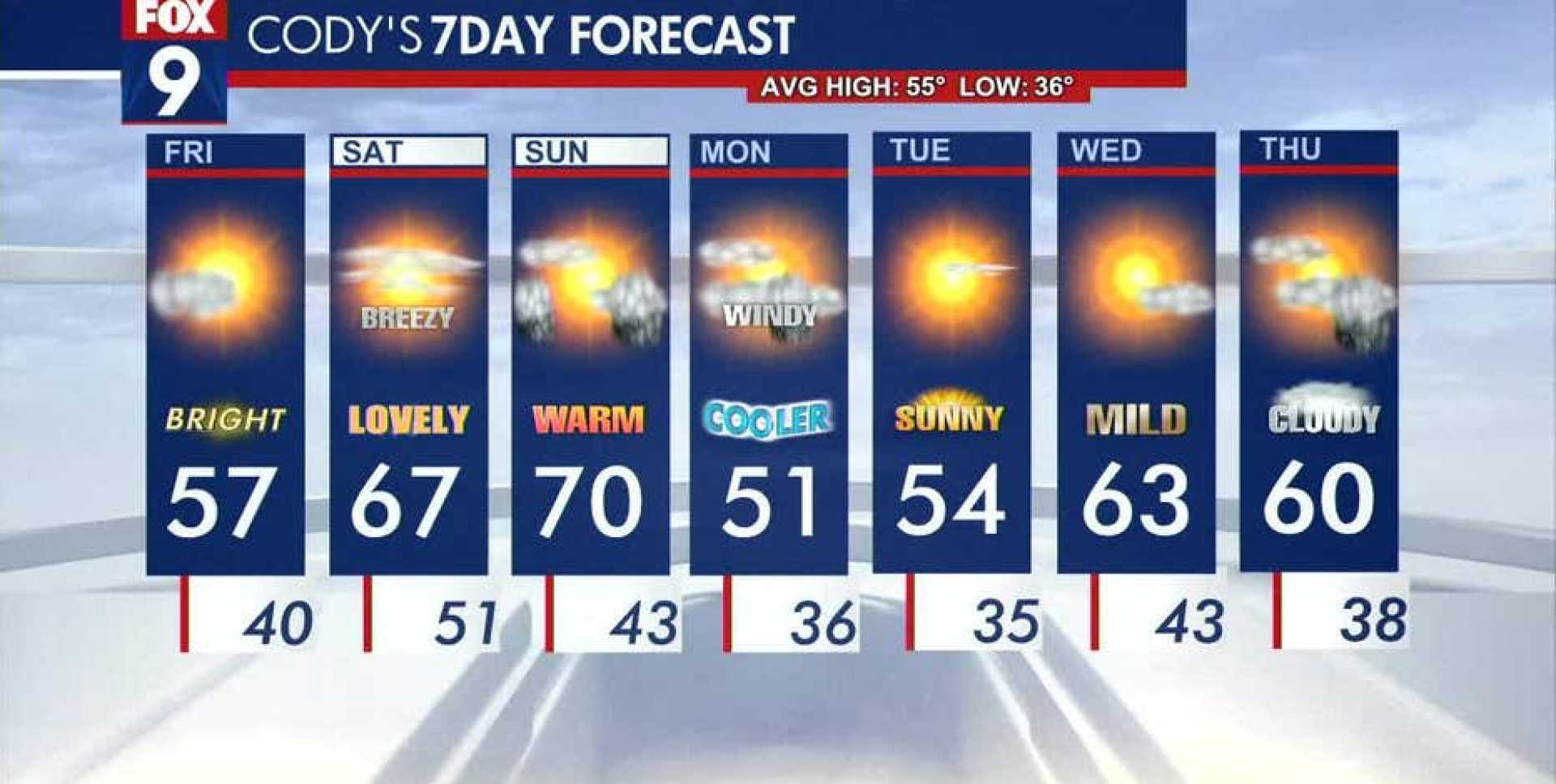
ROCHESTER, Minn. — A lingering cloud cover and isolated showers will characterize the weather in southeastern Minnesota on Thursday. By Friday, however, high pressure is expected to return, paving the way for sunnier and warmer conditions this weekend.
Thursday’s weather forecast indicates a slight chance of spotty showers as temperatures remain near or just below seasonal averages, with afternoon highs reaching the 40s and 50s. Despite these cooler temperatures, some sunshine is anticipated to break through the clouds. “It won’t be a washout, but keep an umbrella handy just in case,” said meteorologist Sara Knox.
As the week progresses, a transition to warmer weather is on track. Friday will see clearing skies and a rise in temperatures, with highs expected to hit the 60s in western regions of Minnesota and remain in the high 40s to 50s in the northern areas.
By Saturday and Sunday, warmer air will dominate, with highs forecasted in the 60s and even into the 70s in southern Minnesota, marking a significant change from the recent chill. The regions around the Twin Cities and St. Cloud remain the few areas not classified as experiencing abnormally dry conditions.
The Minnesota Department of Natural Resources has reported improved drought conditions following last week’s rains, which brought beneficial precipitation to parts of central and western Minnesota. The percentage of the state in at least moderate drought has decreased significantly from 63% to 47% over the past week.
The upcoming weekend will also introduce the possibility of rain starting late Saturday in northwestern Minnesota and spreading into southeastern areas into Sunday and Monday. This may include another round of snowfall for northern Minnesota late Sunday.
“Warm air from the south is gradually pushing its way into the region, and it will feel quite pleasant over the weekend,” noted storm tracker Travis Clark-Smith, emphasizing the south winds pushing temperatures up. Sunday in particular is expected to be breezy with gusts between 25-30 mph, potentially raising temperatures into the low 70s.
Preparations are underway for a potential cooldown after the warm spell, with predictions of northerly winds becoming prominent again by Monday. Highs may drop back into the 40s and 50s through Tuesday before warming up again through the rest of the week leading into Easter.
These dynamic weather changes portray a typical spring pattern where fluctuations in temperature and precipitation are expected. Weather experts encourage residents to stay updated on the forecasts as conditions can evolve rapidly.


