News
LA Wildfires Devastate Thousands of Structures, Could Be Worst in US History

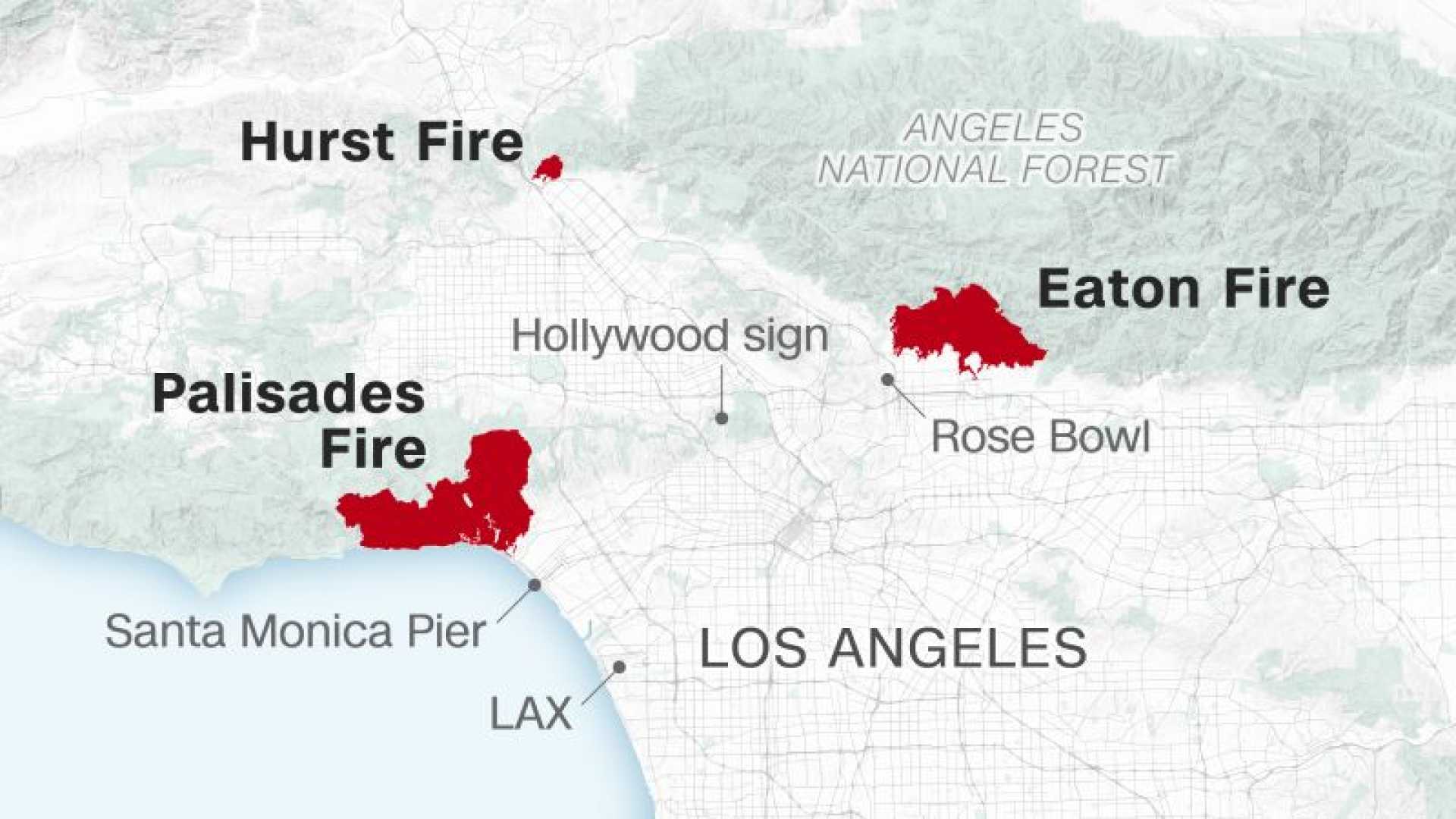
LOS ANGELES, Calif. — The Los Angeles County Fire Department has released detailed maps showing the extensive damage caused by two massive wildfires that have ravaged Southern California, potentially marking them as the worst natural disasters in U.S. history. The fires have destroyed or damaged thousands of structures, primarily homes, across the region.
As of Monday, the Palisades Fire had burned over 23,000 acres, destroying at least 10,000 structures in Pacific Palisades, Malibu, and parts of the Santa Monica Mountains. Meanwhile, the Eaton Fire has leveled approximately 7,000 structures and charred 14,000 acres in Altadena and Pasadena. The maps, which are updated as field inspections continue, use color-coded icons to indicate the status of each structure: red for destroyed, orange for major damage, yellow for minor damage, green for low impact, black for no damage, and grey for inaccessible areas.
Governor Gavin Newsom described the wildfires as a “particularly dangerous situation,” with critical fire weather conditions expected to persist through mid-week. The National Weather Service warned of low humidity and strong offshore winds, which could reach up to 70 mph in mountainous regions, fueling rapid fire growth. “We are bracing for extreme fire behavior,” Newsom said during a press briefing. He also signed executive orders to expedite rebuilding efforts, clear debris, and prepare for potential mudslides and flooding.
Firefighters have made limited progress in containing the blazes. The Palisades Fire is only 13 percent contained, while the Eaton Fire is 27 percent contained. More than 92,000 customers in California, primarily in Ventura and Los Angeles Counties, were left without power on Monday afternoon, according to outage tracker PowerOutage.us.
In response to the crisis, over 100 Orange County restaurants have pledged to donate 20 percent of their Tuesday sales to wildfire relief efforts. The initiative, organized by the nonprofit Dining for a Cause, aims to provide immediate assistance to affected residents. “This is a community effort to support those who have lost everything,” said a spokesperson for the organization.
Residents are urged to stay informed and evacuate if ordered. The Los Angeles County Fire Department has made the damage assessment maps available online, allowing users to search for specific addresses and monitor the evolving situation.


