News
Winter Storm Freya Sets Stage for Hazardous Commuting in NYC Area
NEW YORK, NY — A significant winter storm, named Freya by The Weather Channel, is set to impact the New York City area on Thursday morning, bringing a mix of freezing rain, snow, sleet, and ice. As a result, local schools are announcing closures and delays ahead of the hazardous commute.
According to forecasts, all forms of winter weather are expected to begin falling Wednesday night and continue into Thursday morning, creating treacherous travel conditions throughout the region. NJ 101.5 Chief Meteorologist Dan Zarrow reported that snow will start in the southwest corner of New Jersey and will become heavier as it moves northward.
“By daybreak Thursday, a flip from the icy mix to rain will be underway, beginning along the coast and moving inland,” Zarrow explained. “This is a critical moment as the morning commute starts.” Precipitation should taper off by early Thursday afternoon, with conditions improving in the later part of the day.
As the storm progresses, Friday will be breezy but dry, with the possibility of two more winter storms mid-February. Zarrow mentioned that the upcoming storms will likely bring a similar wintry mix starting late Saturday and potentially more snow on Tuesday.
In areas affected by Winter Storm Freya, commuting conditions have already become problematic. As reported by FlightAware.com, nearly 5,000 flights have been affected due to the storm, with LaGuardia and Newark Liberty International Airports experiencing cancellations and delays.
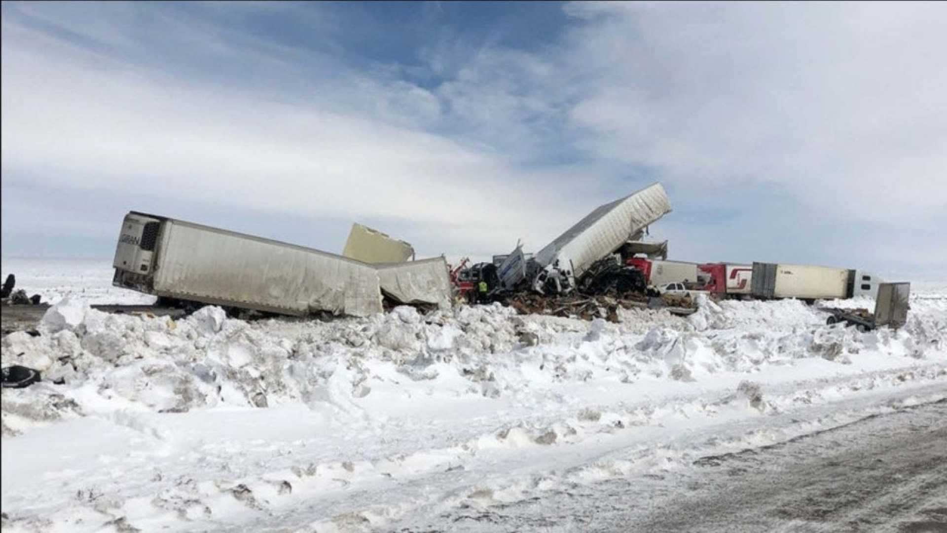
The New Jersey Department of Transportation has issued speed advisories across major highways, recommending that drivers adhere to 45 mph limits in most affected areas. With reports of spinouts across highways, the Connecticut State Police noted multiple accidents, including two involving tractor-trailers on the snowy Massachusetts Parkway.
Local authorities further warned of the damaging potential of ice accumulation, as significant ice storms can lead to widespread power outages and tree damage. Thankfully, reports indicate that as of Thursday morning, fewer than 100,000 customers were without power across affected regions.
In addition to the winter weather warnings across the Tri-State area, parts of West Virginia have been placed under flash flood emergencies following significant rainfall associated with Freya. The National Weather Service warns that while the rain is transitioning to mild temperatures, the risk of flooding remains high due to swollen rivers and creeks.
“Plan on slippery road conditions. These hazardous conditions could affect Thursday morning and evening commutes,” a spokesperson from the National Weather Service cautioned.
While icy conditions were responsible for chaos on the roads, the storm remained unusual as warmer air began to penetrate into the atmosphere. This shifting weather pattern is customary for February, a month historically marked by a peak in winter storms.
As Freya makes its way out of the area late Thursday, forecasters expect another round of snow to begin affecting the Midwest by late Friday. Areas along the I-95 corridor could see up to 4 inches of additional snow, and temperatures across New York may drop, allowing for the potential of further snow over the weekend.


