News
Winter Storm Warning Issued as Snow and Ice Approach Indiana and Kentucky
LOUISVILLE, Ky. — The National Weather Service (NWS) has issued a Winter Storm Warning for several counties in Indiana and Kentucky, set to take effect this evening at 7 PM EST and lasting until 7 AM EST Wednesday. The warning comes as a significant winter storm approaches the region, bringing heavy mixed precipitation.
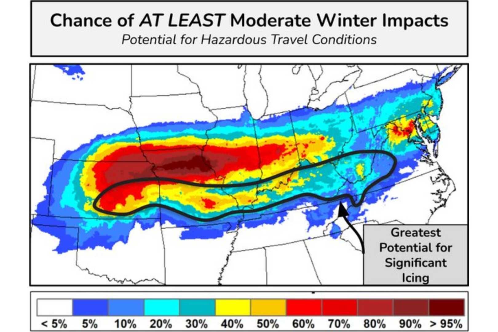
According to the NWS, total snow accumulations are expected to range between 3 and 5 inches, with some areas experiencing locally higher totals due to heavy snowfall bands. Additionally, ice accumulations may reach a light glaze, which could complicate travel conditions.
The affected areas include south central Indiana and various regions in eastern, north central, and southern Kentucky. Residents are advised to prepare for hazardous driving conditions, particularly during Tuesday morning and evening commutes.
“Plan on slippery road conditions,” the NWS warned, emphasizing the need for caution during the expected inclement weather. Updates on the storm’s timing and total snowfall will be provided by the WDRB Weather team throughout the day, both online and on air.
In a related forecast from Massachusetts, another winter storm is anticipated this weekend, with snow beginning Saturday evening. The Boston 25 Weather team indicated that significant snowfall is expected, particularly north of Interstate 90, where totals could reach up to 9 inches. An advisory for winter weather is already in effect across most of the state.
Boston 25 Meteorologist Vicki Graf highlighted the potential for disruptive ice accumulation, warning that portions of the region could see up to a quarter inch of ice. “This could lead to tree branches sagging or breaking, slick roads, and potentially power outages,” Graf stated.
Moreover, a high wind watch is also in place for Monday as winds could gust up to 60 mph, exacerbating the storm’s impact. As the storm progresses, continuous updates will be provided to ensure public safety and preparedness.
For ongoing updates and detailed forecasts, residents are encouraged to check the latest information from local news stations.


