News
Winter Storm Warnings Issued Across 12 States, Up to 48 Inches of Snow Expected
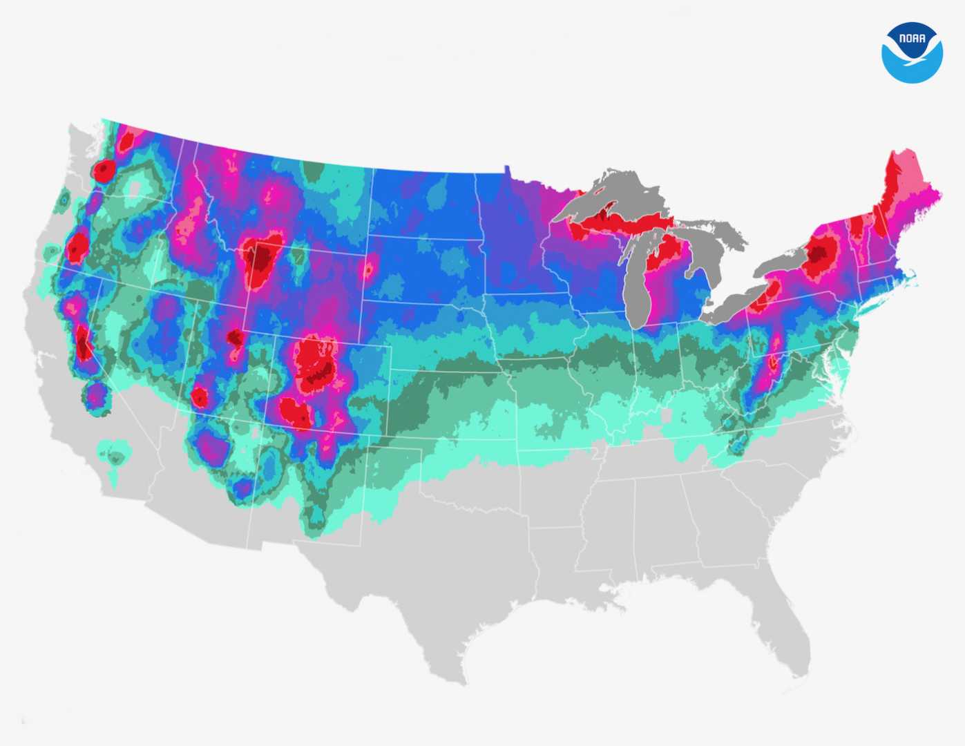
WASHINGTON, D.C. — A massive winter storm is set to blanket 12 states with heavy snowfall, creating hazardous conditions and prompting widespread warnings from the National Weather Service (NWS). Up to 48 inches of snow could accumulate in some areas, particularly in Wyoming‘s highest peaks, while blizzard conditions and dangerously cold wind chills threaten Alaska and other regions.
The storm, expected to hit on Saturday, has triggered winter storm warnings and advisories across Washington, Colorado, Idaho, California, Utah, Nevada, Oregon, Montana, Wyoming, Minnesota, Alaska, and Michigan. The NWS warned of potential frostbite and hypothermia in Wyoming, where temperatures are expected to plummet, and blizzard conditions in Alaska that could reduce visibility to near zero.
In the Pacific Northwest, the West Slopes of the North Cascades and surrounding areas, including Packwood and Stevens Pass, could see 4 to 8 inches of snow above 3,000 feet. The Upper Slopes of the Eastern Washington Cascades and Oregon’s Central and Southern Cascades may receive up to 30 inches of snow in some locations. “Heavy snow is forecast throughout much of the higher terrain of the West, with lighter low elevation snow also possible for parts of the Pacific Northwest,” the NWS Weather Prediction Center said on X.
Montana, Nevada, and California are also bracing for significant snowfall. The Ruby Mountains and East Humboldt Range in Nevada could accumulate up to 27 inches by Monday morning, while Northern California’s Sierra Nevada region faces heavy, wet snow that may lead to power outages from downed trees. In Montana, the Missoula/Bitterroot Valleys are under a Winter Storm Warning until 5 p.m. MST Saturday, with mixed precipitation, ice, and snow squalls making travel nearly impossible.
Further west, the North Oregon Coast Range and South Washington Cascades are under a Winter Storm Warning until 4 a.m. PST Sunday, with 8 to 14 inches of snow expected above 2,500 feet and winds gusting up to 45 mph. The NWS Missoula warned, “Missoula Police Department has issued an emergency travel only due to deteriorating road conditions. We have upgraded the winter weather advisory to a winter storm warning for ice accumulation through morning for the Missoula and Bitterroot Valleys.”
Residents across the affected regions are advised to avoid unnecessary travel and prepare for potential power outages. The NWS recommends keeping winter emergency kits in vehicles, including flashlights, food, and blankets. Local forecasts and road conditions should be checked regularly for updates.
Some weather warnings will remain in effect until Tuesday evening, while others are expected to expire by the weekend. The NWS continues to monitor the storm and will issue updates as conditions evolve.


