News
Wintry Mix Threatens Travel in North Carolina’s Piedmont Triad
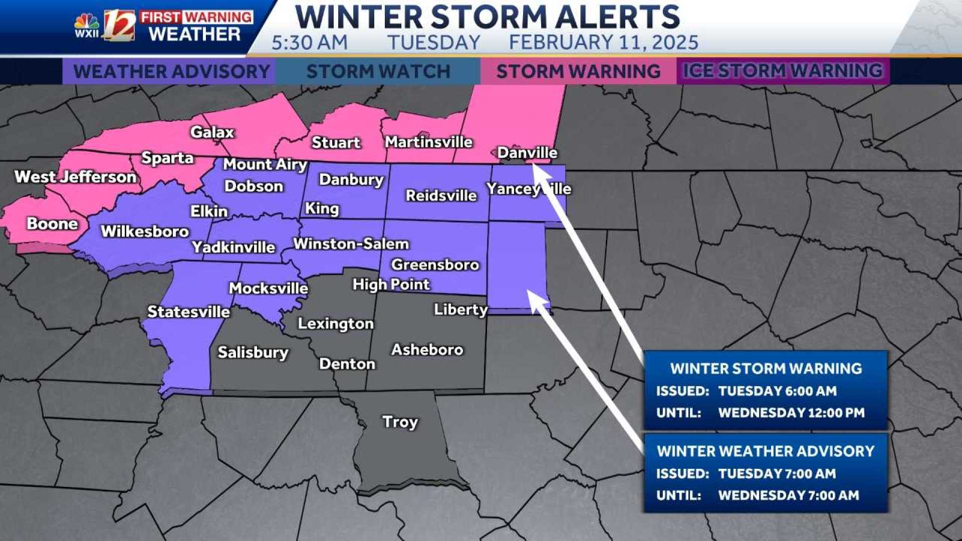
WINSTON-SALEM, N.C. — A wintry mix of snow, sleet, and freezing rain is expected to impact travel across North Carolina‘s Piedmont Triad starting today and continuing into Wednesday. The inclement weather poses risks for icy road conditions, particularly in northern and western counties.
The National Weather Service reports that initial moisture is moving through northern parts of the region, with temperatures hovering at or above freezing in most areas. This positioning allows for primarily rain in the Piedmont while potentially hazardous wintry conditions are anticipated in the northwest foothills and mountains.
“The snowfall and sleet are beginning to accumulate in the Laurel Fork area of Patrick County, where reports indicate totals of up to two inches could develop rapidly,” said meteorologist Dylan Hudler. “We anticipate temperatures will remain marginal, causing a transition toward freezing rain as conditions evolve. This could lead to significant icing in those areas.”
Throughout the day, the Piedmont will likely experience heavy rain with occasional sleet mixing in, especially during the afternoon hours. Forecasters indicate that accumulation of ice as high as a half inch could result in widespread power outages and difficult travel conditions.
According to Eric Southern from Surry County Emergency Services, the risk is particularly pronounced on bridges and overpasses. “Just assume that there is ice on the roads, especially in the foothills and areas to the north,” he stated. “Although we are currently above freezing, conditions can change rapidly and we encourage everyone to drive cautiously.”
The winter weather advisory is in effect for various northern counties through Wednesday morning, with continued monitoring of conditions as the storm system unfolds.
For the Triad, areas south of Interstate 85 are expected to remain mainly rain, while colder temperatures to the north raise concerns for more substantial wintry precipitation. Meteorologists emphasize the importance of staying updated as forecasts can shift as the storm progresses.
By Wednesday afternoon, temperatures should rise sufficiently to alleviate most wintry concerns for the Piedmont, leaving cold rain in its wake, and a revised forecast indicates a potential for 2–4 inches of rain throughout the week, leading to possible flooding.
Surry County schools are currently closed, aiding in keeping traffic volumes down during what could be a hazardous morning commute.
For ongoing updates related to travel and weather conditions, residents are encouraged to utilize the WXII12 News mobile app and check local news sources for the latest advisories.


