News
Wintry Weather Set to Impact Tri-State Area with Multiple Storms
NEW YORK (WABC) — A series of winter storms are poised to affect the Tri-State Area this week, starting with accumulating snow expected on Tuesday night. Meteorologist Brittany Bell reports that snow will range from minimal accumulations in northern areas to as much as six inches in parts of southern New Jersey, prompting a winter storm warning.
The winter weather advisory covers parts of New Jersey, as the northern edge of potential accumulation will be defined by Interstate 80 in both Pennsylvania and New Jersey. Forecasters indicate that a minor shift in the storm’s track could significantly alter expected snowfall totals.
In the New York City metro area, projections estimate that 1 to 3 inches of snow may accumulate across central New Jersey to Long Island. Following Tuesday’s snow, a second storm is anticipated to arrive on Wednesday night, starting with a wintry mix before turning into rain that is expected to last into Thursday morning.
Audrey Puente of FOX 5 NY explained, “As we go into Tuesday night, that’s when we start to see our weather patterns shift just a bit,” highlighting that the region will be on the northern fringe of a storm passing to the south. Forecast models indicate that New York City could see double-digit totals from multiple storm systems between February 10 and February 17.
The development of the first of three winter storms is scheduled for Monday, with preparations already underway. After impacting the Plains, the storm is predicted to sweep into the Valley on Tuesday and affect areas in the Northeast from Tuesday night into Wednesday morning.
As the initial storm subsides on Wednesday, forecasters indicate the second storm will be forming right over the Plains. The National Weather Service has already issued a winter storm watch for parts of New Jersey that will be in effect from Tuesday afternoon through Wednesday afternoon.
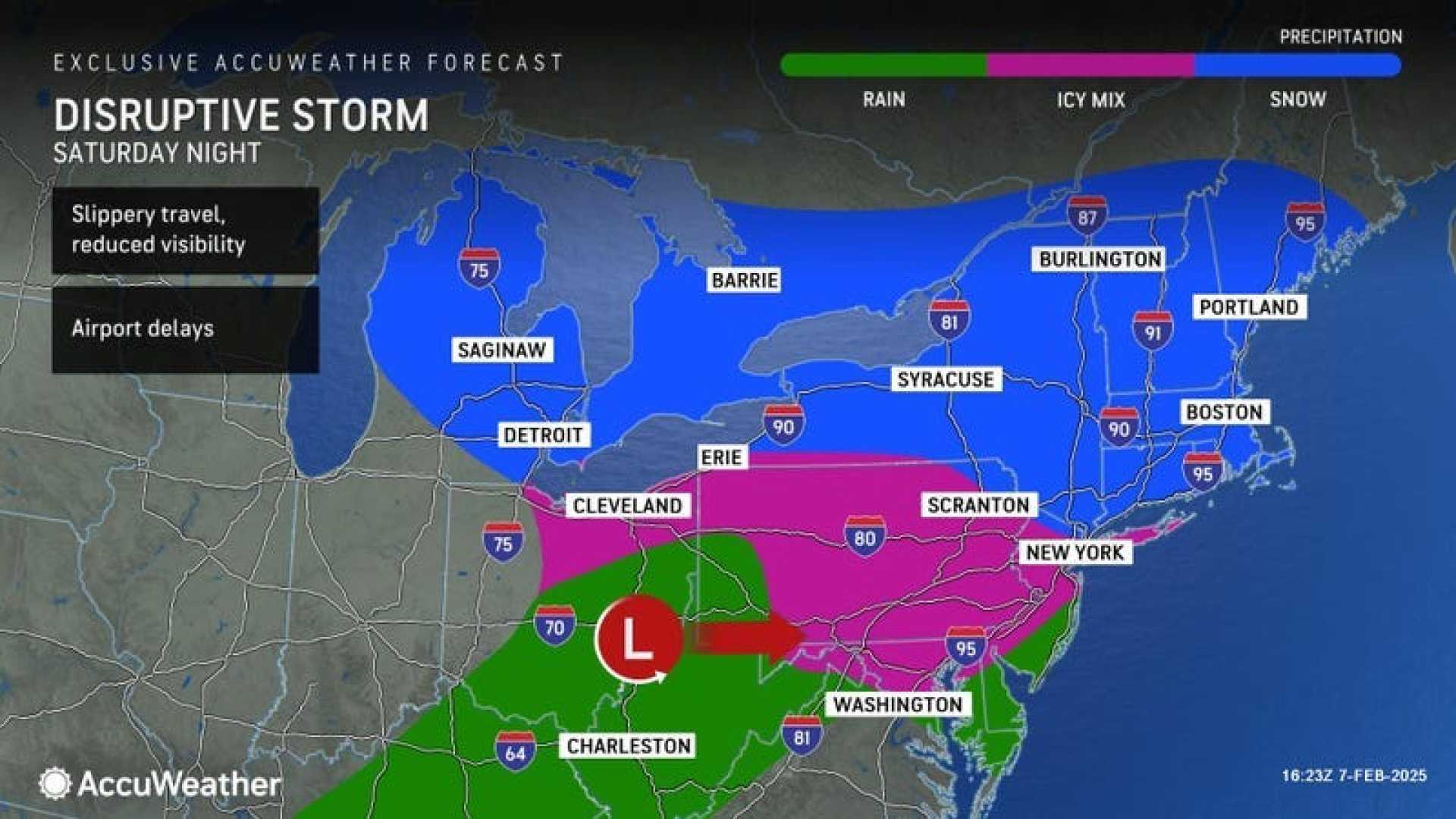
Looking ahead to the weekend, another system is expected to bring additional winter weather on Saturday, possibly transitioning into rain by Sunday morning. This sequence of storms shows no sign of slowing down, with another round of wintry weather anticipated by mid-next week.
A winter weather advisory is also in place for New York City, Long Island, the Hudson Valley, and much of New Jersey, as conditions are expected to deteriorate with the arrival of the next system early Thursday. While not projected to be a significant snowmaker, it could complicate the morning commute. Up to 2 inches of snow and a tenth of an inch of ice is possible in inland areas.
According to Javier Lojan, acting Commissioner of the New York City Department of Sanitation, “The freezing rain and sleet is the biggest concern,” urging residents to exercise caution while traveling.
As of 11 a.m. on Monday, over 600 flight cancellations and delays were reported at New York City’s airports, with nearly 6,000 customers experiencing power outages, particularly in New Jersey.
Early snow totals indicate a trend of mostly light accumulations, with Highland, New York, reporting 2 inches and New Fairfield, Connecticut, receiving about 1.8 inches. Meanwhile, Central Park noted half an inch of snow.
In the upcoming days, NYC is likely to experience another chance for a snow/rain mix on Saturday afternoon, transitioning fully to rain by early Sunday. Additional systems following this weekend may bring significant snow to parts of the region, particularly as another storm develops mid-next week.


