News
Severe Storms Expected Thursday in Northern Plains and Upper Midwest
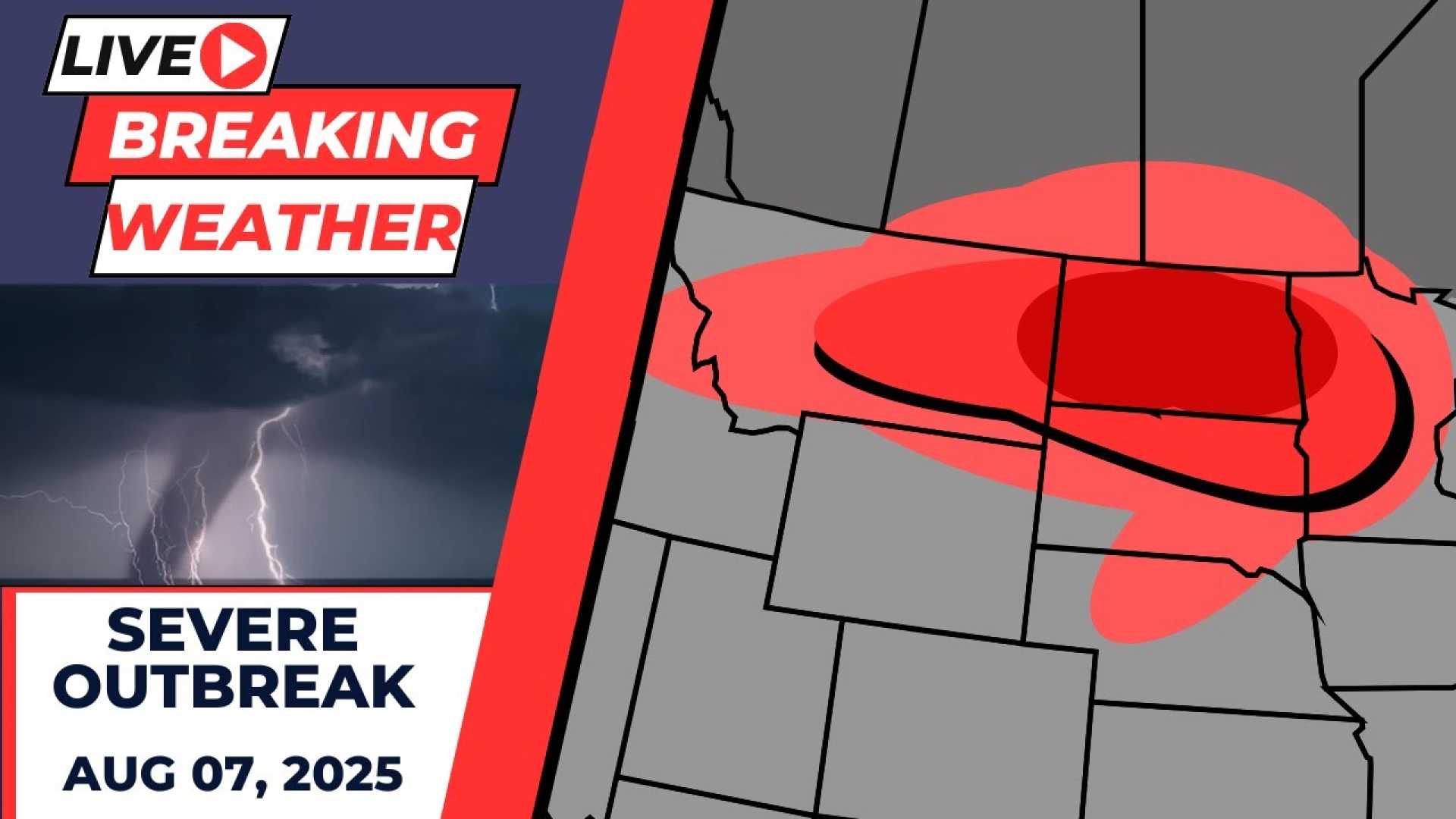
BISMARCK, N.D. – Powerful thunderstorms with hurricane-force winds, tornadoes, and large hail are expected on Thursday, August 7, 2025, across parts of the northern Plains and Upper Midwest. Meteorologists Bob Van Dillen and Bayne Frone from FOX Weather report that a frontal boundary moving through the region will be the focus for severe weather.
The Storm Prediction Center has highlighted areas, including parts of North Dakota and South Dakota, as having the highest risk for severe storms. The threat may shift slightly eastward into the following Friday, bringing risks to additional states.
Severe storms are predicted to develop mainly in the late afternoon and evening hours, with activity potentially continuing overnight. Forecasters warn that these storms could lead to tornadoes or even long-lived outbreak systems if conditions are conducive.
Currently, about 500,000 residents are under the severe thunderstorm threat. Meteorologists noted in an SPC outlook, “Scattered storms are likely to develop during Thursday afternoon and grow into a severe MCS. This setup could support tornadoes, significant wind damage, and hailstones greater than 1 inch.”
As the weekend approaches, storm chances will extend eastward into cities such as Minneapolis and Chicago, although the intensity of these storms will rely on atmospheric instability. Much of the Midwest can expect general thunderstorm activity, but few are anticipated to reach severe thresholds.
Heavy rainfall poses dangers even in non-severe thunderstorms, as it can lead to localized flooding. Additionally, lightning remains a significant cause of storm-related fatalities. Meanwhile, a tropical disturbance is also being monitored in the Atlantic, showing a medium chance for development over the upcoming days.


