News
Severe Weather Alert Issued for Houston Area Monday Night
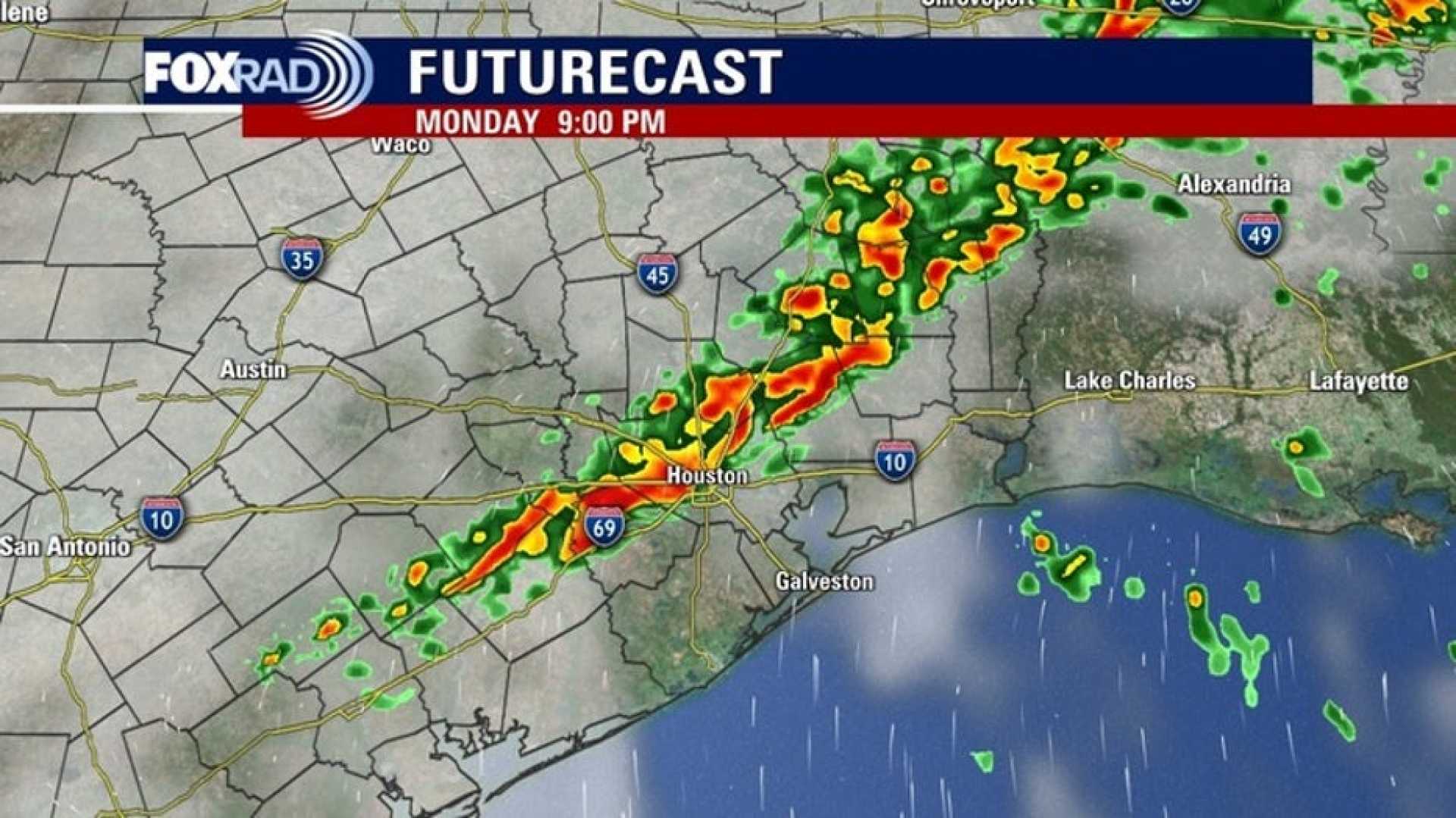
HOUSTON, Texas — A FOX 26 Storm Alert is in effect for Monday night as thunderstorms are expected to sweep through the Houston area. Meteorologists warn that some rain could be heavy, leading to potential flash flooding.
As moisture streams into the region, the threat of severe weather increases, particularly later in the day. Most areas are under a Level 1 risk, while downtown Houston and northern regions face a Level 2 risk for severe conditions.
The National Weather Service has issued a tornado watch for several counties including Harris, Montgomery, and Waller, among others. This watch is effective until 7 p.m. A tornado warning is currently in place for parts of Austin and Waller counties due to a severe thunderstorm capable of producing a tornado.
“This storm system is significant, with damaging winds, hail, and the possibility of tornadoes in the forecast,” said a weather official. The strongest storms are expected north of Interstate 10 and west of Interstate 45.
Travelers are advised to remain vigilant, as air travel disruptions are already occurring in North Texas due to heavy rain. Both Bush and Hobby airports in Houston could experience delays as storms are expected to move through during the evening.
The weather should improve by Thanksgiving, with lower humidity and cooler temperatures. Highs on Thanksgiving are expected to be in the 60s, while lows could drop to the 40s and 50s throughout the region. After Monday’s expected disturbances, drier and more pleasant conditions should prevail into the holiday weekend.


