News
Cooler Weather and Rain Expected in Northern California Next Week
***SACRAMENTO, California*** — A significant change in weather is on the way for Northern California, as meteorologist Dirk Verdoorn from KCRA 3 Weather reports increased cloud cover and cooler temperatures starting Tuesday night. Light showers are expected to begin Wednesday morning.
The transition from warm, sunny weather to cloudy skies will lead to daytime temperatures dropping to the mid-70s across the region. While most of the precipitation will be south of Sacramento, there remains a chance for some sprinkles in the local area and surrounding mountains.
“It’s not a substantial amount of rain, but there’s definitely a possibility for some wet weather,” Verdoorn stated during the weather update. He noted that current temperatures are in the low 80s in areas like Sacramento, Stockton, and Modesto.
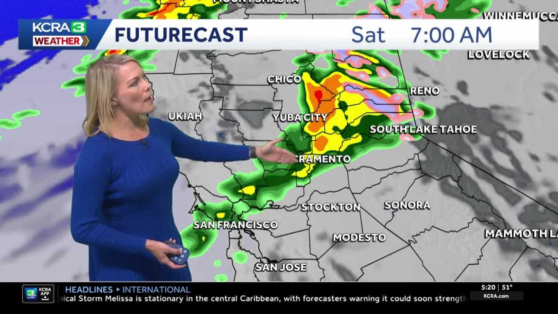
Conditions are projected to improve temporarily on Wednesday afternoon, with drier and warmer weather returning until Friday. However, a more significant chance for rain will develop on Saturday, with on-and-off showers expected throughout the day. Rainfall amounts may vary, ranging from trace amounts in the San Joaquin Valley to about .25 inches in areas north of Sacramento.
Verdoorn pointed out that the mountains could receive over a half-inch of rain, while snow levels are forecasted to remain above pass levels on Saturday but drop below 7,000 feet by Sunday.
As forecasters keep an eye on the storm’s approach, there is a likelihood of chain controls on mountain passes, although the exact details remain uncertain. “We will continue updating this as we get closer to the weekend,” Verdoorn added.


