World
Cyclone Alfred Approaches Queensland: Residents Brace for Impact
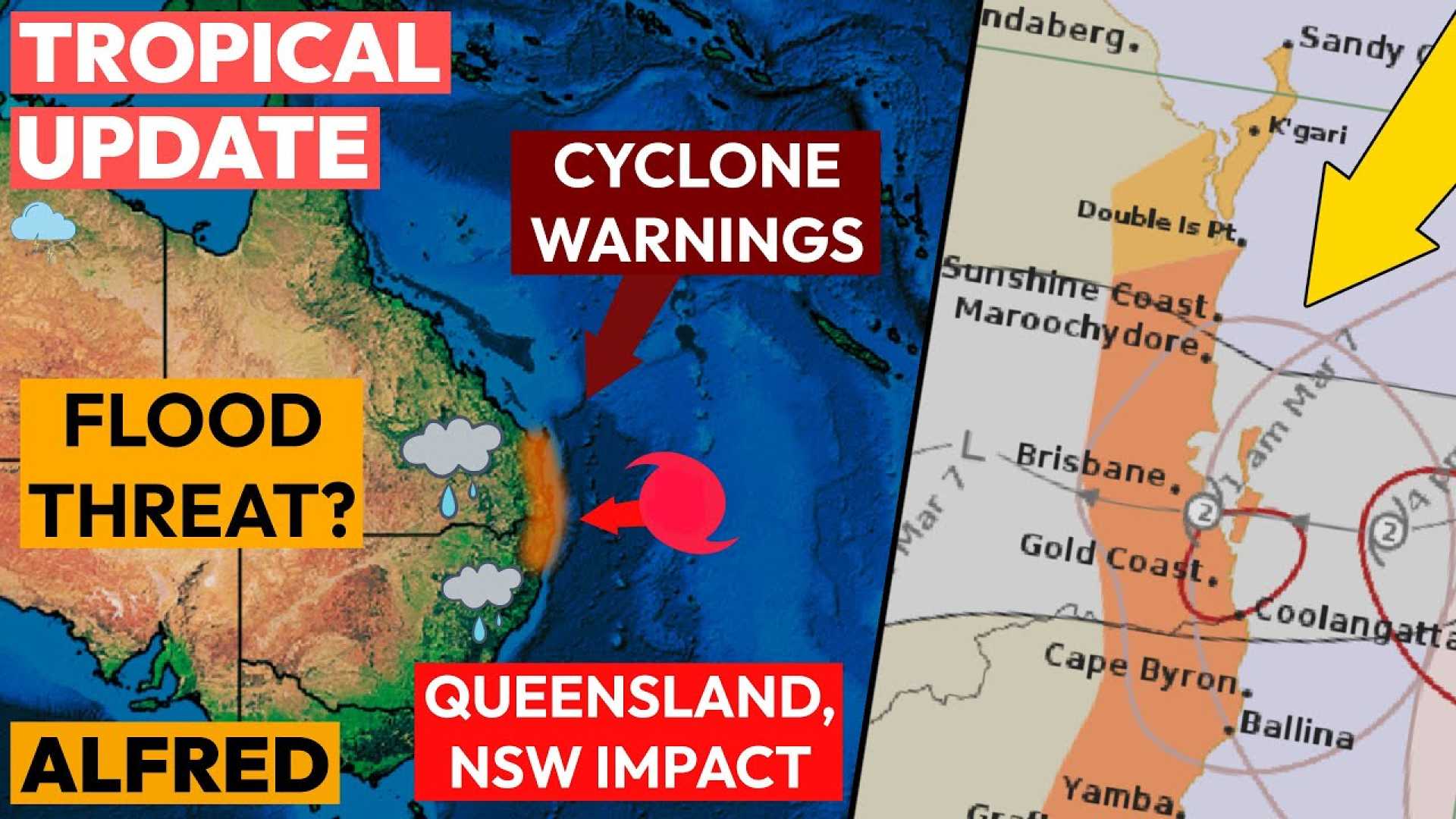
BRISBANE, Australia — Cyclone Alfred is intensifying as it approaches the South East Queensland coast, anticipated to make landfall late Friday or early Saturday, impacting areas stretching into northern New South Wales.
The Bureau of Meteorology reports that the cyclone, currently categorized as a 2, is expected to bring heavy rainfall and destructive winds ranging from 89 to 117 km/h, with gusts up to 164 km/h. Early projections indicated the cyclone could strengthen to a low-end category 3, heightening concerns for residents in the affected regions.
Adrian Schrinner, Lord Mayor of Brisbane, addressed the looming storm, stating, “Models suggest that around 20,000 properties in Brisbane could be at risk for storm surge or flooding.” This information raises alarms as residents in southeastern Queensland and northeastern NSW prepare for potential property damage, flooding, and power outages.
The cyclone’s trajectory has captured attention, with the latest projections indicating a possible prime crossing point between Noosa and Coolangatta, shifting from an early Friday morning forecast to later on Friday. Meteorologists recommend keeping abreast of updates as conditions can change swiftly.
Dr. Hamish Ramsay, a cyclone expert at the Commonwealth Scientific and Industrial Research Organisation (CSIRO), clarifies the phenomena influencing the cyclone’s path: “The steering flow, or the prevailing winds between two and 10 kilometers up in the atmosphere, often dictate a cyclone’s movement. However, a cyclone making landfall this far south is unusual due to mid-latitude weather systems that typically steer such storms away from Australia.”
The Bureau of Meteorology’s models, which incorporate data from various international sources, including Europe, the U.S., and Japan, track the cyclone regularly, providing updated maps every six hours. Output from the models often presents numerous potential tracks, which can resemble a plate of spaghetti. But as these lines begin to align, confidence in predicting the cyclone’s path increases.
A unique atmospheric and oceanic setting has enabled Cyclone Alfred to maintain its intensity, propagating toward warm waters while being shaped by surrounding high-pressure systems. With the cyclone’s core expected to impact regions far to the south, the storm could contribute to tidal surges and heavy surf, raising the risk of serious coastal erosion.
Forecasts indicate that if the cyclone crosses the coast at high tide, the resulting storm surge could inundate low-lying communities, notably along the Gold Coast. Many residents have already faced devastating floods in the past years, and renewed warnings have caused heightened anxiety as Alfred nears.
“The highest mortality rates from tropical cyclones are often linked to rainfall, rather than wind. Therefore, while wind speeds may be a concern, the significant threat lies in potential flooding and the ensuing rain,” Ramsay noted.
As the cyclone continues its approach, warning systems are in place for impacted areas, and preparations are underway. Awareness of cyclone preparedness and safety guidelines can be critical in addressing the storm’s dangers.
For ongoing updates about Cyclone Alfred, residents are urged to monitor the Bureau of Meteorology’s announcements and heed all safety advice from local authorities.


