News
Heat and Scattered Storms Impact Southwest Florida on Tuesday
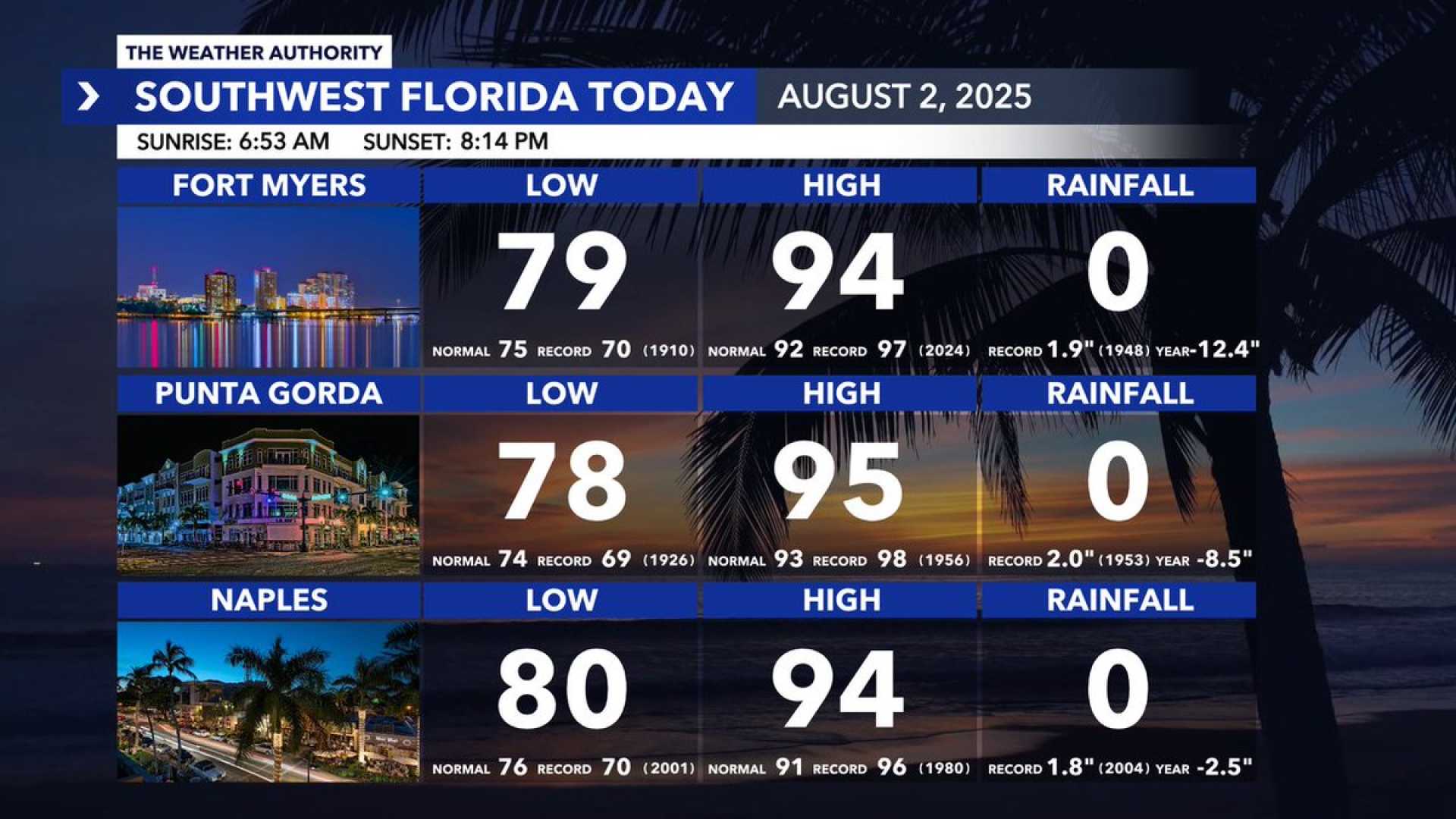
FORT MYERS, Fla. — Southwest Florida is bracing for near-record heat and a slight increase in storm coverage this Tuesday. Heat advisories have been issued for Collier, Hendry, and Glades counties, where the ‘feels-like’ temperatures could reach 112 degrees.
In the late afternoon and evening, scattered showers and thunderstorms are expected to develop. The main threats from these storms include heavy rain, lightning, and gusty winds. While the storms won’t result in a total washout, residents can expect more frequent rain than in recent days.
Overnight, temperatures will drop to the upper 70s, leading to drier conditions. However, rain chances will increase again on Wednesday, bringing widespread rain and storms in the afternoon and evening. Highs for the week will remain in the 90s but may trend closer to seasonal averages in the low 90s by the weekend.
The tropics are becoming more active as August progresses, though there are currently no threats to Southwest Florida. The Atlantic hurricane season runs from June 1 to November 30.
Residents are encouraged to stay hydrated and take precautions when outdoors. Follow local weather updates for the most accurate forecasts during this heat wave.


