News
Major Atmospheric River to Bring Rain and Wind to Western Washington
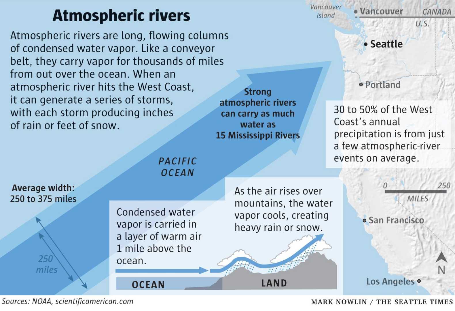
SEATTLE, Washington – An atmospheric river is set to impact Western Washington starting Thursday night, bringing significant rainfall and gusty winds across the region. The National Weather Service forecasts that this weather system will deliver between 1 and 3 inches of rain through the weekend.
The heaviest rain is expected in the Puget Sound Basin on Friday morning, coinciding with the start of the work commute. Wind gusts could reach up to 40 mph in some areas, especially along the coast and in the northwest interior. Motorists are advised to allow extra travel time due to potentially slick roads and low visibility.
Claire Anderson, a meteorologist from FOX 13, noted that after a day of mild and cloudy weather, Friday will bring heavy to moderate rain throughout the day as the first front moves through. The winds will also intensify, with strong gusts lasting into Saturday.
“Rainfall rates may overwhelm clogged drains, leading to isolated street flooding,” said Anderson. “Drivers should be cautious and prepared for difficult travel conditions.”
As the storm progresses into Saturday, another weather system will bring more rain and potentially gusty winds. Snow levels are forecast to drop to around 4,000 feet, which could result in a few inches of snow accumulation at higher elevations like Stevens Pass.
The storm will continue to bring periods of rain into Sunday, but the intensity is expected to decrease. With temperatures in the low 50s, residents can expect cool conditions and overcast skies throughout the weekend.
Local utilities are asking residents to clear storm drains to prevent flooding caused by fallen leaves mixed with rain. While the storm event will create challenges, widespread flooding is not anticipated.
By Monday, rain showers are expected to ease with sunbreaks returning, but rain may resume later in the week, making this period significant for residents as they prepare for typical fall weather.


