News
Major Storm Hits Northern California with Rain and Snow Forecasted
SACRAMENTO, Calif. — Northern California is bracing for its first major storm of the season, bringing significant rain and snow to the region over the next few days. The KCRA 3 weather team has declared Tuesday an Impact Day due to the expected wet conditions, which will affect travel and outdoor plans.
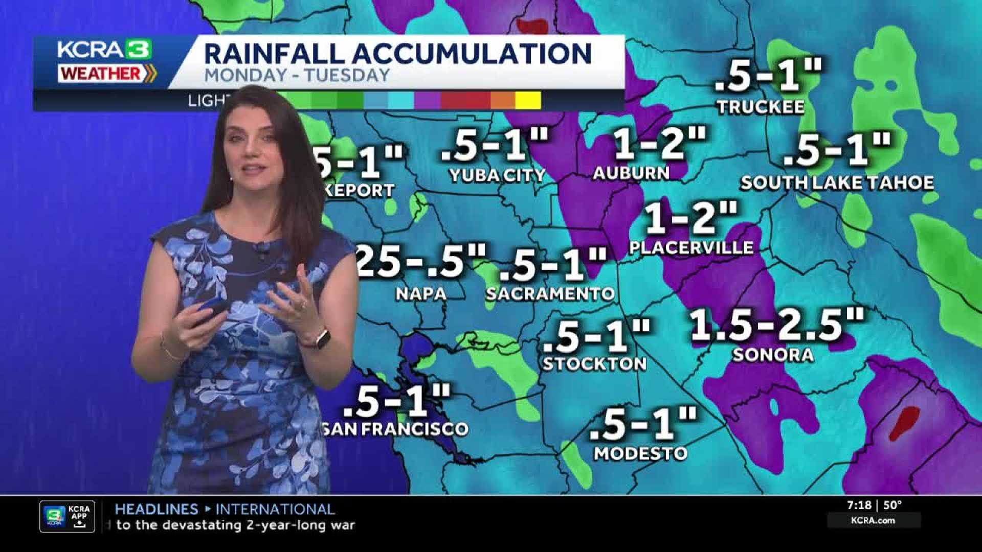
The storm was already causing rain across the Valley Monday evening, with meteorologist Heather Waldman reporting that the heaviest rainfall was occurring in Sacramento. The foothills have experienced less accumulation, but rainfall is anticipated to shift eastward through the night.
By Tuesday, light hit-and-miss showers are expected to persist in the Valley and foothills. Although there will be some dry periods, the temperatures will remain cool, likely ranging from the upper 50s to low 60s. The Valley could receive an additional half inch of rain by the end of Tuesday, while the foothills may see between a quarter and half inch, especially south of Highway 50.
Thunderstorms may develop in the San Joaquin Valley by Tuesday afternoon, although the rain from Monday has reduced the risk of fire starts. Snow levels will also impact travel, dropping to 6,000 feet during the day and to 5,500 feet overnight. Areas south of Highway 50 are expected to receive the most snow, with estimates of 8-12 inches near Donner Pass and up to 30 inches possible at Sonora Pass.
Chain controls are likely on major highways during this storm, requiring lower speed limits—30 mph on Interstate 80 and 25 mph on Highway 50. The weather team is advising motorists to remain cautious, as snow showers may linger into Wednesday before drier conditions return later this week.


