News
Oregon Implements Stricter Wildfire Rules for High-Risk Areas

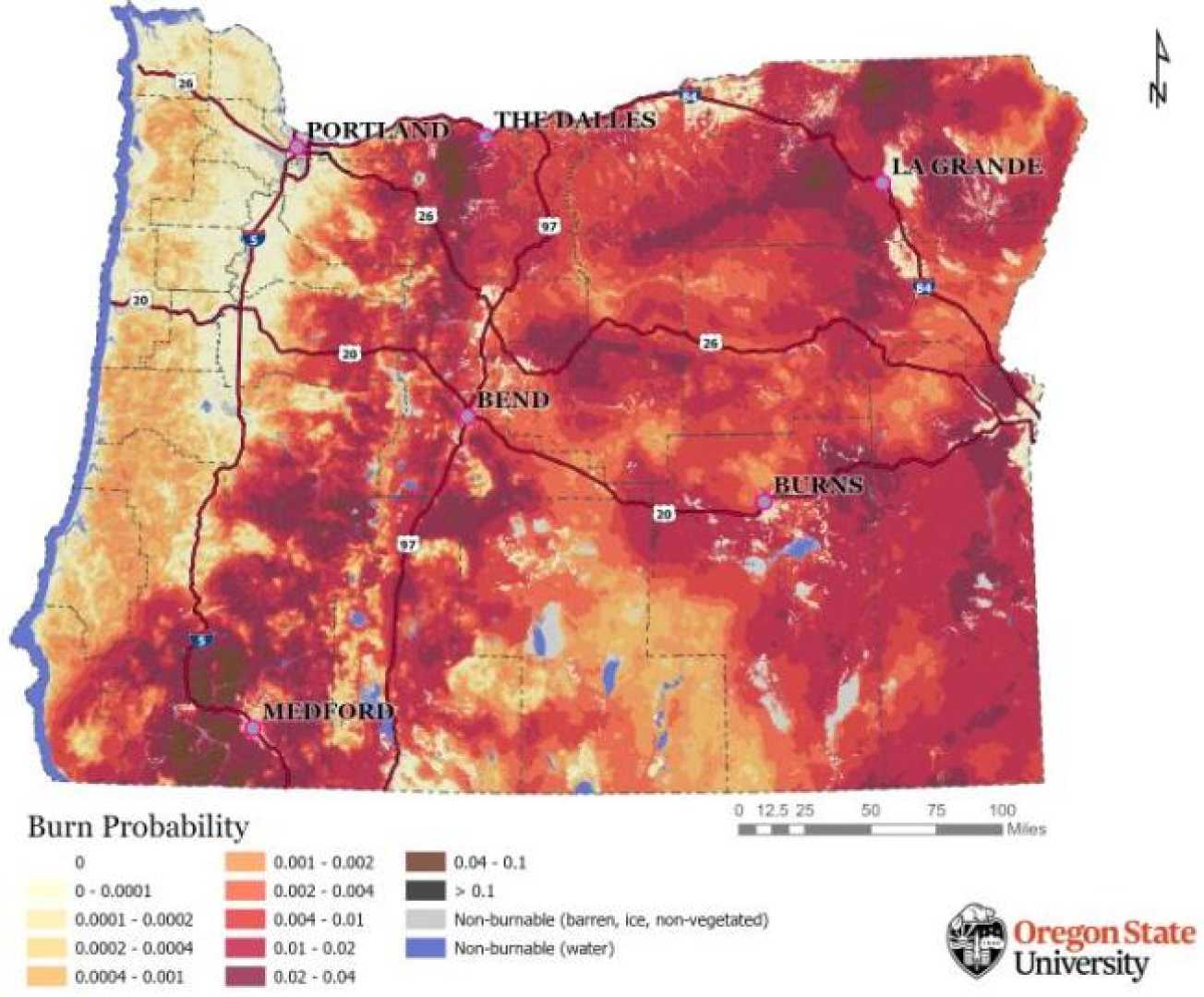
PORTLAND, Ore. (AP) — Oregon homeowners living in certain high-risk wildfire areas will face stricter building codes and mandates to reduce vegetation on their properties under new “wildfire hazard maps” unveiled Tuesday. The maps, developed by the Oregon Department of Forestry and Oregon State University, aim to mitigate wildfire risks in the state’s most vulnerable regions.
The new rules apply to approximately 106,000 tax lots, or 6% of Oregon’s 1.9 million properties, located in high-hazard zones within the wildland-urban interface. These areas, where homes border forests or grasslands, are particularly susceptible to wildfires. The regulations include requirements for fire-resistant building materials and the creation of defensible space by reducing vegetation around homes.
“After 2020, we can’t pretend anymore that this is just an issue for southwest Oregon and central Oregon,” said Andy McEvoy, a wildfire scientist at Oregon State University. “All of those events really cried out for a statewide strategy to respond to wildfire risk.” The 2020 Labor Day wildfires were among the deadliest in Oregon’s history, killing nine people and destroying thousands of homes.
The updated maps reflect feedback from thousands of public comments and adjustments to address concerns about neighbor-to-neighbor variations in hazard zones. Notably, irrigated farmland and pasturelands were reclassified to lower hazard levels due to reduced vegetation fuels during fire season.
Under Oregon law, insurers cannot use the maps to adjust homeowners’ insurance rates or deny coverage. However, McEvoy noted that most insurers already use their own wildfire risk models. The maps will guide state agencies in prioritizing resources for wildfire education, defensible space requirements, and fire-hardening measures.
The adoption process for the new codes will begin after a 30-day appeals period. Property owners in high-hazard zones will receive certified mail notifications outlining their rights and the implications of the designations. The maps will be updated every five years to reflect changing conditions.
Oregon is not alone in addressing wildfire risks. Washington state and Colorado have also implemented measures to manage fire-prone areas, while California recently announced a plan requiring insurers to provide coverage in high-risk zones. As wildfire seasons grow longer and more intense due to climate change, such efforts are becoming increasingly critical.


