News
Severe Storm Brings Heavy Rain and Tornado Warning to Central Coast
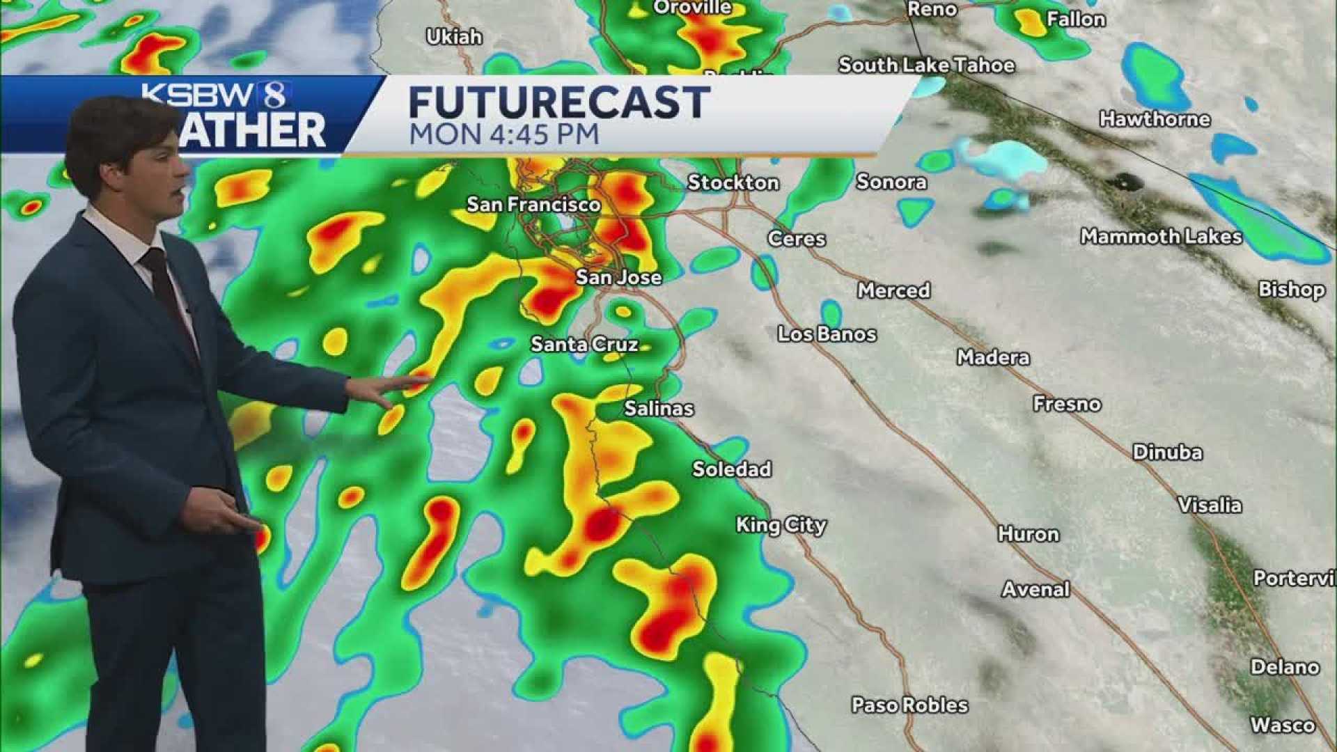
San Luis Obispo, California – A low-pressure system has moved into the Central Coast region, bringing heavy rain and imminent severe weather overnight into Tuesday. Meteorologist Vivian Rennie reported that this storm has been anticipated for over a week and its effects are now being felt.
As of 11:15 p.m. Monday, the National Weather Service issued a tornado warning for areas including Cayucos, Morro Bay, and Pismo Beach, expected to be in effect until 12:15 a.m. Community members are advised to move to interior rooms for safety as the storm progresses.
Earlier updates noted strong storm activity across the north coast, with wind gusts reaching up to 50 mph, potential flooding, and the risk of brief, weak tornadoes. A flood advisory is now in effect for the entire Central Coast until 3 a.m. Minor flooding is anticipated in low-lying and poorly draining areas, prompting officials to advise against unnecessary travel.
Rennie highlighted the progression of the storm, which started with light patchy rain Monday afternoon and is expected to intensify overnight. The cold front is predicted to bring a significant amount of rainfall, with rates possibly reaching 0.5 inches per hour. Residents should avoid driving during this period to prevent hazards related to heavy rain and potential flooding.
As the storm continues into Tuesday morning, increased rain activity and thunderstorms are expected, although Rennie noted that the possibility of severe activity, such as isolated weak tornadoes, remains low. Rain totals are projected to average about one inch, particularly affecting higher elevations in the Santa Lucia mountains and the Los Padres National Forest.
Following the storm, temperatures will drop significantly, with a gradual recovery projected as sunny weather returns later in the week. Residents are encouraged to stay tuned for ongoing updates throughout the night.


