News
Severe Storms Expected in Oklahoma Tonight
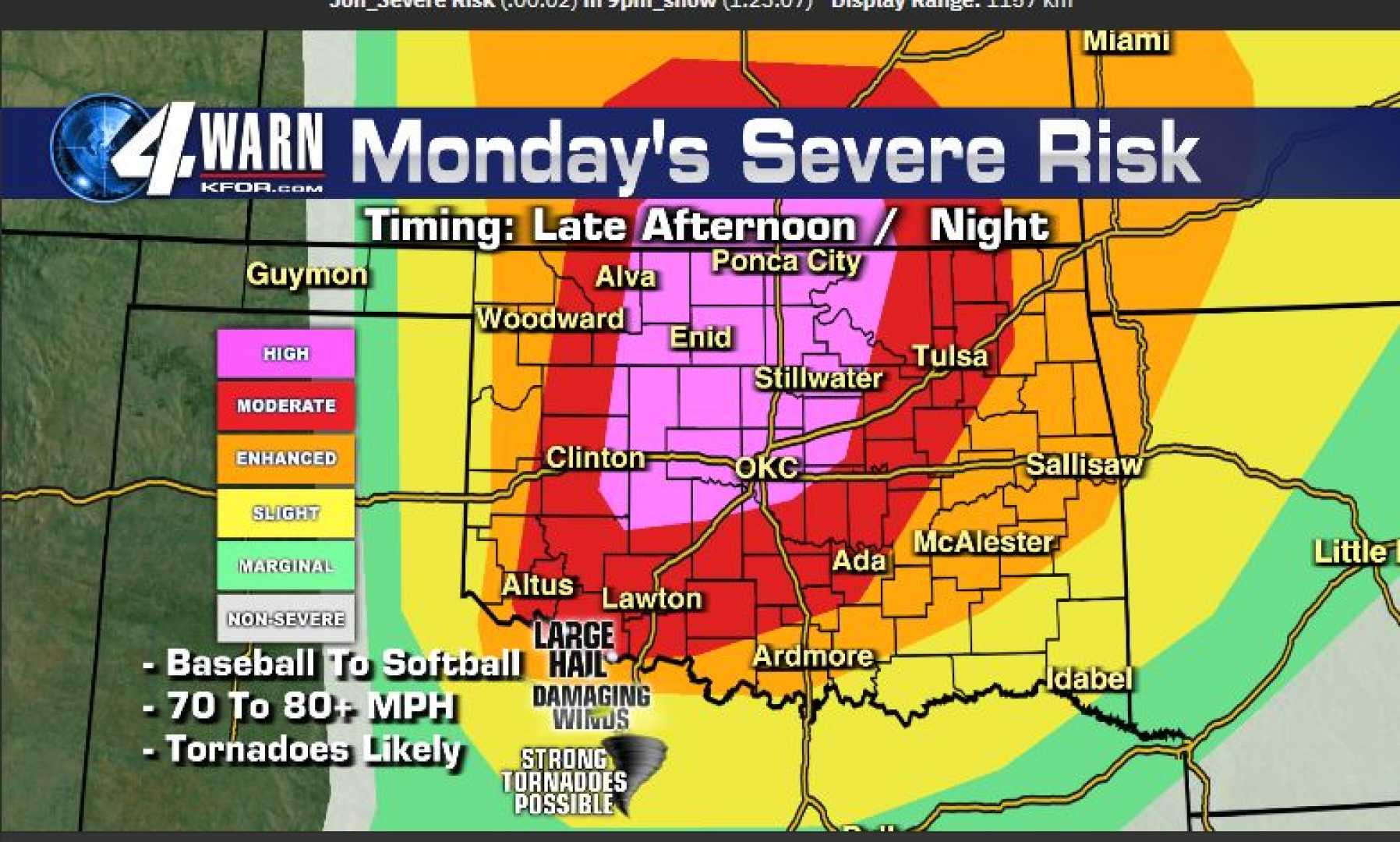
TULSA, Okla. — The risk for severe weather in Oklahoma is increasing, with thunderstorms expected to roll through the state tonight. The forecast indicates that rain and storms will begin in central Oklahoma between 7 PM and 8 PM.
Chief Meteorologist Damon Lane reported that while the tornado threat is low, it still exists, with a marginal to slight risk for areas including Oklahoma City and south toward Pauls Valley. On a scale of 1 to 10, this threat ranks at a one, rising to a two in some regions, such as Chickasha and Duncan.
Wind gusts could reach between 50 to 60 miles per hour, and hail may reach sizes between quarters and half dollars. The storms are forecasted to last well into the early morning hours, with additional thunderstorm activity expected towards midnight near Ardmore.
A Flood Watch is also in effect for parts of Oklahoma from 7 AM Friday to 7 AM Saturday due to the potential for significant rainfall. Residents should prepare for widespread amounts of 1 to 3 inches, with some areas possibly receiving up to 5 inches of rain.
As the situation develops, meteorologists urge residents to stay informed through various warning systems and to have emergency plans in place to ensure safety during severe weather. The storms are expected to pass by noon on Friday, but localized flooding could persist into the weekend.


