News
Severe Storms Set to Disrupt Easter Plans Across the Midwest and South
OMAHA, Neb. – Severe weather has returned to the Plains, with forecasts indicating a continuation of storms throughout the Midwest and South during the Easter weekend. The National Weather Service warns of large hail, damaging winds, isolated tornadoes, and potential flooding rains as severe thunderstorms are predicted from the Ohio Valley to the Southern Plains.
On Friday morning, southern Wisconsin was heavily impacted by storms that produced hail as large as baseballs and wind gusts reaching up to 68 mph. Reports from Edgerton, approximately 20 miles southeast of Madison, noted damage to vehicles from the severe weather. Meteorologists stress that the main threats of wind damage and large hail will persist through early Saturday, alongside the possibility of isolated tornadoes.
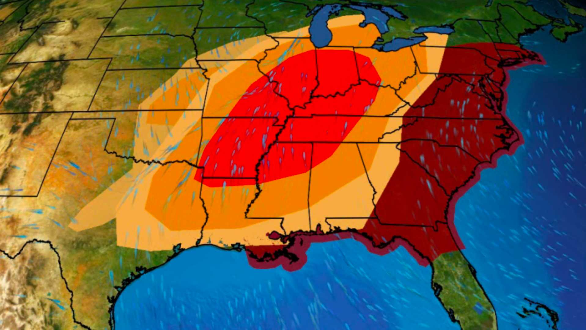
The storms are anticipated to intensify during the Easter holiday weekend, affecting regions from eastern Texas to the lower and mid-Mississippi valleys on Sunday. The most severe weather is expected in northern and central Missouri and southwestern Illinois, including areas like Columbia, Jefferson, Missouri, and Quincy, Illinois. Meteorologist Jonathan Erdman highlighted that damaging thunderstorm winds, significant hail, and the risk of tornadoes will pose threats each day.
In addition to wind and hail, there is a chance of localized flash flooding in the lower Ohio and Mississippi River valleys, particularly closer to Friday night through Saturday night. Areas including Dallas-Fort Worth, Tulsa, Oklahoma, and St. Louis should remain vigilant as they could experience heavy rain during this timeframe.
Earlier in the week, thunderstorms swept across eastern Nebraska into western Iowa, spawning at least three tornadoes while delivering damaging hail and wind. In Dodge County, Nebraska, one storm produced wind gusts of 82 mph, with baseball-sized hail causing damage to homes in Fremont. A notable EF3 tornado struck the far northern Omaha metro area around 7 p.m. CT, resulting in damage near Bennington and Fort Calhoun, located about 10 to 15 miles north of downtown Omaha.
Another tornado, potentially the same system, was later observed across the Missouri River, producing softball-sized hail (4-inch diameter) just east of Council Bluffs, Iowa. The southern supercell activity lasted approximately 6.5 hours, beginning with hail reports in Grand Island, Nebraska, before stretching nearly 230 miles to Clarke County, Iowa.
As forecasters look ahead, the weather pattern is shifting, with a jet stream moving southward and bringing warmer, more humid air from the Gulf of Mexico into the central U.S. This shift typically heightens the potential for severe weather as spring progresses. Over the last week, however, conditions have been less favorable for severe storms, following an earlier outbreak in mid-April.
The National Weather Service urges residents in affected areas to remain prepared as the severe weather unfolds. They recommend having several reliable sources for weather alerts, including smartphones and local media, and ensuring that devices are fully charged. People should also identify the safest location in their home to go to if a warning is issued, and those in manufactured homes should consider nearby storm shelters.
It’s critical to heed any issued warnings, as severe thunderstorms can bring life-threatening conditions. Flash flooding already claimed 33 lives nationally in 2025, with 21 fatalities occurring in vehicles. Therefore, preparation and vigilance in the face of adverse weather is vital for safety this Easter weekend.


