News
Severe Storms Threaten Oklahoma with Tornadoes and Hail
TULSA, Okla. — Severe storms are sweeping through the Tulsa area and broader Oklahoma as meteorologists track their movement Sunday morning, May 18, 2025. News On 6 teams are monitoring the weather conditions with updates on where the storms may impact next.
As morning progresses, scattered storms are expected to redevelop mainly in northeastern Oklahoma, though severe weather threats are deemed lower at this time. Nonetheless, strong winds and small hail are possible. By Sunday afternoon, a humid airmass will dominate eastern Oklahoma while a dry line sharpens across western areas.
Travis Meyer, Chief Meteorologist at News On 6, stated that a warm air layer is present, potentially limiting storm formation. However, as the day advances into late afternoon and evening, at least a few storms could materialize east of the dry line, leading to supercells capable of various severe weather forms.
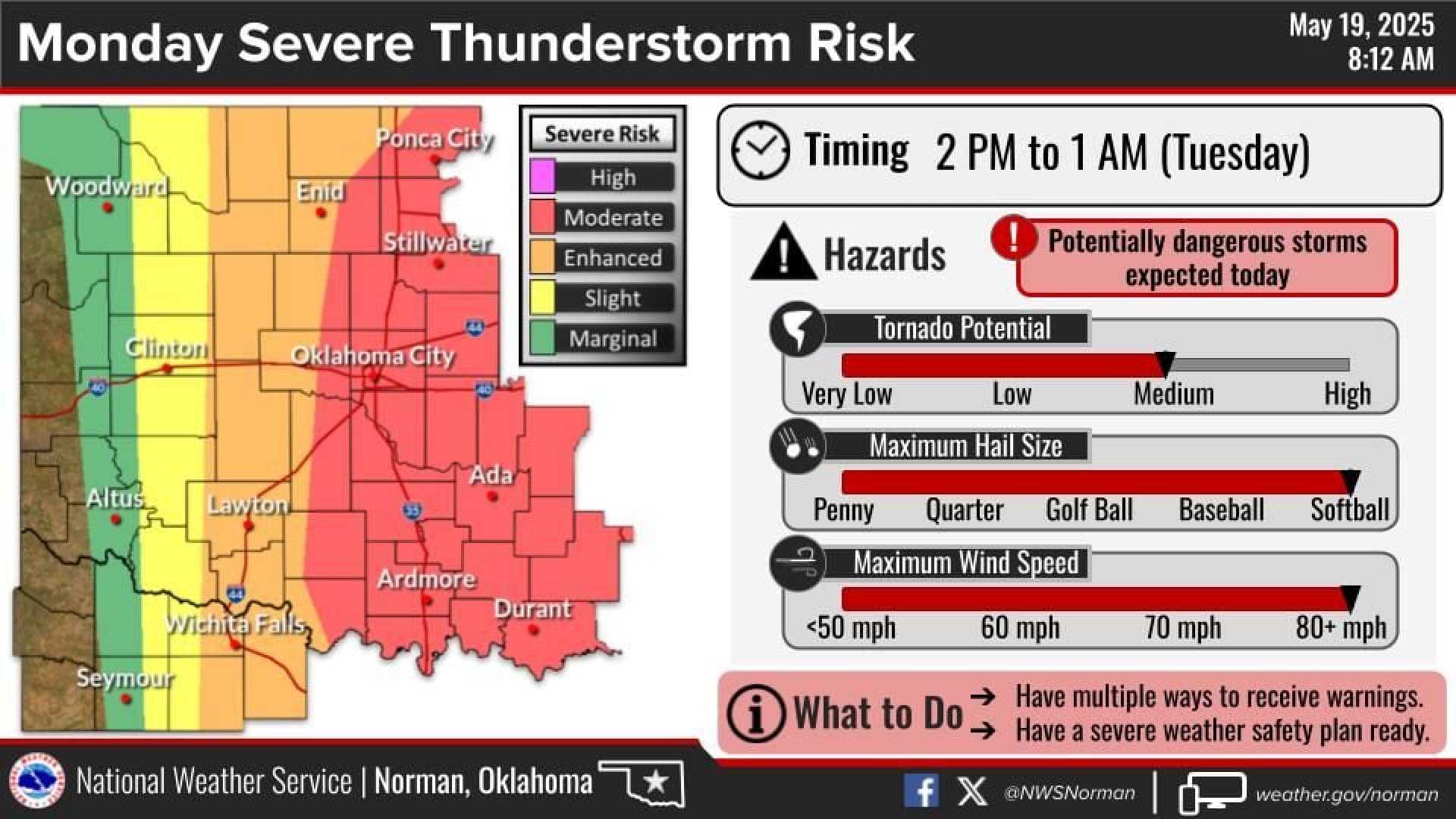
“We are expecting the highest likelihood of severe weather on Monday,” Meyer warned. “All forms of severe weather will be in play.”
By early morning, active storms were reported pushing east into counties including Adair, Cherokee, and Haskell. Significant gusts were recorded between 45 and 60 mph in southern Tulsa County.
“Though storms have weakened near Bartlesville, we continue to see strong winds and lightning reported across the area,” reported news team members stationed in various locations.
At 12:08 a.m., severe thunderstorm warnings plagued multiple counties, with alerts set to expire around 4 a.m. for affected regions. North and east of Tulsa seem most at risk for morning severe weather.
Updates also indicated that areas could see tornado watches extending through central and eastern Oklahoma until Monday evening.
The public is encouraged to remain alert to updates as these storms approach various counties, with meteorologists reminding all to prepare for further developments as this situation unfolds.


