News
Severe Thunderstorms Expected in Twin Cities This Evening
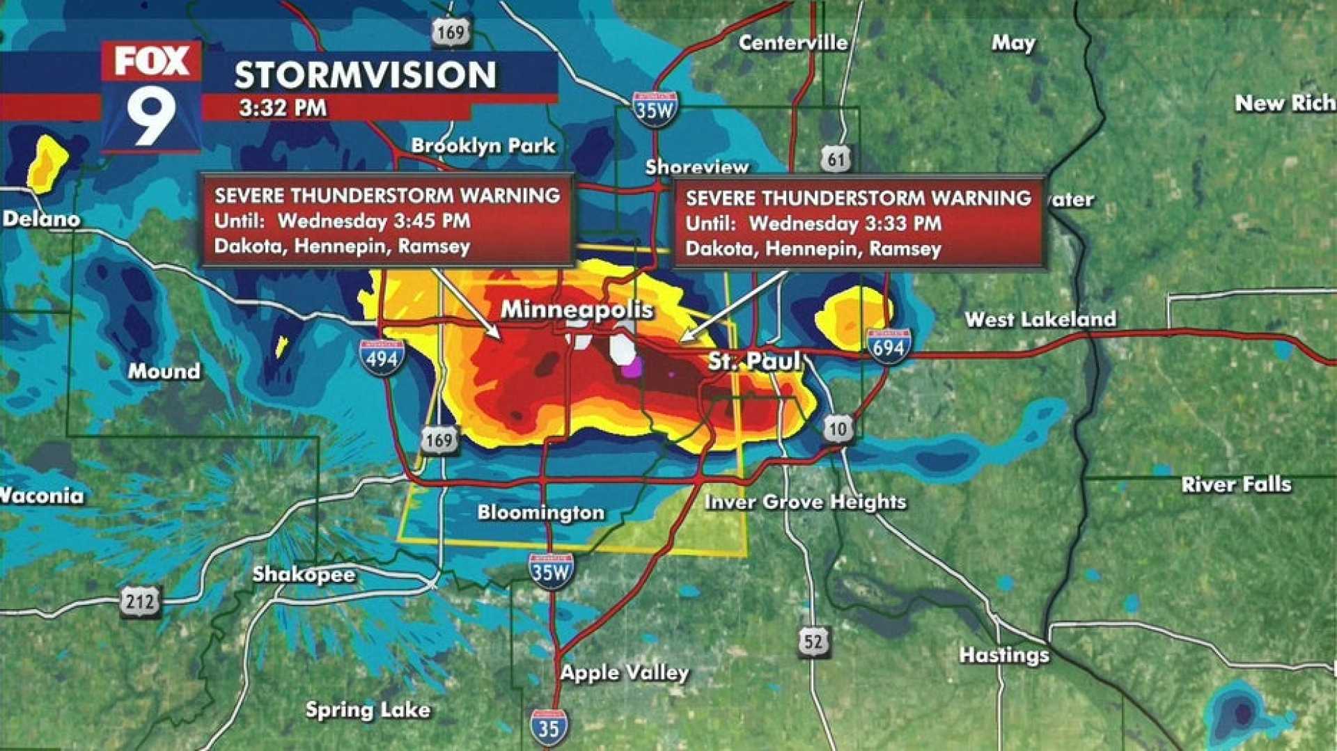
MINNEAPOLIS, Minnesota — A Forecast First Alert is in effect as severe thunderstorms are expected in the Twin Cities Friday evening. Meteorologist Jonathan Yuhas indicates that the storms are anticipated to impact the area between 5:00 p.m. and 11:00 p.m., with the greatest threat for severe weather occurring from 6:00 p.m. to 8:00 p.m. This weather system poses a risk of tornadoes, damaging winds, hail, and heavy rainfall.
Friday’s weather will be partly cloudy, warm, and humid with temperatures reaching into the upper 80s and dew points in the low 70s. The National Weather Service warns that thunderstorms will develop rapidly west of the Twin Cities after 4:00 p.m.
The severe thunderstorm threat is expected to diminish after 11:00 p.m. Tonight, a second wave of storms may approach the region after 6:00 a.m. Saturday, presenting similar risks from damaging winds and heavy rainfall.
Saturday morning will see cloudy skies, transitioning to partly cloudy conditions in the afternoon with temperatures in the low to mid 80s. Another chance of scattered thunderstorms and significant rainfall is possible early Sunday morning, lasting until 11:00 a.m.
Heavy rain over saturated soils could lead to flooding around the Twin Cities. Weather experts predict that the most prolonged period of rain will occur from Monday into Tuesday morning, with total rainfall amounts ranging from 1 to 3 inches, and potentially 4 inches in some areas.
Following this weather event, calmer and less humid conditions are expected starting Tuesday, leading into the first day of the Minnesota State Fair on Thursday, August 21, with highs in the upper 70s to near 80 degrees.


