News
Severe Weather Threat Looms with Tornadoes and Extreme Heat
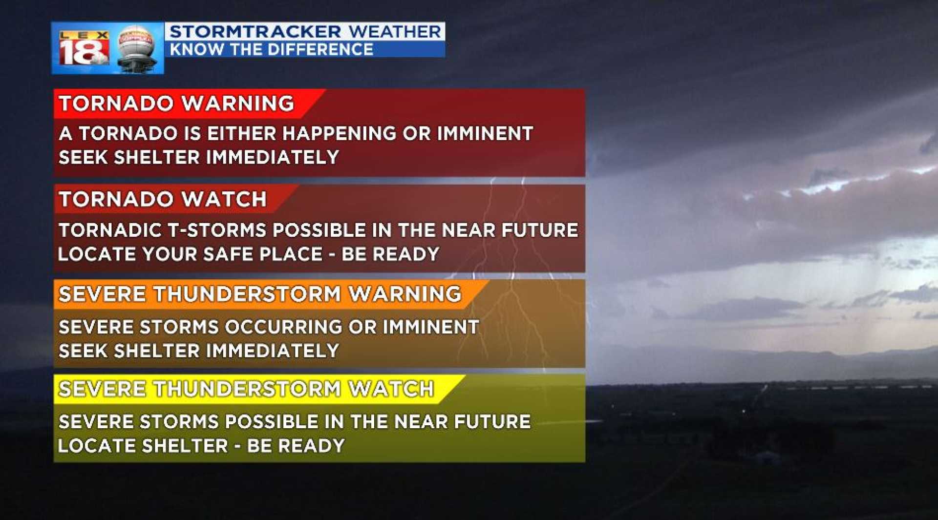
FARGO, N.D. – Today marks a First Alert Weather Day as a significant severe weather threat is expected this evening into the overnight hours. Tornadoes, including some strong ones, could occur mainly south of Highway 2.
Forecasters warn of large hail exceeding 2 inches in diameter and damaging wind gusts exceeding 75 mph. As storms are forecasted to hit during the night, it is crucial that residents have ways to receive alerts and warnings. The Valley News Live Weather app is recommended for timely notifications.
In preparation, residents should ensure their phones are fully charged and park vehicles in garages if possible. It is also advised to secure outdoor furniture and bring in potted plants to minimize damage.
Starting Saturday, the storm track is expected to lift northward, reducing the chance for severe weather while bringing higher temperatures. Weekend highs will reach the 80s to 90s, with a risk of isolated severe storms if warm air aloft can be overcome. Dew points will also climb into the 60s and 70s, increasing humidity levels.
An Extreme Heat Watch has been issued for southern Valley and much of Minnesota, with heat index values potentially exceeding 100 degrees. As the ridge shifts eastward by Sunday night, showers and storms may reappear, coinciding with a drop in temperatures by Monday.
Next week is projected to bring cooler weather with temperatures starting in the 50s and low 60s, with afternoon highs only in the 60s and low 70s. Rain remains a possibility as the week progresses, particularly towards the end of the week.


