News
Snowfall Forecast for Syracuse Sparks Travel Alerts as Winter Weather Approaches
Syracuse, N.Y. — Syracuse and Central New York are bracing for another round of snow, expected to hit late Monday night and continue into Tuesday. Meteorologists project snowfall amounts to vary across the region, with the heaviest accumulation occurring south and southeast of Onondaga County.
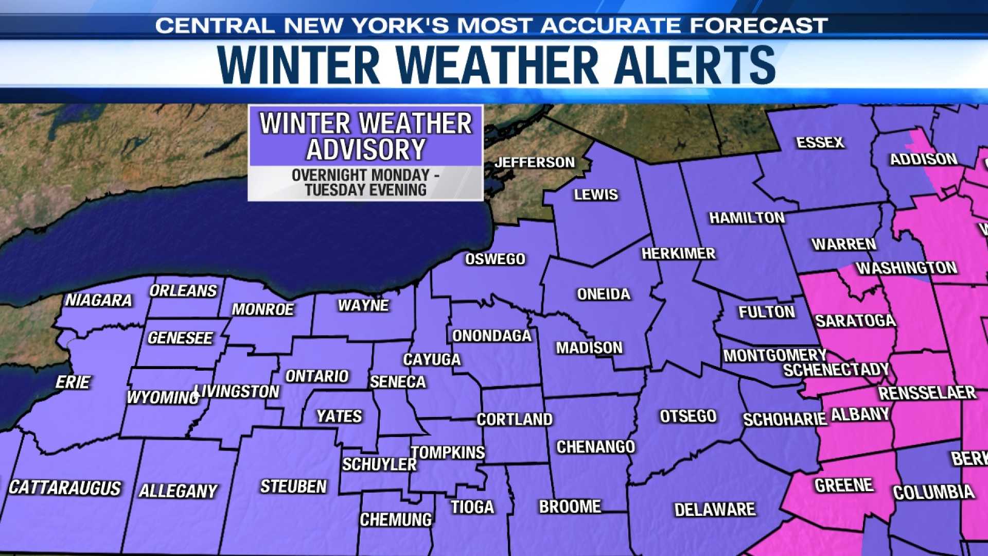
The National Weather Service has issued Winter Weather Advisories for Central New York, starting at 1 AM on Tuesday and lasting until 7 PM the same day. While the snowfall will not be as severe as the recent Black Friday lake effect snow event, officials urge the public to stay aware of weather conditions.
Forecasts indicate that areas near Lake Ontario may receive up to 3 inches of snow, while Syracuse is predicted to see 3 to 5 inches. In contrast, regions to the southeast could receive 6 to 9 inches, with potential totals surpassing a foot in the eastern Catskill Mountains. Temperatures are expected to remain cold, dipping into the low twenties.
This system is expected to impact the Tuesday morning commute, delivering moderate snow before tapering off to flurries in the evening. Shortly after, a new weather front is projected to bring additional snowfall by Thursday. The coldest air of the season will arrive by Friday, with wind chills expected to reach the single digits.
The extended seven-day forecast suggests continued chances for snow and colder temperatures. Stay updated through local news sources for the latest on weather alerts and forecasts.


