News
Storm Pummels Carolinas with Heavy Rain, Strong Winds
NAGS HEAD, N.C. – A powerful coastal storm is impacting the Carolinas with heavy rain and strong winds, raising flooding concerns as peak conditions unfold. The FOX Forecast Center predicts wind gusts near 60 mph and advises residents to stay off the roads as the storm intensifies.
The storm, which has been developing near the coast, is expected to drift northward over the next few days, bringing additional rounds of unsettled weather to the Mid-Atlantic region. Monday and Tuesday are projected to be particularly wet and stormy.
Forecasters are unsure about the exact path of the storm, but they indicate that widespread, heavy rain is likely across much of North Carolina and Virginia. Areas could see rainfall totals range from 2 to 5 inches depending on localized conditions.
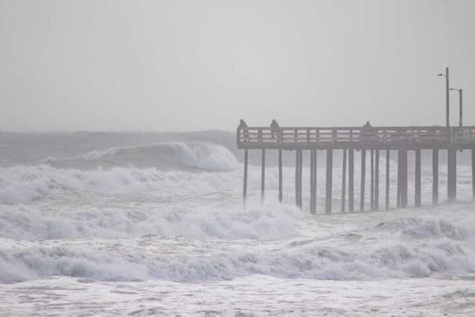
The Weather Prediction Center has issued a Level 2 out of 4 flood threat for parts of North Carolina and Virginia on Monday, dropping to Level 1 on Tuesday. Along with heavy rainfall, strong winds are pushing water onto shore, causing coastal flood worries.
“What the storm is doing is pushing a lot of winds onto shore,” said a FOX Weather meteorologist. “This compound effect is significant for areas like Virginia and the Carolinas.” Coastal Flood Advisories, Wind Advisories, and High Surf Advisories are in effect from North Carolina to Virginia.
On Monday, wind gusts of 60 mph were already being recorded, leading to power outages in the region. Residents are advised to avoid the water due to life-threatening rip currents expected along the East Coast.
Although this system has a very dynamic structure that could resemble tropical storms, the cooler offshore waters are not conducive to its development into a tropical storm. Instead, meteorologists attribute its strength to the interaction of warm and cool air masses.


