News
Tampa Bay to Experience First True Cold Snap of Autumn
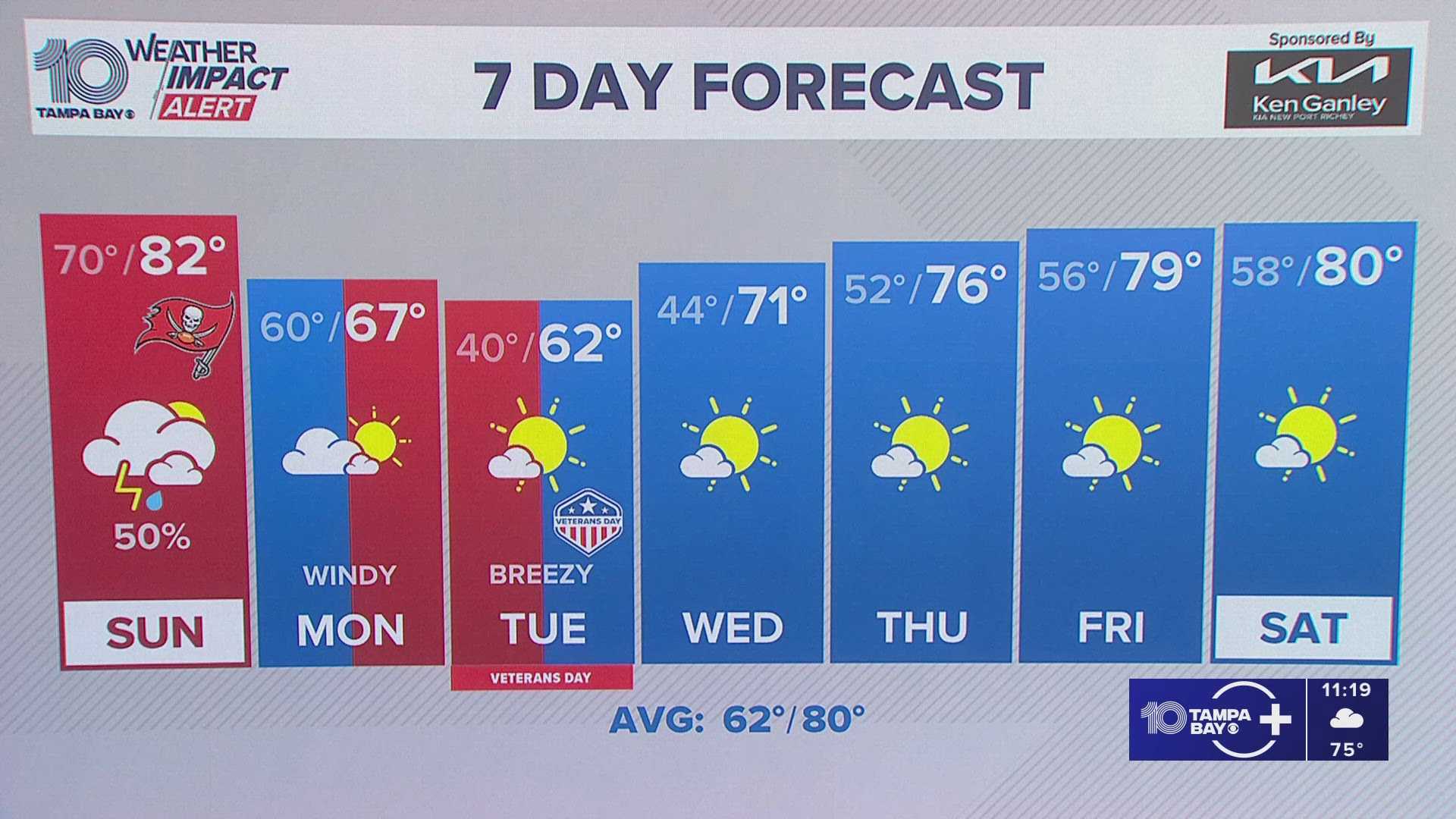
TAMPA, Fla. – A strong cold front is set to hit Tampa Bay, bringing significant temperature drops as the region welcomes its first taste of late-autumn air by Monday. According to the National Weather Service in Tampa Bay-Ruskin, temperatures are expected to reach the low 80s on Sunday before the front arrives Sunday night.
As the front moves through, isolated thunderstorms may occur, particularly north of I-4 and west of I-75. Most of the rain will dissipate quickly, making way for clearing skies and a northwest breeze by sunrise on Monday.
Monday will see an immediate change in conditions, with highs forecasted around 66 degrees, almost 20 degrees cooler than Sunday. Wind gusts could reach up to 25 mph, giving the day a brisk feel typical of late November.
Temperatures will dip further Monday night, with lows dropping to the upper 30s inland and low 40s near the bay—marking the coolest temperatures Tampa has seen since spring. Monday, being Veterans Day, is expected to start bright and brisk, with highs near 62 degrees, making it perfect for outdoor ceremonies and walks.
By midweek, sunshine and gradual warming will return, but the changing weather reflects a broader trend as Arctic air pushes southward through the Plains and Southeast. For now, Tampa Bay residents can look forward to enjoying one last summer-like weekend followed by the cooldown they’ve been anticipating.
The five-day forecast for Tampa includes:
Sat: 84/69 – Patchy morning fog; mostly sunny, light breeze.
Sun: 83/59 – Slight storm chance late; humid and warm.
Mon: 66/39 – Sunny and breezy; sharp cooldown.
Tue (Veterans Day): 62/44 – Clear and crisp; cool air lingers.
Wed: 72/50 – Mostly sunny; gradual warming trend.


