News
Tornado Warnings Issued as Severe Weather Hits Central U.S.

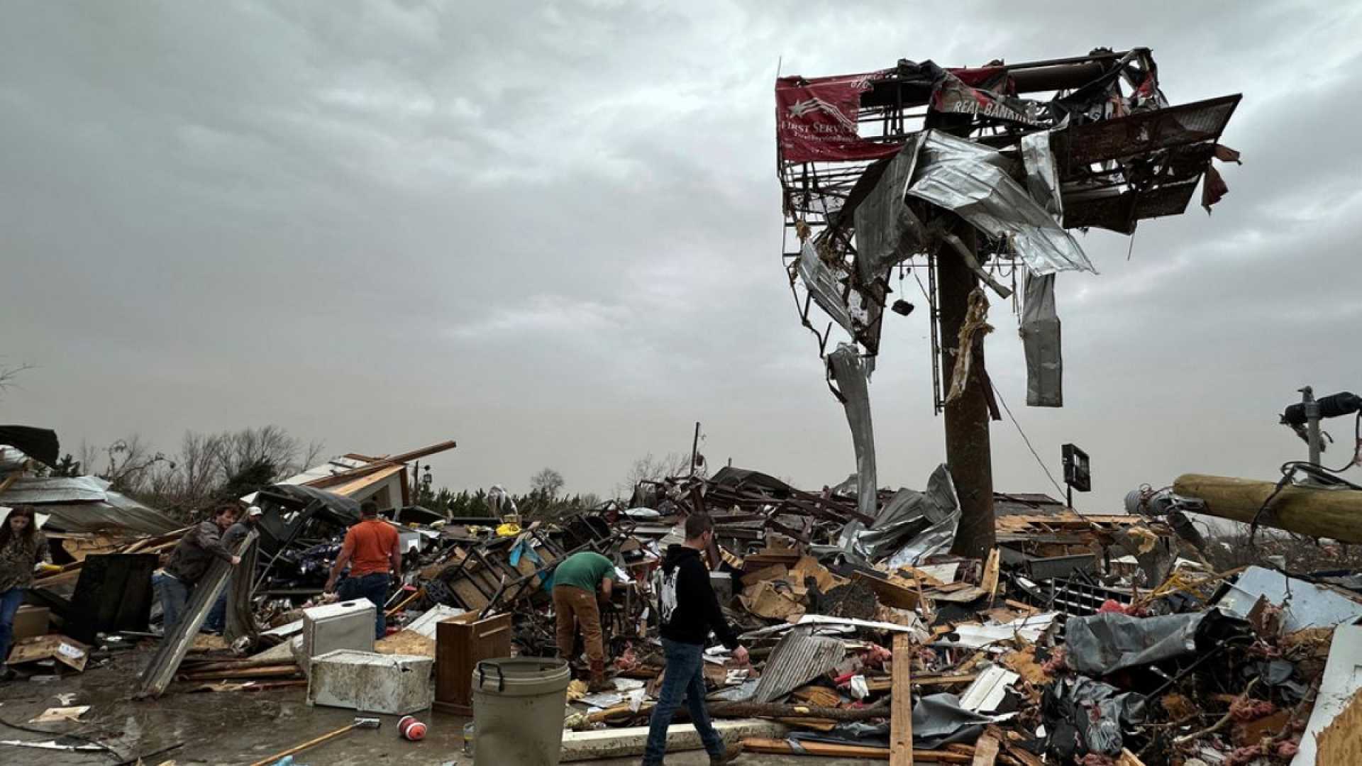
Little Rock, Arkansas – Millions of residents across the central United States faced tornado alerts on Sunday, as confirmed tornadoes were reported in Michigan and Missouri due to an unstable weather system that resulted in widespread power outages and large hail.
Approximately 170 million individuals, from Illinois to eastern Texas and beyond, could be affected over the next two days as unusually warm air collides with a powerful cold front. March has already witnessed an extraordinary number of tornado reports, surpassing last year’s figures for the same period, putting some areas once again at risk.
This weekend’s temperatures felt more like late May or early June across the plains and the East Coast, but the arrival of a cold front on Sunday is expected to end this unusual warmth abruptly. As colder air clashes with the warm, humid air, significant thunderstorms are anticipated.
Images sent to KOCO, a CNN affiliate, showed hailstones ranging from the size of a quarter to that of a golf ball on Saturday night. Following winter storms, over half a million customers were without power in Michigan, and 65,182 in Wisconsin as of Sunday night. Additionally, more than 100,000 customers lost power in Indiana.
By Sunday evening, a total of 12 million people were under tornado watches stretching from Indiana to Arkansas. The Storm Prediction Center issued a tornado warning for parts of northern Arkansas, southern Illinois, southwestern Indiana, western Kentucky, southeastern Missouri, and western Tennessee until 10 p.m. EDT. Areas under warning include Jonesboro, Arkansas; Paducah, Kentucky; and Memphis, Tennessee.
A tornado watch was issued before 7 p.m. EDT, lasting until 1 a.m. in northern Kentucky and southwestern Ohio. Intense thunderstorms are expected after dark, heightening concerns, as studies have shown that tornadoes occurring at night are almost twice as likely to be deadly as those that happen during the day.
Some storms are forecasted to bring heavy rainfall, increasing the risk of flash flooding from the South to the Midwest. Following the impending severe weather, meteorologists are monitoring a widespread area from Texas to the Midwest for the possibility of another round of thunderstorms by Wednesday.
The severe weather threat will extend into Monday as powerful thunderstorms continue to impact the East, from the Appalachians to Louisiana and Mississippi through the morning. While some storms may weaken briefly with daylight, they are expected to regain strength by afternoon.
By Monday night, the severe weather threat will reach almost the entire East Coast, endangering nearly 100 million people. Cities from New Orleans to Boston fall within the affected region, although specific threats will vary.
The main concern in the Northeast will be destructive wind gusts. A broad stretch of the South, from the Mid-Atlantic to the Gulf Coast, will face a full range of severe weather hazards including hail, tornadoes, and strong winds.
Storms are expected to linger overnight from the Mid-Atlantic through the Northeast before moving out to the Atlantic Ocean on Tuesday morning. This year, approximately 300 tornado reports have already been noted since January, nearly double the 164 reports at the same time last year. Since 2010, only three years (2023, 2017, and 2013) have recorded more tornadoes in the first three months of the year.
Confirmation of this year’s severe storm pattern suggests that a succession of severe weather systems this spring is likely to continue. Residents in affected regions are urged to stay informed and have multiple ways to receive weather alerts, especially in areas at risk for nighttime storms.
Gene Norman contributed to this report.


