News
Severe Storms Strike Oklahoma City Area with Tornado Warnings
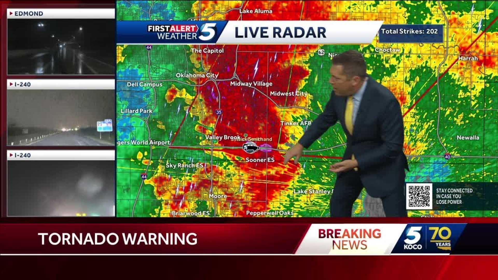
OKLAHOMA CITY, Okla. — Severe thunderstorms rolling into the Oklahoma City metropolitan area on Tuesday prompted multiple tornado warnings and severe weather alerts. The KOCO 5 First Alert Weather Team has been actively tracking the rapidly developing storms.
At 10:55 p.m. CDT, a tornado warning was issued for Noble and Payne counties for a storm located 4 miles southeast of Perry, which was moving east at 65 mph. Residents were advised to take immediate cover.
Before that, at 10:48 p.m., another tornado warning was issued for Oklahoma and Logan counties, with a storm detected south of Cedar Valley. This storm was moving east at 60 mph, again prompting shelter procedures.
Further warnings continued throughout the evening, including one for Noble, Logan, Payne, and Garfield counties due to a severe thunderstorm capable of producing a tornado, located 4 miles west of Orlando. This warning was set to remain in effect until 11:15 p.m.
KCOC 5 Field Meteorologist Michael Armstrong reported power outages in Kingfisher and noted heavy traffic congestion on Interstate 40 near Meridian, as severe weather pushed into the area.
Conditions worsened, and multiple other tornado warnings were issued as storms moved quickly through the region, some recorded at speeds of 70 mph. Immediate action was recommended for those in the affected areas.
Reports of damage began flowing in as well. At around 9:03 p.m., officials reported damage in Ellis County, with at least one house impacted south of Lake Vincent.
Multiple severe thunderstorm warnings were also in effect, causing concern for high winds up to 70 mph and possible quarter-size hail. The storms were expected to continue throughout the night and early morning, posing risks for flooding and further damage.
As severe weather continued, caution was advised throughout the Oklahoma City area, with local officials reminding residents to stay informed on weather updates and alerts.


