News
Atlantic Hurricane Season Eyes Possible Development of Tropical Disturbance
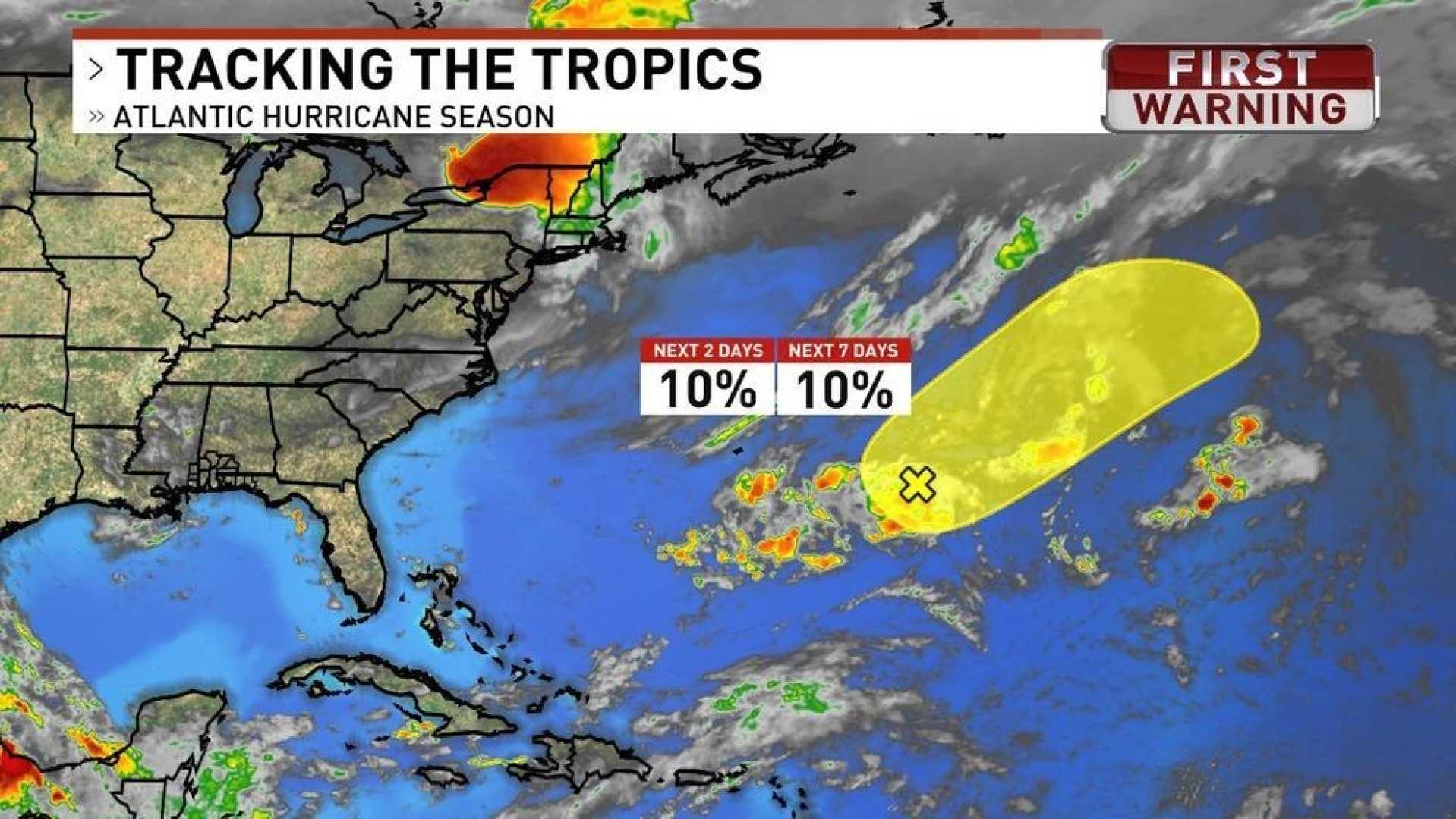
ORLANDO, Fla. – The National Hurricane Center (NHC) is monitoring a low-pressure system located about 500 miles east-southeast of Bermuda for potential tropical development. As of 8 a.m. Sunday, the system shows a 10% chance of becoming a tropical storm in the next two to seven days.
Currently producing disorganized showers and thunderstorms, the disturbance is moving northeastward across the central Atlantic. According to the NHC, slow development is possible in the next couple of days; however, it is expected to encounter strong upper-level winds that will hinder any further growth.
“Some slow development is possible during the next day or so while the low moves northeastward over the central Atlantic,” the NHC stated in its latest report. By Monday night, the system is anticipated to move over cooler waters, which will limit its chances for intensification.
If the system does develop into a tropical storm, it would be named Andrea. Typically, the first named storm in the Atlantic season forms around June 20. The Atlantic hurricane season runs from June 1 to November 30 each year.
Despite the low chance of development, the NHC reassures that the system poses no threat to land as it progresses further into the open ocean. Forecasters from Colorado State University and NOAA expect an above-average hurricane season, indicating a higher number of named storms, hurricanes, and major hurricanes than usual.


