News
Severe Michigan Heat Wave Nearing End as Storms Approaching
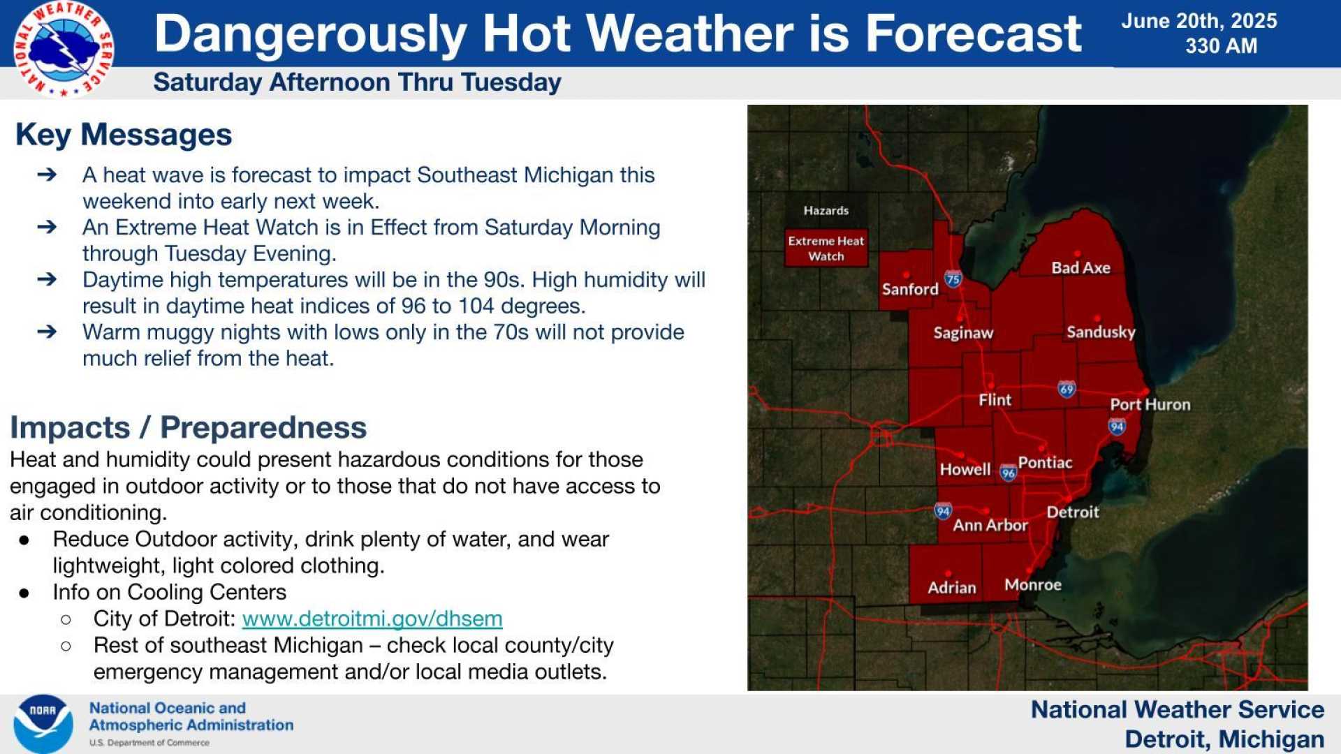
Detroit, Michigan — A scorching heat wave that has gripped Michigan, with temperatures feeling as high as 105 degrees, is expected to end Tuesday evening. However, residents are warned of possible storms and flooding as conditions change.
According to the National Weather Service, a network outage during the extreme heat weekend affected several weather broadcasts across the state. WNG-647, broadcasting from Adrian, was the only station still offline as of Monday. Other affected stations included KEC-63 (Southfield), KIH-29 (Clio), WNG-582 (Sandusky), and WNG-701 (Bad Axe).
U.S. Rep. Debbie Dingell, D-Ann Arbor, raised concerns in a letter to the National Oceanic and Atmospheric Administration about the outages. “We are in one of the most dangerous weeks of the year in Michigan,” she wrote, referencing the 29 tornadoes reported in the state this year, marking one of the highest totals since 1991. Dingell highlighted the increased risks for heat-related illnesses and severe storms.
Forecasters predict a marginal risk for storms this week. Residents are encouraged to remain vigilant as large hail, damaging winds of up to 60 mph, and heavy rain could lead to localized flooding. The Great Lakes Water Authority is taking precautions and advised those in flood-prone areas to stay alert.
As part of its response, the water authority stated that the regional system is operating as designed and that crews are monitoring conditions closely. Residents are urged to relocate valuables from basements as a precautionary measure.


