News
La Niña Set to Influence Winter Weather Patterns in the U.S.
Washington, D.C. — As much of the United States enjoys a break from excessive heat, forecasters are already looking ahead to winter and the potential return of La Niña, a significant climate phenomenon. The National Oceanic and Atmospheric Administration (NOAA) reports a roughly 53% chance of La Niña developing this fall, with a slightly higher 58% likelihood by the end of the year.
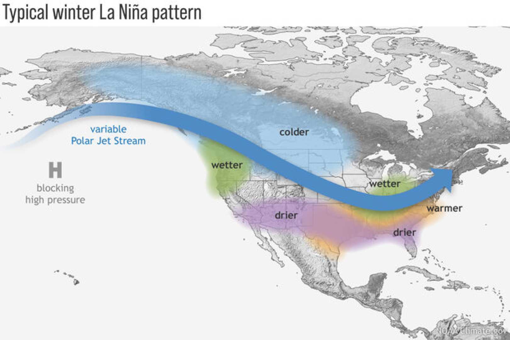
La Niña, characterized by cooler than average water temperatures in the equatorial Pacific, influences global weather patterns, including temperature and precipitation across the U.S. According to NOAA, once La Niña arrives, it is expected to persist throughout much of the winter.
The upcoming La Niña is predicted to impact the jet stream significantly, which often shifts northward during these events. This shift can bring stormy weather to northern states while leaving the southern U.S. drier. This year’s weak La Niña may result in unpredictable weather patterns, with potential impacts varying across regions.
No significant precipitation does not guarantee snowfall, as temperatures also play a crucial role. The Climate Prediction Center anticipates a drier winter in the southern states, while some northern regions may see more precipitation than usual.
In past winters, La Niña’s effects have led to warmer conditions in the South and cooler weather in parts of the Northwest and North Central states. This year, much of the South, Southwest, Rockies, and Eastern Seaboard are predicted to experience above-average temperatures.
Although last winter was not a record-breaking warm season, it still ranked among the warmest experienced in over a century. As global temperatures continue to rise due to climate change, understanding La Niña’s expected effects this winter is critical for anticipating upcoming weather conditions.


