News
Rain Returns to Indiana as Cold Front Sweeps Through
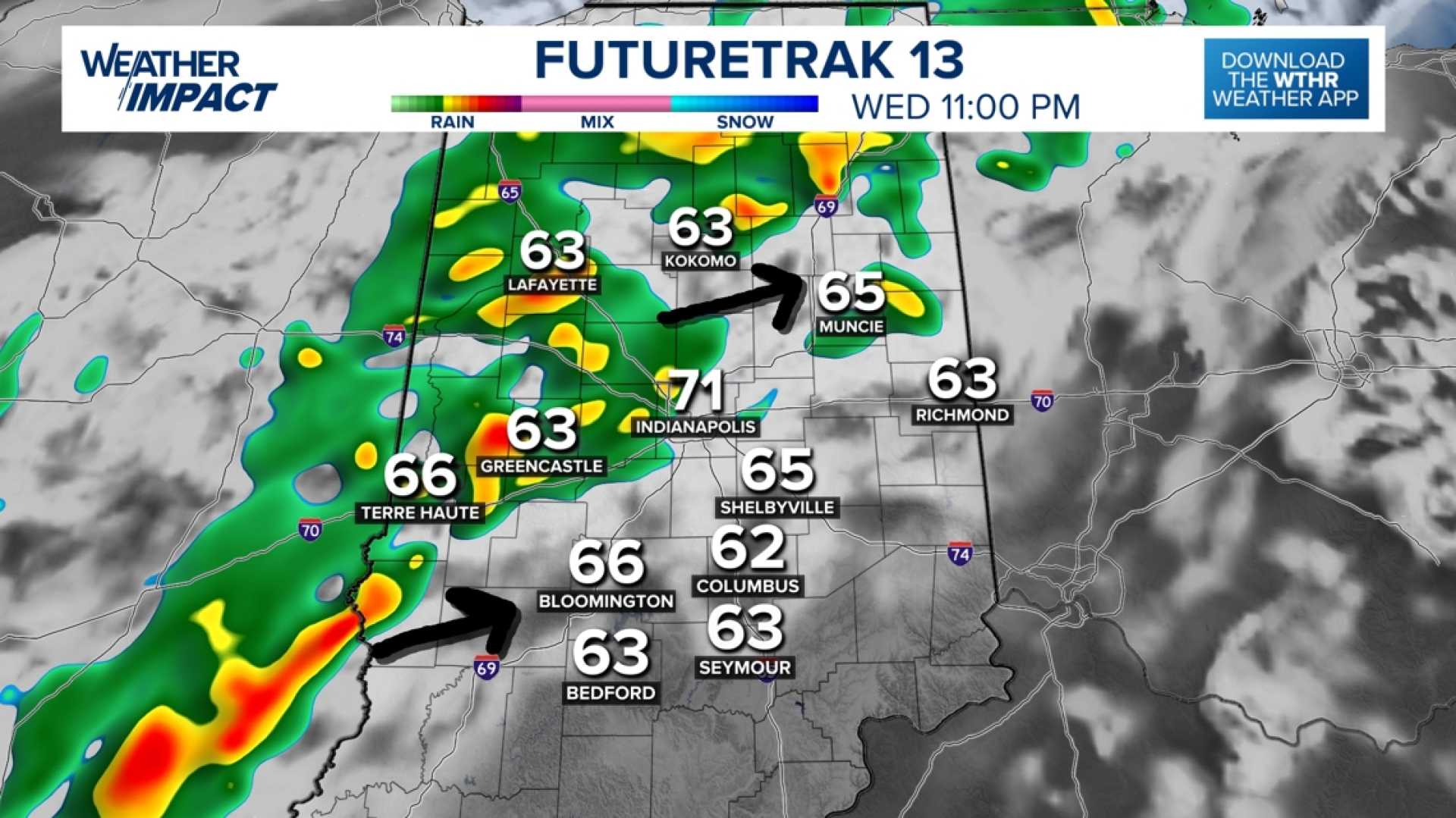
INDIANA, USA — A cold front moving through the Great Lakes will bring rain and cooler temperatures to Indiana starting Wednesday night. Meteorologists predict a temperature drop of about 10 degrees, with highs in the low 70s expected on Thursday.
Rainfall will begin late Wednesday, with scattered showers continuing into early Thursday morning. Andrew White, a meteorologist with the National Weather Service in Indianapolis, stated, “We are expecting a frontal passage Wednesday night that’s going to bring rain and maybe a few rumbles of thunder to the state followed by much cooler temperatures.”
The heaviest rain is expected in the northern part of Indiana, with amounts of up to an inch. Central and southern regions may see between a quarter and half an inch. White noted that although showers are anticipated, the weather will not result in a total washout.
Before the front arrives, Wednesday will be warmer, with highs in the low to mid-80s. By Thursday, a shift to cooler air will bring highs in the upper 60s and low 70s, along with a chance for scattered rain showers.
“We are not really too worried about severe weather with this front; however, there could be gusts from 30 to 40 mph and a rumble of thunder, so be mindful of that if you’re outside,” White advised.
The chilly weather is expected to continue through the weekend, offering Hoosiers a brief taste of fall after the warm conditions experienced earlier in September. Many residents are in need of rain, as Indiana is approximately 1-3 inches below average rainfall for this time of year.
Matt Standridge, a meteorologist from WTHR, expressed optimism about the much-needed rainfall. He stated, “We think the vast majority of Hoosiers should at least get a little rain tonight – maybe some good sleeping weather!”


