News
Atmospheric River Hits Western Washington with Heavy Rain and Snow
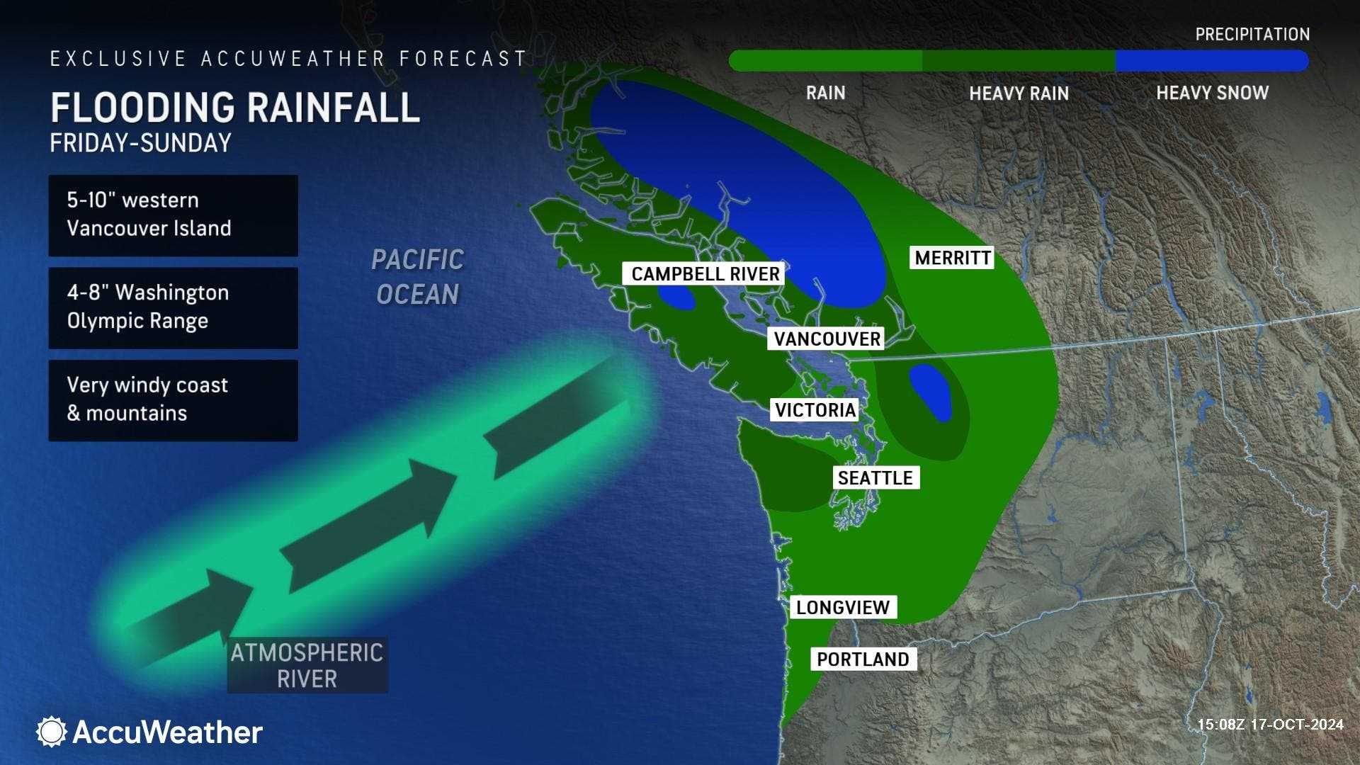
SEATTLE, Washington — An atmospheric river is sweeping through western Washington, expected to deliver 1 to 3 inches of rain and significant mountain snow this weekend.
The weather, described as the first atmospheric river of the fall season, began affecting the region on Saturday, October 23, with rain arriving just in time for the weekend. According to the National Weather Service (NWS), this storm is also bringing gusty winds, marking the start of the Pacific Northwest’s stormy season.
The NWS issued a Gale Watch effective from Saturday morning through late that night for the northern coast, and a Winter Weather Advisory that will last until 5 a.m. Sunday for parts of northwest and west central Washington. Cooler air is set to move into the Cascades by Saturday afternoon, lowering the snow level to about 3,500 feet.
Areas above this elevation are likely to see total snow accumulations between 6 to 10 inches, while Mount Rainier could receive up to 14 inches. Stevens, White, and Blewitt Passes are expected to see steady snowfall, while Snoqualmie Pass might experience a rain-snow mix.
State Route 410 Chinook Pass and State Route 123 Cayuse Pass were closed for the season on Friday due to anticipated snowfall. Travelers heading over the passes are advised to allow extra time and prepare for winter driving conditions.
The storm will continue through Sunday with heavy showers and gusty winds expected, making travel through mountain passes difficult. The public is encouraged to check weather conditions before heading out.


