News
Impact Day in Pittsburgh: Rain, Wind, and Cool Temperatures Expected
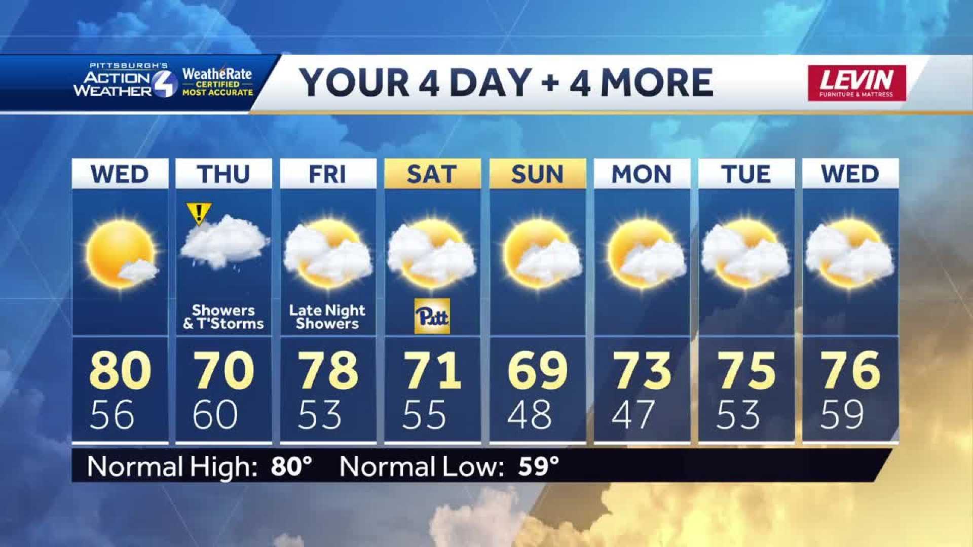
PITTSBURGH, Pennsylvania — Thursday is labeled as an Impact Day as a cold front moves into western Pennsylvania, bringing periods of rain, isolated thunderstorms, and gusty winds.
The rain is expected to arrive in two waves, starting in the morning and continuing into the afternoon. Meteorologists warn that some areas may experience pockets of heavy rain and strong winds, particularly during the morning commute.
“The morning round will have the potential for heavy downpours and gusty winds, while the afternoon could see a few thunderstorms as well,” said a local weather anchor. Activity is expected to taper off around the evening commute.
The National Weather Service indicates that the highest temperatures on Thursday will reach around 68 degrees Fahrenheit, with lows dropping to about 54 degrees. Wind gusts could reach up to 35 mph, making conditions even more blustery.
Looking ahead, another wave of rain is forecasted late Friday into Saturday morning, with the heaviest rainfall anticipated in the early hours of Saturday. Despite the rain, high school football games should be drier later on Saturday.
The cooling trend is expected to persist throughout the weekend, with temperatures remaining in the 60s. A gradual warming trend will return in the early part of next week.
Friday’s forecast includes morning fog followed by partly cloudy skies and a high of 80 degrees. Overnight temperatures are projected to be a warm 61 degrees.


