Low Pressure System Might Become Tropical Cyclone Near Texas
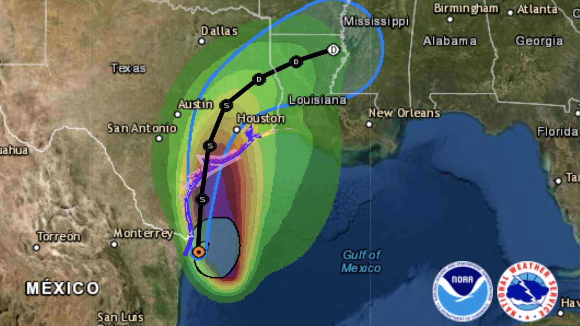
Houston, Texas – A low pressure system in the southwestern Gulf of Mexico has a 50% chance of developing into a tropical cyclone, according to the National Weather Service (NWS). The system, which is moving west-northwest, is expected to bring heavy rainfall to the Houston and Galveston areas on Friday and Saturday.
As of Friday morning, the NWS reported the disturbance could make landfall in northeastern Mexico or southern Texas later in the day. “This system is bringing in some extra moisture,” said Cameron Self, a meteorologist with the NWS Houston-Galveston office. “So there is a somewhat higher potential today and tomorrow for some of those thunderstorms to be locally heavy, with the primary concern being localized flooding.”
The NWS has also warned of strong rip currents along the Gulf Coast, elevated winds, and increased sea levels. CenterPoint Energy, the main electricity supplier for much of the Houston region, is monitoring the system and is prepared to act if needed. Matt Lanza, the company’s manager of meteorology, stated, “We will continue to monitor, review new models and data, and leverage our technology assets so we are prepared.”
Meanwhile, Tropical Storm Erin is churning in the Atlantic Ocean, moving west toward the Caribbean. It is projected to strengthen into a hurricane, becoming the season’s first by Friday. Erin is expected to cause heavy rain, high rip currents, and tropical storm-force winds in the northern Leeward Islands, Virgin Islands, and Puerto Rico over the weekend. The storm is not forecast to enter the Gulf, and its impacts on the East Coast and Bahamas remain uncertain.
This article has been updated on Aug. 14 and 15, 2025, with new forecasts from the NWS.