News
Severe Storms Threaten 175 Million in U.S. This Weekend
WASHINGTON, D.C. — A dangerous weather event is set to impact nearly 175 million people across the central and eastern U.S. this weekend, with severe thunderstorms potentially bringing damaging winds, large hail, and tornadoes. Unusually warm conditions this March have already led to a series of powerful storms and an uptick in tornado reports compared to the same period last year.
The National Weather Service warns that while the weekend forecast does not indicate extreme conditions, the threat could escalate rapidly, putting millions at risk. Sunday is expected to feel more like late May or early June, as a strong cold front moves east from the Midwest and interacts with the warm, humid air prevailing over eastern states.
Severe thunderstorms are predicted to begin Saturday night, primarily affecting areas from Kansas and Missouri to Iowa. The most significant risk will materialize on Sunday, when the storms are expected to reach their peak intensity.
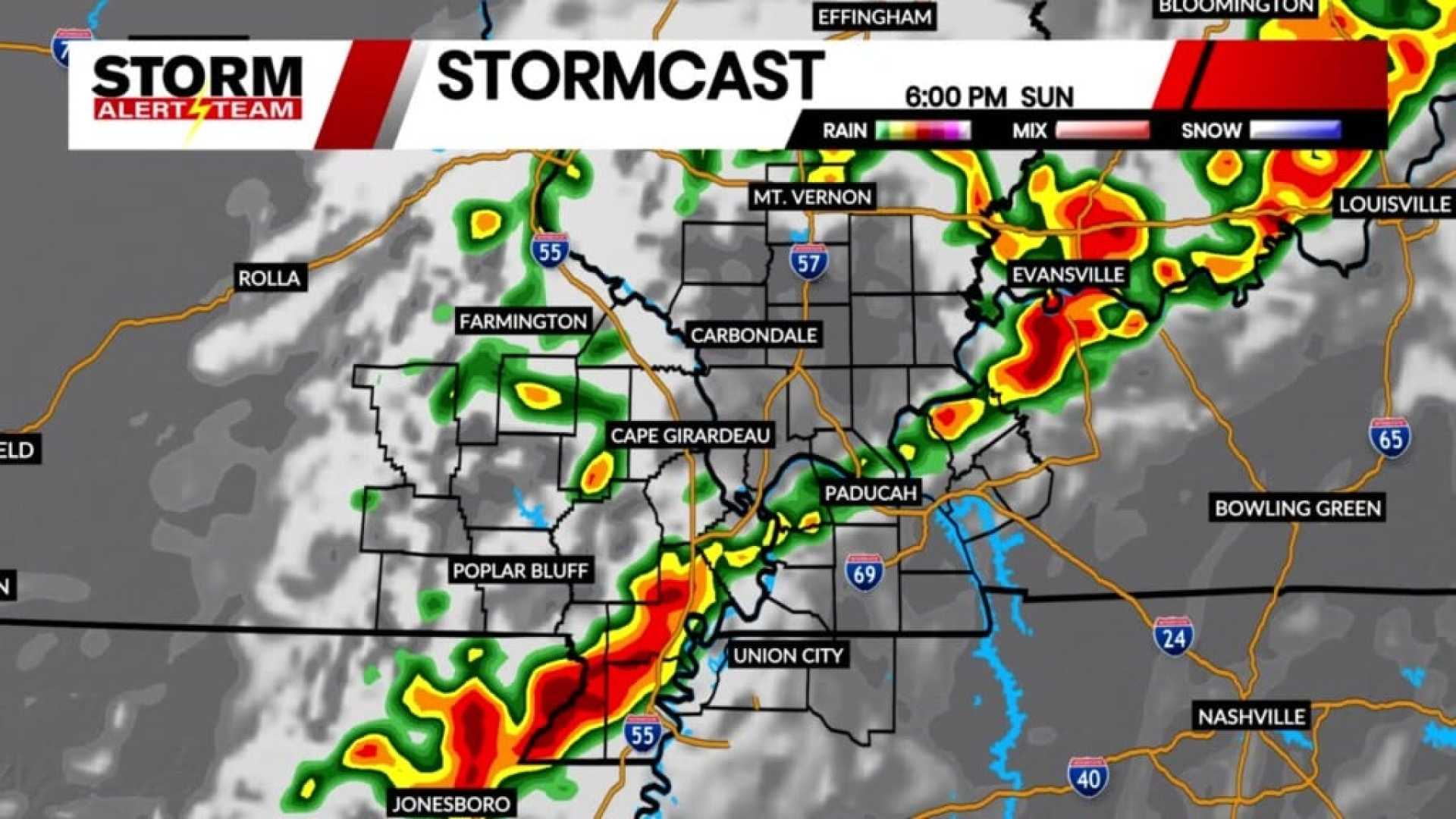
A cold front stretching from the Midwest to the Southern Plains will sweep away the unseasonable warmth, setting the stage for explosive thunderstorms as it collides with the moist air. According to the Storm Prediction Center (SPC), over 25 million people are under a level 3 out of 5 risk for severe storms, including cities like Nashville, Indianapolis, and St. Louis. An additional 45 million people surrounding these areas, including Dallas, Chicago, and Cleveland, face a level 2 out of 5 risk.
The threat for severe weather will begin Sunday afternoon, stretching from Illinois to eastern Texas, with the storms expected to increase in intensity as they move eastward into the night across the regions including the Mississippi, Ohio, and Tennessee valleys. The SPC warns of hail larger than golf balls, damaging wind gusts, and potential tornadoes.
Conditions in the atmosphere favor the development of tornadoes, some of which could be strong, classified as EF2 or higher. Nighttime tornadoes are particularly dangerous, having almost double the likelihood of being fatal compared to those occurring during daylight hours. Additionally, heavy rainfall associated with these storms could lead to flash flooding in areas from the South to the Midwest.
This year has already seen a busy start to tornado season, with around 300 reported tornadoes since the beginning of 2025, compared to 164 by the end of March last year. Only three years since 2010 recorded more tornadoes in the first three months: 2023, 2017, and 2013. Last year marked a notable increase in tornado activity extending into December, with close to 2,000 reports total.
Powerful storms are expected to continue through Monday morning, potentially stretching from the Appalachians down to Louisiana and Mississippi. While some storm activity may diminish during the early hours, intensification is forecasted for the afternoon as they progress eastward.
By Monday night, thunderstorms could impact nearly the entire East Coast, with more than 100 million people under a level 2 out of 5 risk according to the SPC. Major cities from New Orleans to Boston will be affected, though specific threats may vary by region.
The Northeast is facing a higher risk of powerful wind gusts rather than tornadoes or hail. Meanwhile, the atmosphere in the southern states from the Mid-Atlantic to the Gulf Coast is more conducive to thunderstorms carrying a variety of hazards, including large hail and tornadoes.
The stormy weather is expected to continue throughout Monday night, primarily from the Mid-Atlantic to the Northeast, before moving out to the Atlantic Ocean by Tuesday morning. However, another potential severe storm threat is predicted, with the SPC warning of a large area from Texas to the Midwest to monitor for severe thunderstorms on Wednesday.


