News
Severe Thunderstorm Watch Issued for Southern Minnesota
Rochester, MN – The National Weather Service (NWS) has issued a severe thunderstorm watch for most of southern Minnesota, including the Rochester area, effective until 10 p.m. CDT on Thursday evening. The watch, which was announced at 3:45 p.m., comes amid forecasts of significant thunderstorms expected to develop and possibly intensify throughout the evening.
The watch zone indicates a risk for hazardous weather events, including large hail potentially reaching 2 inches in diameter, damaging wind gusts up to 70 mph, and a possibility of tornadoes. The severe thunderstorm watch area extends to approximately 65 statute miles east and west of a line originating from 25 miles northeast of Minneapolis to 30 miles southwest of Storm Lake, Iowa.
With storms developing across the region, NWS forecasters have warned that the stronger storms could cluster together as they advance towards the Mississippi River later this evening. Affected areas also include notable locations such as Owatonna, Red Wing, Austin, Albert Lea, Mankato, and the Twin Cities.
“As storms move eastward, residents in the watch zone should stay alert for changing conditions and be prepared to seek shelter if warnings are issued,” said the NWS statement accompanying the watch.
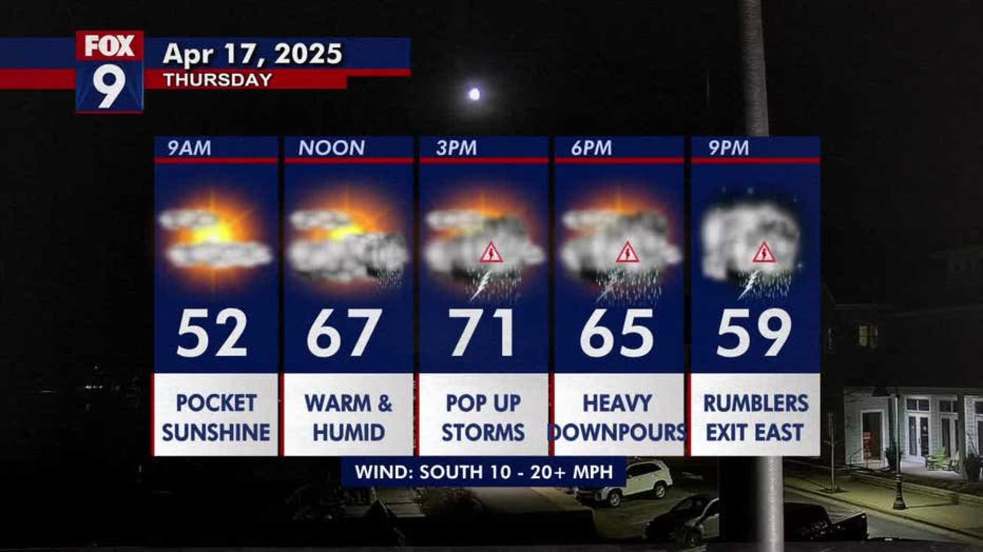
In the Rochester area, rain is expected, with precipitation totals projected to reach between three-quarters to an inch before the storms diminish late Thursday night. Showers are likely to continue into the morning hours on Friday.
In a related weather development, conditions are predicted to remain warm and humid leading up to the storms, with daytime highs expected to be in the low 70s and dew points in the muggy range. Thursday evening may see gusty winds and heavy rainfall accompanying the storm clouds.
The storm watch has prompted local authorities to remind residents about the importance of having an emergency plan and preparedness for potential severe weather events. Those in the affected areas are advised to have necessary supplies ready and stay tuned for updates from local news and the NWS.
The severe thunderstorm watch is part of a larger pattern of severe weather that has been impacting various regions across the Midwest this spring. With a rapidly changing weather landscape, experts continue to monitor conditions to keep residents informed and safe.


