News
Significant Drop in Temperatures Expected as Arctic Air Moves to the UK

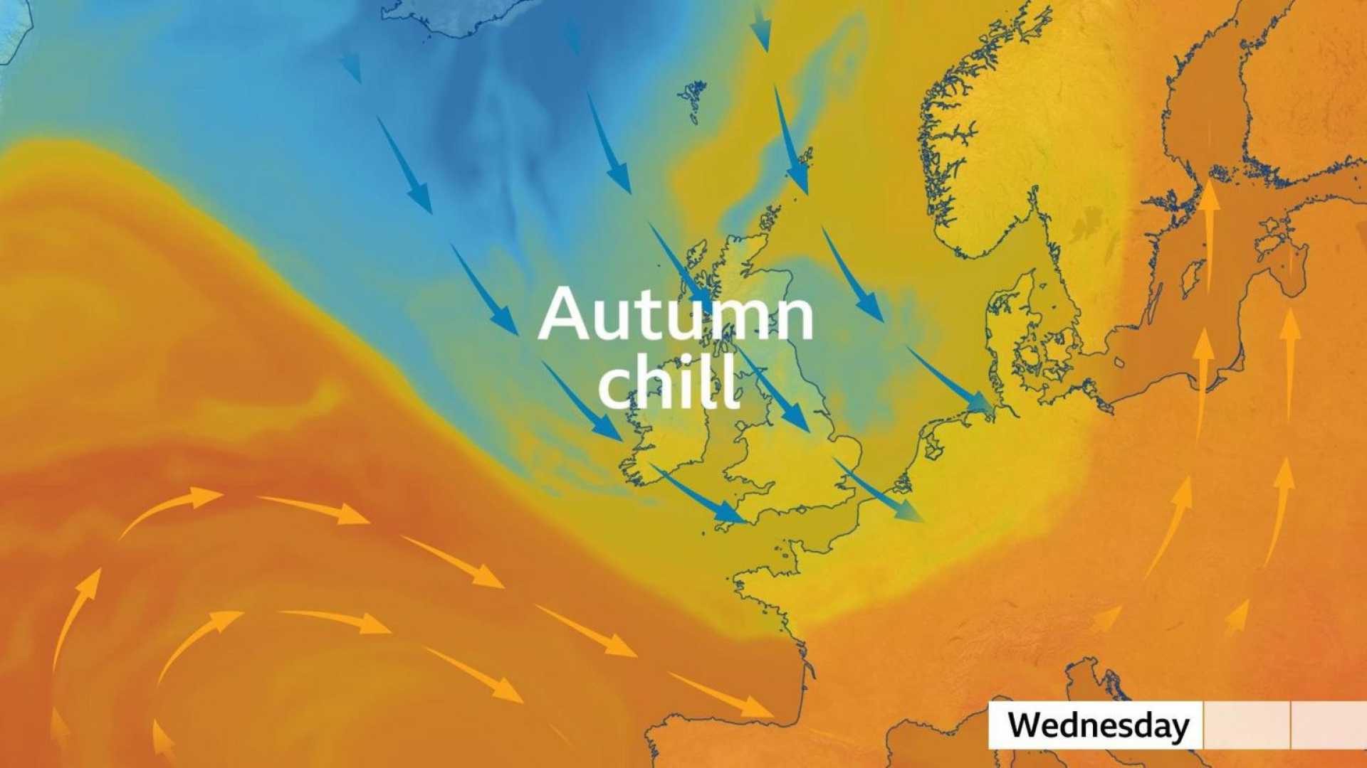
This week, the weather in the UK is set to experience a notable shift towards autumn-like conditions. Following an extended period of wet weather, which included thunderstorms and flash flooding, an influx of cold air from the Arctic is anticipated.
From mid-week, temperatures across the country are expected to drop significantly, falling between four to seven degrees Celsius below the seasonal average. The Scottish mountains may even see wintry showers, as cold conditions become established.
Although some media reports are characterizing this weather change as an “Arctic blast,” it is important to note that while the air does originate from the Arctic, the term “blast” may be a bit exaggerated for this context. Nevertheless, a distinct and noticeable change in the weather is on the horizon.
Last week, eastern England experienced an unseasonably high temperature of 28 degrees Celsius with high humidity levels. Starting Tuesday, strong north-westerly winds will sweep colder air over the UK, leading daytime high temperatures to range from nine to 14 degrees Celsius. The wind chill factor is likely to make it feel even colder.
The north-western regions of the UK will see an increase in showers, some of which may be heavy and accompanied by hail. As temperatures drop, there is potential for snow in the higher elevations of Scotland—a typical occurrence as summer transitions into winter.
As nighttime temperatures dip, conditions could become quite chilly, with forecasts predicting lows of three to six degrees Celsius by Thursday night. This may lead to ground frost in rural areas.
By Friday and the weekend, the wind direction is expected to shift to a south-westerly, which typically brings warmer, more seasonally average temperatures around 16 to 20 degrees Celsius.
Recent rainfall has left many regions, particularly parts of England and Wales, with exceptionally wet conditions. In Shropshire, Shawbury has reported rainfall that is one and a half times the average for September, accumulating 96mm compared to the expected 65mm within just eight days.
As the week progresses, further showers are expected, primarily in the north and west. Occasionally, some areas in the south-east may also experience these weather systems, including possible thunderstorms. A brief drier period is anticipated on Thursday, followed by more persistent rain late on Friday.
The Met Office has issued weather warnings for heavy rain, especially in Scotland. This area of low pressure is expected to result in strong winds alongside the rainfall.


