News
Storm Threat Looms Over Baltimore with Heavy Rain and Wind
BALTIMORE, Maryland — Chief Meteorologist Gerard Jebaily has issued a weather alert for the Baltimore area, forecasting heavy rain and gusty winds from tonight through Thursday. The potential for isolated tornadoes and coastal flooding exists as the region braces for severe weather.
Rain is expected to begin late Wednesday night, continuing into Thursday, with rainfall totals ranging from one to three inches. Some areas may see even higher amounts. Drivers should prepare for a rainy morning commute on Thursday, as heavy rain could create ponding on roads.
The Storm Prediction Center has identified the Baltimore metro under a marginal risk for severe weather, indicating that thunderstorms may develop with the possibility of strong gusty winds. Winds could gust up to 30 mph on Thursday, increasing to 40 mph on Friday.
Coastal flood alerts are in effect for low-lying areas along the Chesapeake Bay, where high tide could lead to localized flooding, particularly around Annapolis and the Inner Harbor in Baltimore.
Despite the storm systems, Halloween is expected to be mostly dry but chilly, with temperatures in the upper 50s to low 60s. Parents planning to take their children trick-or-treating should have them dress in layers to stay warm.
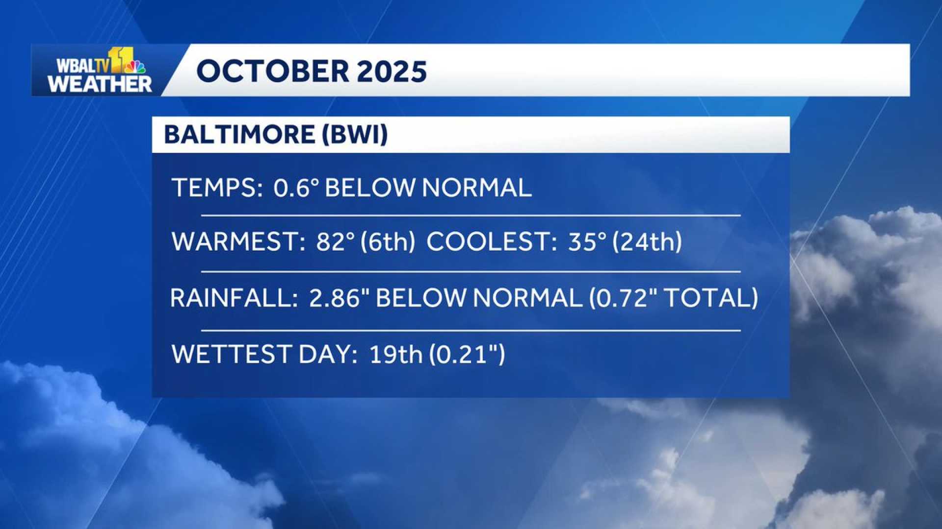
The forecast shows improvement over the weekend with temperatures stabilizing in the low 60s, making it a pleasant break after the expected storms. Significant rainfall this week is welcomed due to prior drought conditions.
As the weather develops, officials advise staying alert and prepared with a plan in case severe weather warnings are issued.


