News
Tropical Storm Gabrielle Forecast to Strengthen Over Atlantic
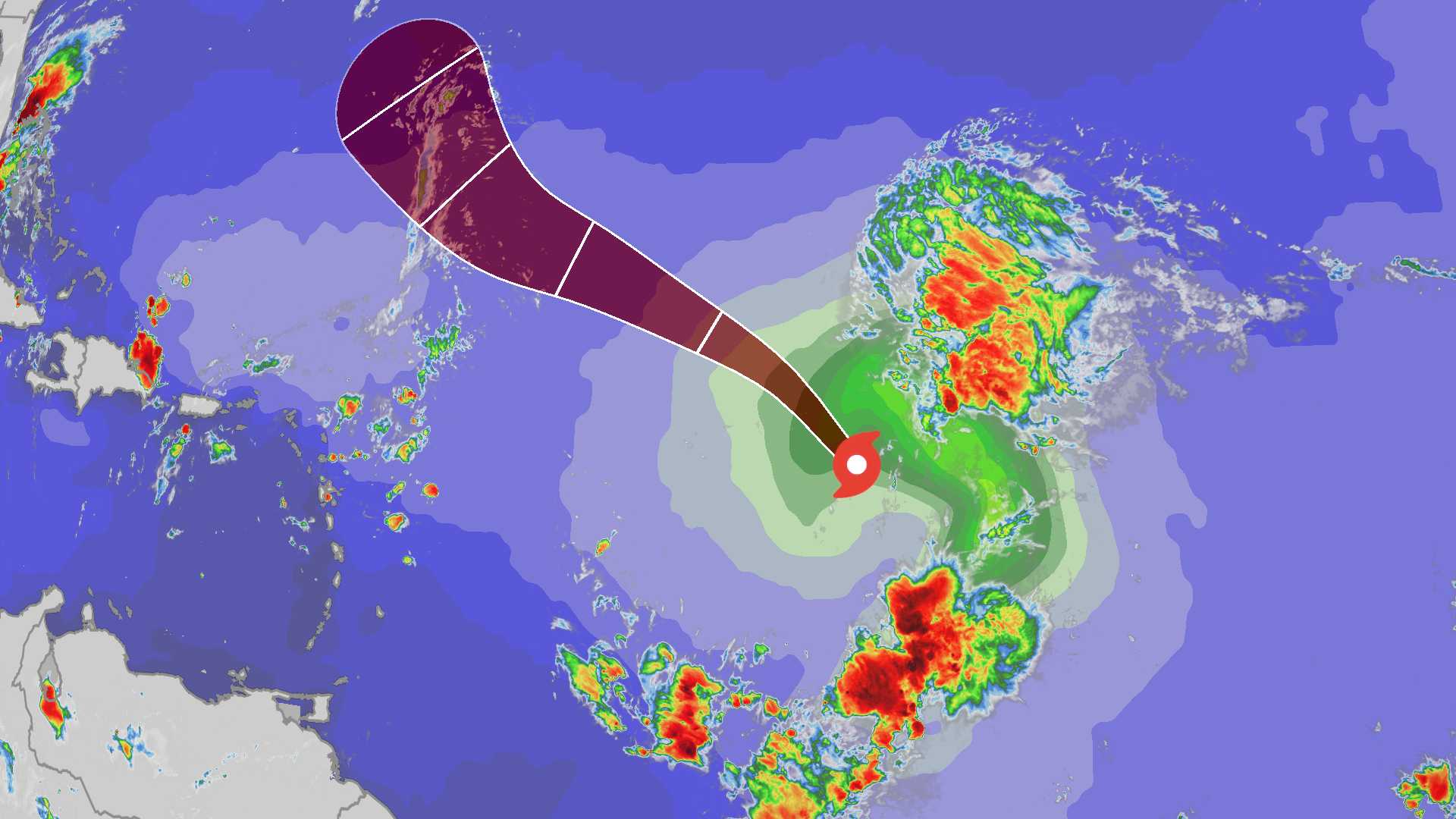
MIAMI, Fla. — Tropical Storm Gabrielle continues to move northwest over the Atlantic Ocean, with forecasters predicting it may strengthen into a hurricane by early next week. As of Saturday morning, Gabrielle has maximum sustained winds of 60 mph and is moving northwest at 13 mph.
The National Hurricane Center (NHC) issued an update stating the storm is expected to pass east of Bermuda as it intensifies. Currently, Gabrielle is struggling to organize properly due to wind shear and dry air, but conditions are forecast to improve, allowing it to develop further.
Gabrielle is roughly 700 miles east-northeast of the northern Leeward Islands. The storm’s path indicates it will continue northwest before making a turn northeast into the central Atlantic. “The current environmental conditions could allow Gabrielle to become a hurricane,” an NHC spokesperson stated.
No direct impacts to the U.S. are expected from Gabrielle at this time. However, coastal areas along the U.S. East Coast may experience swells from the storm. Forecast models suggest the storm will remain over open waters and not threaten land.
Forecasters note that while Gabrielle is the first tropical storm in the Atlantic since mid-August, the second half of the hurricane season is traditionally the busiest. David Zierden, a climatologist from Florida State University, remarked that warming sea temperatures can fuel storm formation and intensification.
The NHC is also monitoring other weather systems in the Atlantic, but none are expected to pose immediate threats. The hurricane season continues until November 30, and experts indicate that we may see increased activity due to favorable oceanic and atmospheric conditions.


