Tropical Storm Threats Loom Over Southeast U.S. This Week
Miami, FL – Tropical storms Humberto and Imelda are expected to develop later this week, potentially threatening parts of the Southeast U.S. and the Bahamas. As the Atlantic Basin’s hurricane season remains active, meteorologists caution residents to stay informed about these developments.
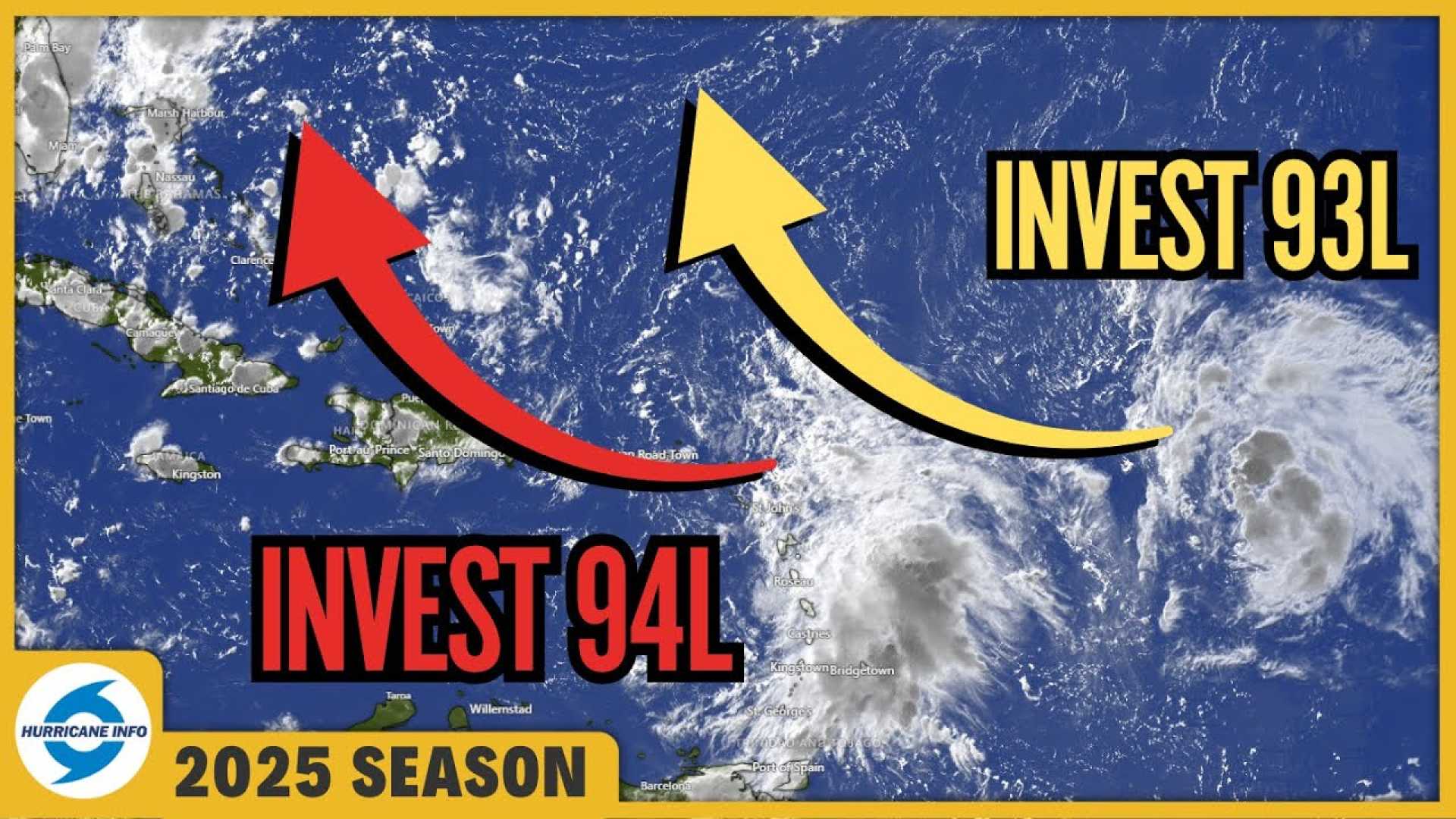
The National Hurricane Center has identified two main areas of interest. The easternmost wave, designated as Invest 93L, is located about 700 miles east of the Leeward Islands. Most forecasts indicate this wave could develop into a hurricane, posing a risk to Bermuda by early next week.
The western wave, labeled Invest 94L, is expected to bring heavy rain to Puerto Rico and the Virgin Islands and will continue moving towards Hispaniola, eastern Cuba, and the Bahamas. This system might also develop by this weekend.
Hurricane Hunter aircraft could begin reconnaissance missions on Wednesday once the system shows sufficient organization. Current models suggest that Invest 94L could approach the eastern U.S. coast, potentially creating dangerous surf and rip currents from Florida to New England, even if it does not make landfall.
Residents of the Bahamas and the U.S. East Coast should closely monitor these systems, as they may impact weather patterns significantly next week. The warm ocean waters of late September can fuel tropical storms, contributing to the potential development of both systems.
Forecasters also suggest that the two disturbances could interact, creating a scenario where one absorbs the other or they rotate around each other. Both scenarios have previously occurred in similar conditions.
With the climatological peak of the hurricane season having passed on September 10, forecasts indicate a higher chance of tropical activity in the coming weeks. Historically, about 60% of seasonal activity occurs after mid-September, and late September through early October has been noted as a particularly active period.
As meteorological conditions become more conducive for tropical development, experts are urging vigilance. The next tropical depression to take shape will be named Humberto, should it gain sufficient wind speed.