News
Winter Storm Hits Central Iowa; Travel Disruptions Expected
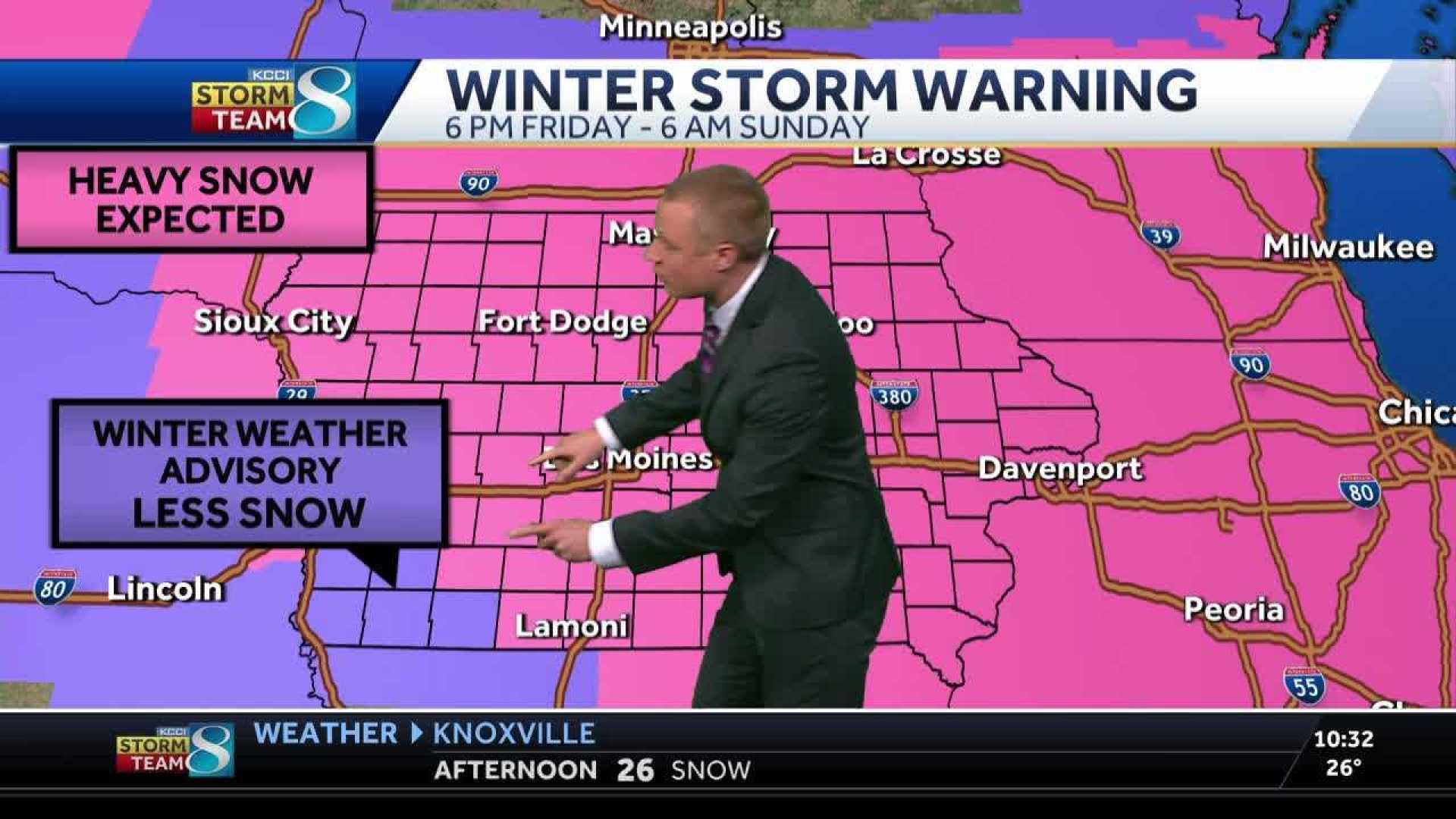
DES MOINES, Iowa — A winter storm warning is in effect for most of Iowa through Sunday morning. The storm is expected to bring nearly continuous snowfall for over 24 hours, with some areas potentially receiving over a foot of snow.
Officials recommend that residents delay or cancel their travel plans on Saturday. If travel is necessary, motorists are advised to pack an emergency kit in case they become stranded.
As snow began falling late Friday afternoon, accumulations of 4-8 inches were anticipated by Saturday morning. A second wave of snow is expected to move in Saturday morning as low pressure strengthens over northeast Kansas.
Temperatures in southern Iowa are expected to rise slightly, leading to wetter snow and possible mixed precipitation during the day. However, as winds shift and cooler air moves in during the afternoon, snow will become powdery, especially in northern Iowa.
Peak wind gusts may exceed 30 mph Saturday night, leading to blowing and drifting snow, but blizzard conditions are not expected. Snow accumulation is likely to be significant, with totals reaching 10 inches or more in many areas, especially in regions from north-central to southeast Iowa.
Many schools and churches have canceled activities for Sunday, and Iowa State University has decided to cancel classes on Monday, December 1, to help students return to campus after Thanksgiving. Facilities crews will work throughout the weekend to clear roads and sidewalks.
As the storm progresses, travel disruptions are expected across major cities, including Des Moines and Chicago. Airline passengers should prepare for delays and cancellations as well.
The storm, named Winter Storm Bellamy, is part of a weather pattern stretching from the Rockies to the Great Lakes, impacting millions across the Midwest.


