News
Snow and Rain Expected This Week in New Hampshire
MANCHESTER, N.H. — Two storm systems are set to impact travel in New Hampshire this weekend and into next week. The first system arrives Sunday, bringing light snow in northern regions and transitioning to rain in the south.
Temperatures on Sunday will reach the upper 30s and low 40s. The northern and central parts of the state may see a coating of to 2 inches of snow, especially on elevated terrain.
This could result in slippery travel during the afternoon as the holiday weekend wraps up. Minor accumulations are expected to end by Sunday night, with southern areas likely experiencing mainly rain.
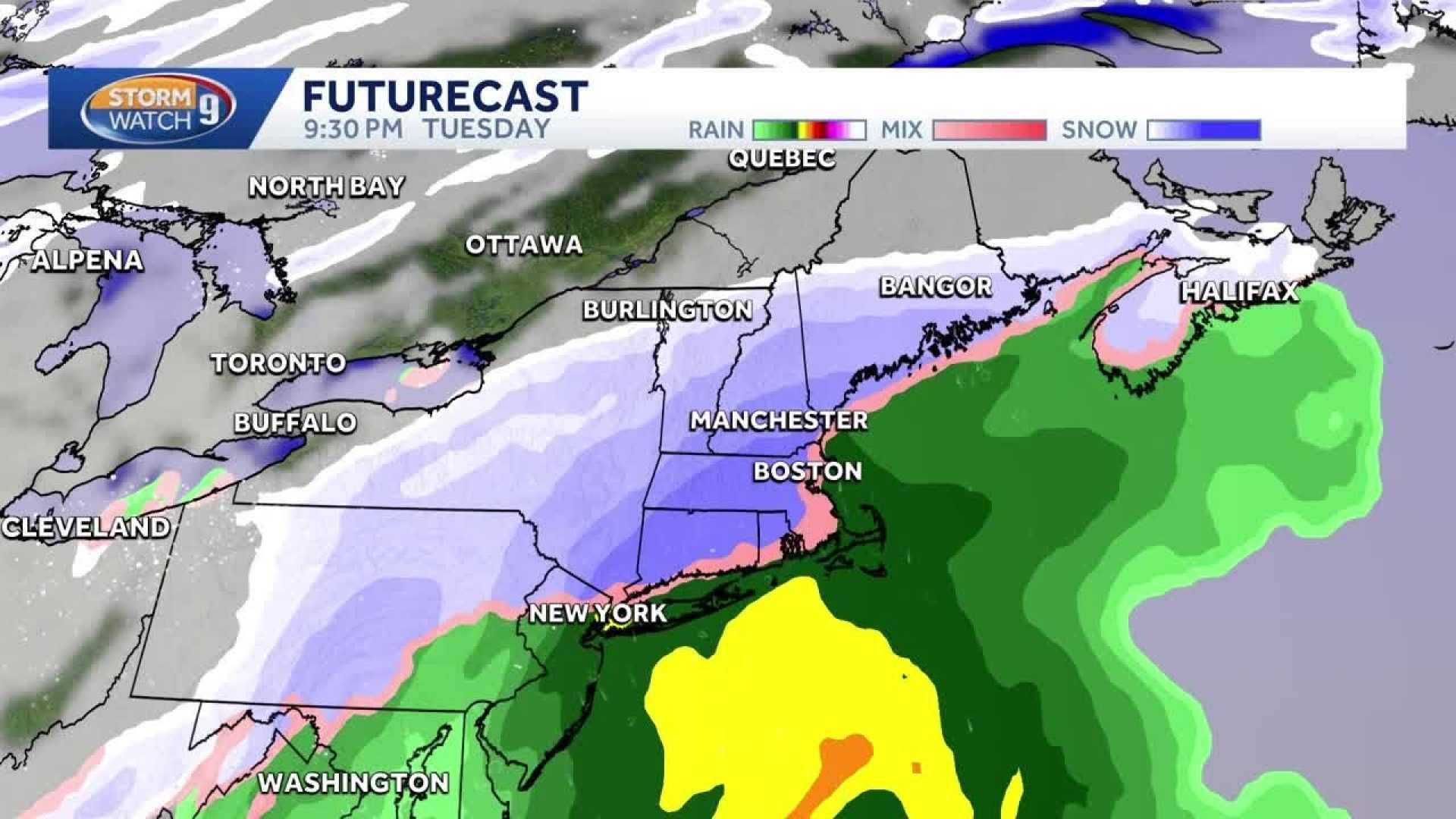
On Monday, New Hampshire will enjoy a break in the weather with sunny skies and temperatures in the mid-30s, a welcome respite before the next storm system arrives on Tuesday. Snow is predicted to start in the morning hours and could accumulate throughout the day.
The New Hampshire National Weather Service warns that Tuesday could bring 4 to 8 inches of snow in many areas, particularly affecting cities like Manchester, Concord, and Nashua. The heaviest snowfall is expected to occur in the afternoon and evening.
Travelers are advised to prepare for delays and potential hazards as the storm system moves in. The statewide significant snowfall is anticipated to end by early Wednesday morning.
As for the overall weather pattern, temperatures are expected to remain below average for early December, hovering around the 40-degree mark during the week.


