News
Heat Advisory Issued as Temperatures Soar Across Multiple States
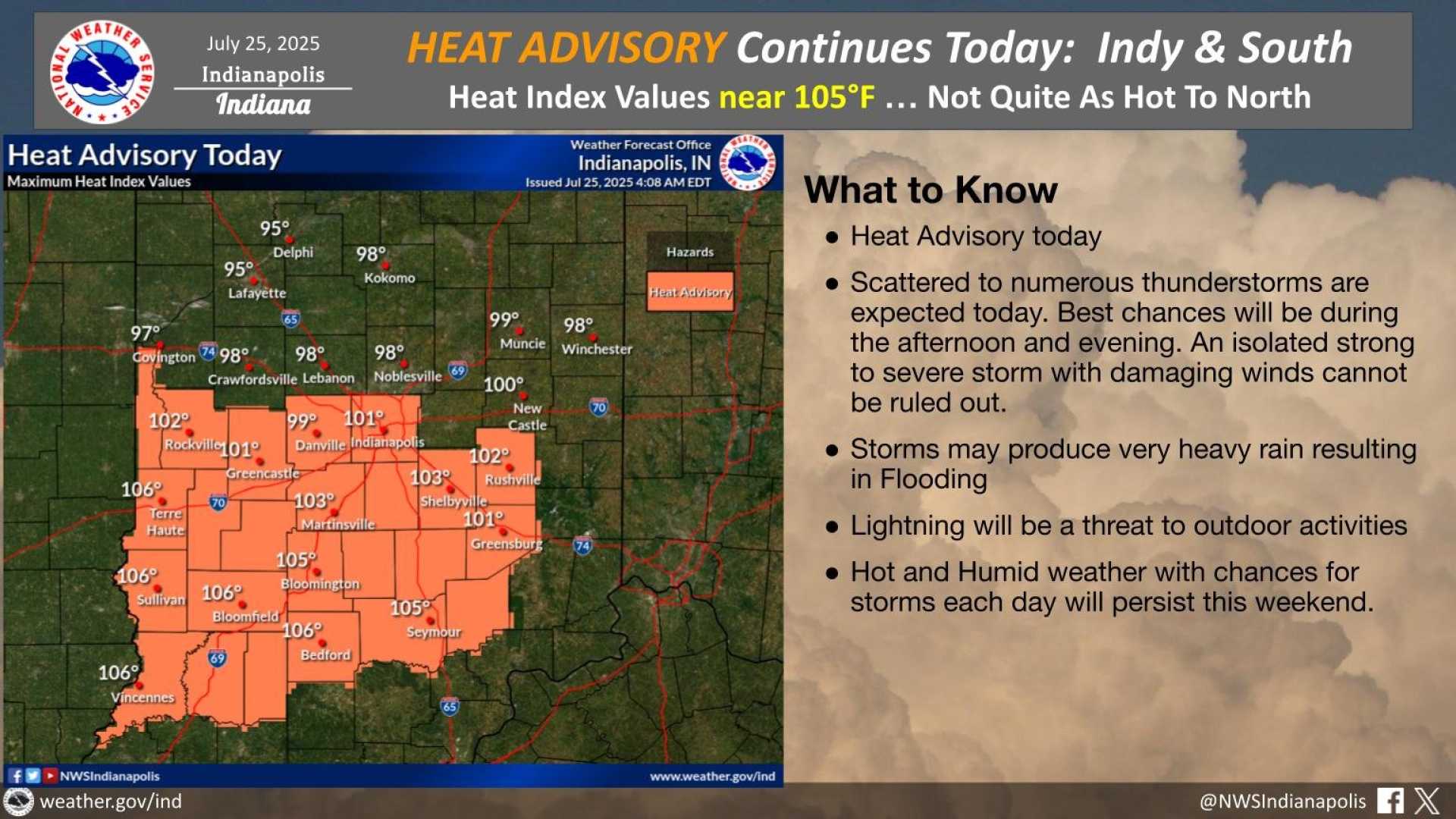
INDIANAPOLIS, Indiana — A Heat Advisory is in effect for areas along and south of the Interstate 70 corridor this weekend, lasting through 8 p.m. Monday. Expect dangerously high heat indices, peaking at 110 degrees on both Monday and Tuesday.
Temperatures across the region are forecast to reach the low 90s this afternoon, with heat indices hitting up to 105 degrees, especially for those in southern Indiana. Meteorologists warn to stay hydrated and avoid strenuous outdoor activities during peak heat hours.
A disturbance is also bringing potential thunderstorms this afternoon. Although these storms are not expected to reach severe levels, they could provide brief heavy rain and lightning. Meteorologist Jill Gilardi notes that scattered showers may develop across northern Indiana as well.
This evening, a more organized line of storms is predicted to move into central Indiana, with the timing set between 2 p.m. and 8 p.m. Residents are advised to keep an eye on the sky if they have outdoor plans such as attending the Brickyard 400 at the Indianapolis Motor Speedway.
Looking ahead, Monday and Tuesday promise continued high temperatures, prompting both days to be designated as Weather Impact Alert Days. Highs will remain in the low to mid 90s, and the heat index is expected to climb towards 110 degrees, emphasizing the need to take precautions and limit exposure to the heat.
By the middle of the week, cooler air will start moving in, likely dropping temperatures significantly. The upcoming weekend could see highs in the upper 70s, bringing welcome relief from the intense summer heat.


