News
Hurricane Erin Set to Impact Eastern North Carolina This Week
NEWPORT, N.C. — Eastern North Carolina should brace for the effects of Hurricane Erin, including coastal flooding, starting Tuesday. The storm, currently a Category 4 hurricane, is expected to remain offshore but will still affect the region, according to Erik Heden, a meteorologist with the National Weather Service.
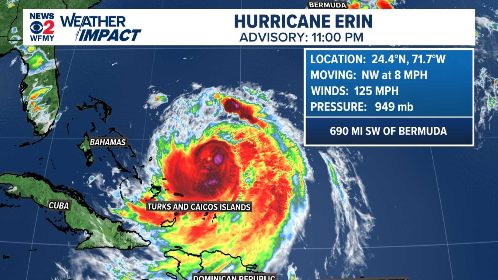
As of Monday afternoon, the storm was approximately 820 miles south-southeast of Buxton and moving northwest at 10 mph. Officials noted that dangerous surf, rip currents, storm surge, and significant beach erosion are among the potential impacts.
A storm surge watch and tropical storm watch were issued for eastern Carteret County and surrounding areas, including Hatteras Island. Forecasters predict water levels could rise by 4 feet in some places, especially in areas from Duck to Cape Lookout.
“Elevated water levels will likely be accompanied by large and destructive waves,” Heden warned during a briefing. The peak storm surge forecast is expected within 48 hours before it occurs.
Heden stated that meteorologists began monitoring Hurricane Erin last Friday. The storm’s status fluctuated over the weekend, being classified as a Category 5 on Saturday before weakening to Category 4 and later to Category 3. By Sunday night, it had intensified again to Category 4 with sustained winds of 140 mph.
Tropical storm force wind gusts are anticipated for the coastline, primarily affecting the Outer Banks. Forecasters believe the earliest winds may hit the coastline by Wednesday morning, with significant gusts likely by Wednesday evening.
Coastal flooding is expected to begin as early as Tuesday and continue into late Thursday. The National Weather Service warns of possible soundside flooding in Carteret County, Ocracoke, and Hatteras Island due to northeastern winds.
Rip currents will pose a serious threat due to the expected 15 to 20-foot waves. In preparation, Hyde and Dare counties have declared states of emergency and initiated evacuations for various island zones.
Mandatory evacuations began Sunday afternoon in Dare County, affecting Hatteras Island and ordering visitors to leave by 10 a.m. Monday, while residents must evacuate starting Tuesday morning. Hyde County echoed these evacuations for Ocracoke Island.
“It is crucial that residents heed these warnings, especially those with medical needs,” officials said, emphasizing the importance of safety as road access may become limited.
The North Carolina Department of Transportation announced restrictions on ferries, allowing only residents and essential personnel to board ferries to Ocracoke due to the weather. Ferry services from Ocracoke will be limited until evacuations are complete.
Officials are closing beach accesses and facilities at Cape Hatteras National Seashore due to potential flooding and erosion. Numerous visitor centers and campgrounds will close to ensure public safety this week.
Erin’s trajectory suggests it will remain offshore, but officials urge vigilance as the storm could still produce significant coastal impacts. Plans to monitor ongoing developments are in place as the park services announce further updates as necessary.


