News
Hurricane Erin Strengthens, Coastal Warnings Issued Ahead of Impact
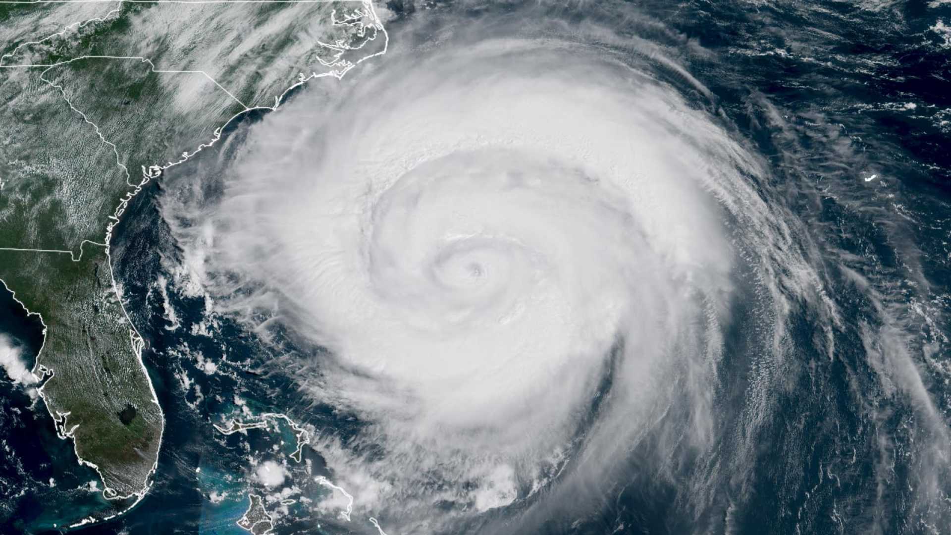
MIAMI, Fla. (AP) – Hurricane Erin has rapidly intensified, reaching winds of 130 mph as it becomes a Category 4 hurricane, with meteorologists closely monitoring its impact on the Southeastern U.S.
The storm’s strength increased significantly since the last advisory and is now located 500 miles off the east coast of Florida. Despite its distance, the effects are already being felt, prompting tropical storm warnings along the Carolina coastline.
As of the latest reports, Erin’s wind speeds extend 260 miles from its center, with an eye that can be clearly seen in satellite imagery. The storm’s pressure has also dropped to 941 millibars, indicating it is becoming better organized.
The National Hurricane Center suggests that Erin will move northeast, but significant impacts are expected. The outer bands of the storm are already causing hazardous conditions along the coast, including a high rip current risk and surf waves of 6 to 10 feet.
Alongside Erin, meteorologists are monitoring two other systems in the Atlantic. The first has a 60% chance of developing into a tropical depression, while the second has a 40% chance according to the latest forecasts.
Officials are warning residents and beachgoers about the danger posed by rip currents, especially during peak conditions expected next week. Despite Erin’s trajectory being confirmed as remaining offshore, precautions are still advised for those on the coast.
Stay tuned to local weather updates as the storms continue to evolve.


