News
Hurricane Erin Threatens US East Coast with Deadly Surf and Storm Surge
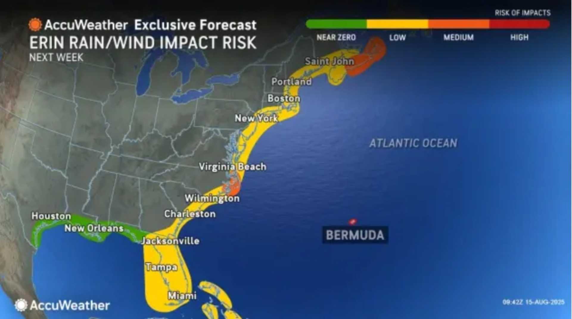
Wrightsville Beach, North Carolina — Hurricane Erin is set to create dangerous rip currents and destructive waves along the entire US East Coast, particularly affecting North Carolina’s Outer Banks. As the Atlantic hurricane season peaks, Erin, now a Category 3 hurricane, is bringing heavy surf conditions but is not projected to make landfall.
Erin rapidly intensified over the weekend, surprising meteorologists. With maximum sustained winds reaching 160 mph, the storm has unleashed dangerous surf conditions from the East Coast to Bermuda. Local officials in New Hanover County reported at least 75 rip-current rescues along the southern coast of North Carolina on Monday as conditions worsened. Wrightsville Beach has issued a no-swim advisory that will last through Friday.
A tropical storm watch is currently in effect from central North Carolina up past Kitty Hawk, encompassing the Pamlico Sound, where winds potentially reaching 73 mph are possible within 48 hours. Dare and Hyde counties, covering much of the Outer Banks, have declared local states of emergency, mandating evacuations for Hatteras and Ocracoke islands.
Meanwhile, warnings are in place for the Turks and Caicos Islands and the southeastern Bahamas as Erin’s outer bands have already caused substantial flooding, power outages, and airport shutdowns across Puerto Rico. Residents are urged to remain vigilant as more weather conditions develop in the storm’s wake.
According to the National Hurricane Center, Erin is expected to remain a major hurricane throughout the week, with significant risks of coastal flooding and beach erosion. Waves of 20 feet or more are forecast, with National Park Service officials warning that these could destroy protective dune structures and lead to severe flooding inland.
This month’s highest tides in the Outer Banks will coincide with Erin’s waves on Wednesday and Thursday, amplifying the threat of flooding. Homes in vulnerable areas have already collapsed under previous storms, and officials are warning that properties in Rodanthe could be at risk of similar fates this week.
Additionally, meteorologists are keeping an eye on another tropical wave trailing Erin, which has a 60% chance of developing into another storm, potentially named Fernand, within the next seven days. In contrast, a third disturbance just off the coast of Africa presents a low chance for further development.
The atmospheric conditions fueling Erin serve as a reminder of the changing climate, as storms are now capable of intensifying at unprecedented speeds. As August unfolds, it continues to represent the busiest stretch of the Atlantic hurricane season, with forecasters remaining alert for further developments.


